Deering in Pemiscot County, Missouri — The American Midwest (Upper Plains)
Deering
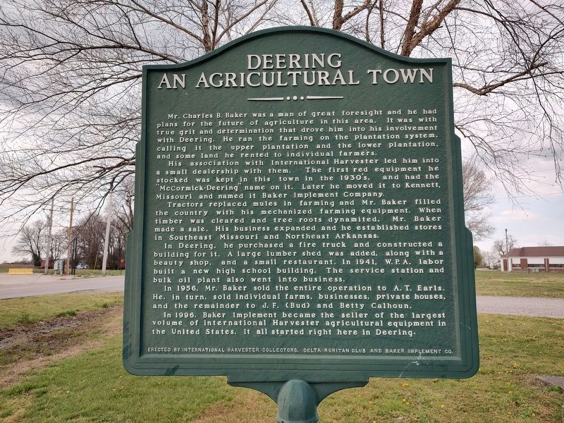
An Agricultural Town
⎯⎯⎯
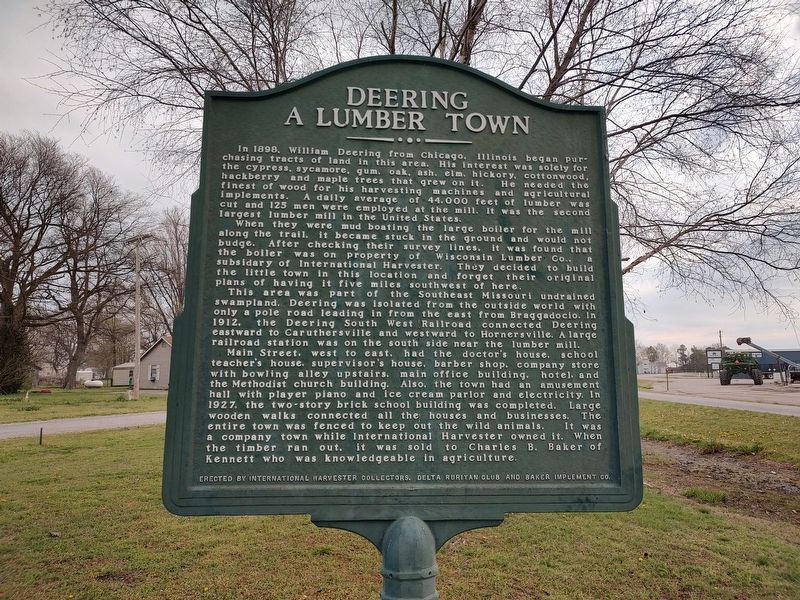
A Lumber Town
Photographed by Jimmy Emerson, March 25, 2026
1. Deering Marker
His association with International Harvester led him into a small dealership with them. The first red equipment he stocked was kept in this town in the 1930's, and had the "McCormick-Deering" name on it. Later he moved it to Kennett, Missouri and named it Baker Implement Company.
Tractors replaced mules in farming and Mr. Baker filled the country with his mechanized farming equipment. When timber was cleared and tree roots dynamited, Mr. Baker made a sale. His business expanded and he established stores in Southeast Missouri and Northeast Arkansas.
In Deering, he purchased a fire truck and constructed a building for it. A large lumber shed was added, along with a beauty shop, and a small restaurant. In 1941, W.P.A. labor built a new high school
this page online
In 1956, Mr. Baker sold the entire operation to A. T. Earls. He, in turn, sold individual farms, businesses, private houses, and the remainder to J. F. (Bud) and Betty Calhoun.
In 1996, Baker Implement became the seller of the largest volume of International Harvester agricultural equipment in the United States. It all started right here in Deering.
When they were mud boating the large boiler for the mill along the trail, it became stuck in the ground and would not budge. After checking their survey lines, it was found that the boiler was on property of Wisconsin Lumber Col, a subsidiary
Photographed by Jimmy Emerson, March 25, 2026
2. Deering Marker
This area was part of the Southeast Missouri undrained swampland. Deering was isolated from the outside world with only a pole road leading in from the east from Braggadocio. In 1912, the Deering South West Railroad connected Deering eastward to Caruthersville and westward to Hornersville. A large railroad station was on the south side near the lumber mill.
Main Street, west to east, had the doctor's house, school teacher's house, supervisor's house, barber shop, company store with bowling alley upstairs, main office building, hotel, and the Methodist church building. Also, the town had an amusement hall with player piano and ice cream parlor and electricity. In 1927, the two-story brick school building was completed. Large wooden walks connected all the houses and businesses. The entire town was fenced to keep out the wild animals. It was a company town while International Harvester owned it. When the timber ran out, it was sold to Charles B. Baker of Kennett who was knowledgeable
Photographed by Jimmy Emerson, March 25, 2026
3. Deering Marker
Erected by International Harvesters Collectors, Delta Ruritan Club and Baker Implement Co.
Topics. This historical marker is listed in these topic lists: Agriculture • Horticulture & Forestry • Industry & Commerce • Roads & Vehicles • Settlements & Settlers. A significant historical year for this entry is 1941.
Location. 36° 11.45′ N, 89° 53.102′ W. Marker is in Deering, Missouri, in Pemiscot County. It is at the intersection of State Highway J and 3rd Street, on the right when traveling west on State Highway J. Touch for map. Marker is at or near this postal address: 6346 Hwy J, Deering MO 63840, United States of America. Touch for directions.

Regionally, this marker is in the Missouri Bootheel. It is also in the American Midwest, in the Mississippi Delta, in the Lewis & Clark Corridor, in the Corn Belt, and in the Great River Road Region. Globally, it is in North America, the Western Hemisphere, the Western World, and the Anglosphere. Historically, it finds itself in what was once the territory of the Mississippian Culture, the Louisiana Purchase, and the Antebellum South.
Other nearby markers. At least 6 other markers are within 11 miles of this marker, measured as the crow flies: Hayti School Building (approx. 8.2 miles away); Kennett City Hall and Masonic Lodge (approx. 10 miles away); Independence Township War Memorial (approx. 10.1 miles away); The Village of Kennett (approx. 10.1 miles away); Gold Star Memorial (approx. 10.1 miles away); Kennett Sound Studios (approx. 10.2 miles away).
Another marker is no longer nearby. Kennett (was approx. 10 miles away but has been confirmed missing).
Credits. This page was last revised on March 31, 2026. It was originally submitted on March 25, 2026, by Jimmy Emerson of Dalton, Georgia. This page has been viewed 29 times since then. Photos: 1, 2, 3. submitted on March 25, 2026, by Jimmy Emerson of Dalton, Georgia. • Devry Becker Jones was the editor who published this page.
