Centerville near Williamsburg in James City County, Virginia — The American South (Mid-Atlantic)
Spencer's Ordinary
Photographed by Evan Dwyer, February 14, 2026
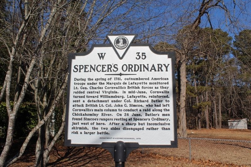
1. Spencer's Ordinary Marker
During the spring of 1781, outnumbered American troops under the Marquis de Lafayette monitored Lt. Gen. Charles Cornwallis's British forces as they raided central Virginia. In mid-June, Cornwallis turned toward Williamsburg. Lafayette, reinforced, sent a detachment under Col. Richard Butler to attack British Lt. Col. John G. Simcoe, who had left Cornwallis's main column to conduct a raid along the Chickahominy River. On 26 June, Butler's men found Simcoe's rangers resting at Spencer's Ordinary, just west of here. After a sharp but inconclusive skirmish, the two sides disengaged rather than risk a larger battle.
Erected 2016 by Virginia Department of Historic Resources. (Marker Number W-35.)
Topics and series. This historical marker is listed in these topic lists: Colonial Era • Patriots & Patriotism • War, US Revolutionary. In addition, it is included in the Virginia Department of Historic Resources (DHR) series list. A significant historical date for this entry is June 26, 1781.
Location. 37° 18.991′ N, 76° 47.386′ W. Marker is near Williamsburg, Virginia, in James City County. It is in Centerville. It is at the
this page online

Regionally, this marker is on Virginia’s Peninsula, in Coastal Virginia, and in the Hampton Roads Metropolitan Area. It is also in the American South, specifically in the Upper South, in the Tidewater, and on the Eastern Seaboard. Globally, it is in the North Atlantic Region, North America, the Western Hemisphere, the Western World, and the Anglosphere. Historically, it finds itself in what was once the territory of the Mississippian Culture, one of the original Thirteen Colonies, one of the Confederate States of America, and the Antebellum South.
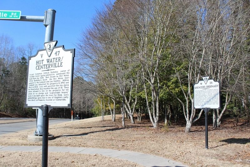
Other nearby markers. At least 8 other markers are within walking distance of this marker: Hot Water / Centerville (here, next to this marker); Lightfoot Home (approx. half a mile away); Brown Home (approx. half a mile away); Jackson Home
Photographed by Evan Dwyer, February 14, 2026
2. Spencer's Ordinary Marker
Another marker is no longer nearby. Early Settlement and Cemetery (was approx. 0.6 miles away but has been replaced with another marker now near it).
Related marker. Click here for another marker that is related to this marker. It was the original W-35 state marker, located 3 miles northeast.
Photographed by Evan Dwyer, February 14, 2026
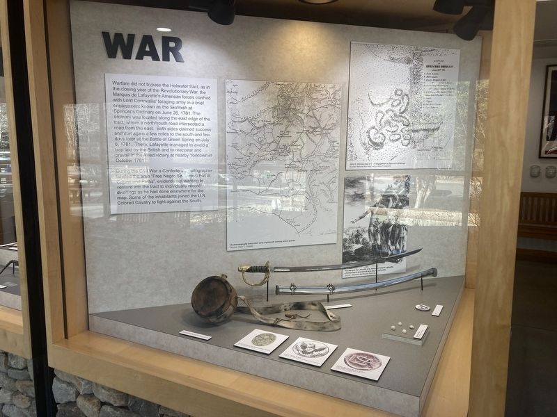
3. Spencer's Ordinary Exhibit
In the Freedom Park Interpretive Center
Photographed by Evan Dwyer, February 14, 2026
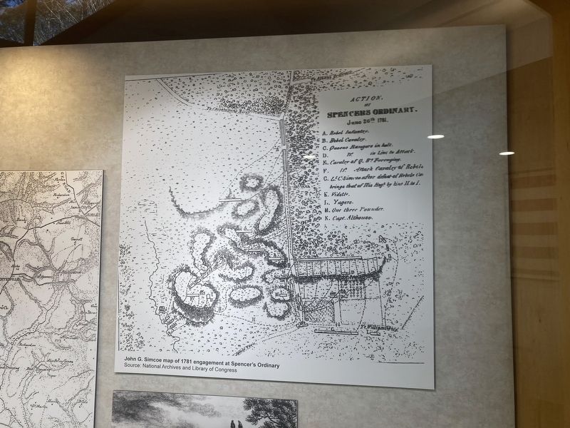
4. Spencer's Ordinary Map
Simcoe map of the fight, part of the exhibit within Freedom Park's Interpretive Center.
Photographed by Evan Dwyer, February 14, 2026
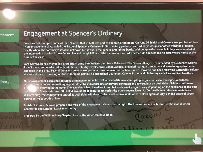
5. Interpretive Center Digital Panel
One of the slides in the interactive display unit, part of the Freedom Park Interpretive Center's exhibit on the park's history, describes the engagement further.
Credits. This page was last revised on March 30, 2026. It was originally submitted on March 13, 2026, by Evan Dwyer of Richmond, Virginia. This page has been viewed 49 times since then. Last updated on March 29, 2026, by Caleb Kemplin of Virginia Beach, Virginia. Photos: 1, 2, 3, 4, 5. submitted on March 13, 2026, by Evan Dwyer of Richmond, Virginia. • Devry Becker Jones was the editor who published this page.
