Fodor in New Albany in Franklin County, Ohio — The American Midwest (Great Lakes)
Disposal of Land in Plain Township
Photographed by William Fischer, Jr., March 8, 2009
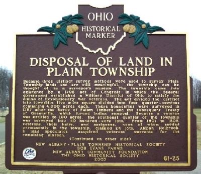
1. Disposal of Land in Plain Township Marker (Side A)
Because three distinct survey methods were used to survey Plain Township lands and are still meaningful, the township can be thought of as a surveyor's museum. The township came into existence by a 1796 act of Congress in which the federal government established a Military District of Ohio to satisfy the claims of Revolutionary War veterans. The act divided the district into townships five miles square divided into four quarter-sections containing 4,000 acres each. These boundaries were surveyed in 1797 after the Battle of Fallen Timbers and the subsequent Treaty of Greenville, which forced Indian removal. Because a veteran was entitled to 100 acres, the southeast quarter of the township was surveyed into 40 hundred-acre lots. From 1801 to 1805, veterans, their heirs, and assignees, none of whom settled permanently in the township, claimed 24 lots. Abijah Holbrook, a land speculator, acquired veterans' warrants for the remaining sixteen.
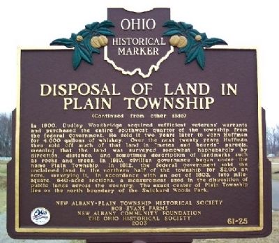
In 1800, Dudley Woodbridge acquired sufficient veterans' warrants and purchased the entire southwest quarter of the township from the federal government. He sold it two years later
this page online
Erected 2003 by New Albany Plain Township Historical Society, Bob Evans Farms, New Albany Community Foundation, and The Ohio Historical Society. (Marker Number 61-25.)
Topics and series. This historical marker is listed in these topic lists: Indigenous Peoples and Communities • Settlements & Settlers • War, US Revolutionary • Wars, US Indian. In addition, it is included in the Ohio Historical Society / The Ohio History Connection
Photographed by William Fischer, Jr., March 8, 2009
2. Disposal of Land in Plain Township Marker (Side B)
Location. Marker is missing. It was located near 40° 5.337′ N, 82° 49.082′ W. Marker was in New Albany, Ohio, in Franklin County. It was in Fodor. It was on Swickard Woods Boulevard north of Fodor Road, on the right when traveling east. The marker stands in parking area 100 feet SW of water park in Swickard Woods Community Park. Touch for map. Marker was at or near this postal address: 7625 Swickard Woods Blvd, New Albany OH 43054, United States of America. Touch for directions.

Regionally, this marker was in the Scioto Valley and in the Columbus Metropolitan Area. It was also in the American Midwest and in the Corn Belt. Globally, it was in North America, the Western Hemisphere, the Western World, and the Anglosphere. Historically, it found itself in what was once the Haudenosaunee (Iroquois) Confederacy, the territory of the Mississippian Culture, and the Northwest Territory.
Other nearby markers. At least 8 other markers are within walking distance of this location: Wexner Community Park (about 400 feet away, measured in a direct line); Nature Preserve & Wetlands
Photographed by William Fischer, Jr., March 8, 2009
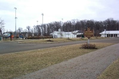
3. Disposal of Land in Plain Township Marker
Swickard Woods Community Park in background.
Credits. This page was last revised on April 8, 2026. It was originally submitted on March 27, 2009, by William Fischer, Jr. of Reynoldsburg, Ohio. This page has been viewed 1,260 times since then and 33 times this year. Last updated on April 4, 2026, by Craig Doda of Napoleon, Ohio. Photos: 1, 2, 3. submitted on March 27, 2009, by William Fischer, Jr. of Reynoldsburg, Ohio. • Devry Becker Jones was the editor who published this page.
