Downtown in Cleveland in Cuyahoga County, Ohio — The American Midwest (Great Lakes)
Lighthouse Park
Photographed by Craig Doda, March 8, 2026
1. Lighthouse Park Marker
Overview and History
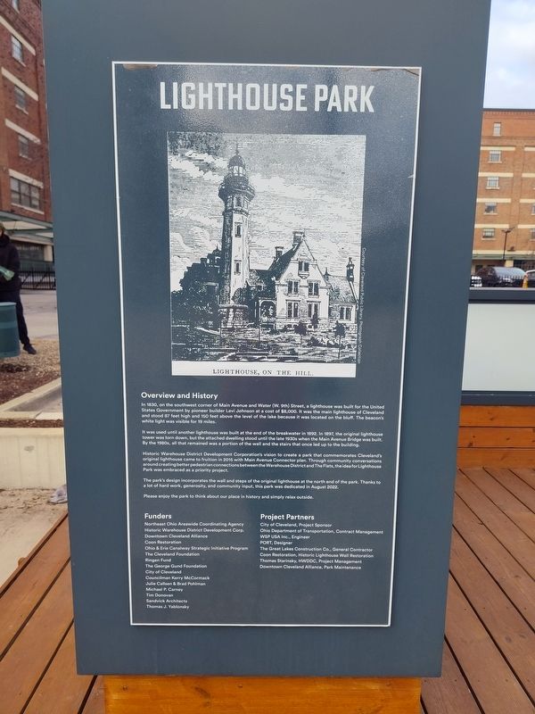
In 1830, on the southwest corner of Main Avenue and Water (W. 9th) Street, a lighthouse was built for the United States Government by pioneer builder Levi Johnson at a cost of $8,000. It was the main lighthouse of Cleveland and stood 87 feet high and 150 feet above the level of the lake because it was located on the bluff. The beacon's white light was visible for 19 miles.
It was used until another lighthouse was built at the end of the breakwater in 1892. In 1897, the original lighthouse tower was torn down, but the attached dwelling stood until the late 1930s when the Main Avenue Bridge was built. By the 1980s, all that remained was a portion of the wall and the stairs that once led up to the building.
Historic Warehouse District Development Corporation's vision to create a park that commemorates Cleveland's original lighthouse came to fruition in 2015 with Main Avenue Connector plan. Through community conversations around creating better pedestrian connections between the Warehouse District and The Flats, the idea for Lighthouse Park was embraced as a priority project.
The park's design incorporates
this page online
Topics and series. This historical marker is listed in these topic lists: Architecture • Communications • Parks & Recreational Areas • Waterways & Vessels. In addition, it is included in the Lighthouses series list. A significant historical month for this entry is August 2022.
Location. 41° 30.018′ N, 81° 42.116′ W. Marker is in Cleveland, Ohio, in Cuyahoga County. It is in Downtown. It is at the intersection of West 9th Street and West Lakeside Avenue, on the right when traveling east on West 9th Street. Touch for map. Marker is at or near this postal address: 1211 W 9th St, Cleveland OH 44113, United States of America. Touch for directions.

Regionally, this marker is on the Lake Erie Shore and in the Western Reserve. It is also in the American Midwest. Globally, it is in North America, on the Great Lakes, in the Western Hemisphere, in the Western World, and in the Anglosphere. Historically, it finds itself in what was once the Haudenosaunee
Photographed by Craig Doda, March 8, 2026
2. Lighthouse Park Marker
Other nearby markers. At least 8 other markers are within walking distance of this marker: Warehouse District Anthology (a few steps from this marker); The Early Years (a few steps from this marker); Peter Weddell / Levi Johnson / Charles Otis (within shouting distance of this marker); Nowy Port Lighthouse (within shouting distance of this marker); Surveyors' Landmark (within shouting distance of this marker); William Bingham (about 500 feet away, measured in a direct line); Hardware Industry (about 500 feet away); The Garment Industry (about 700 feet away). Touch for a list and map of all markers in Cleveland.
Credits. This page was last revised on April 5, 2026. It was originally submitted on April 5, 2026, by Craig Doda of Napoleon, Ohio. This page has been viewed 23 times since then. Photos: 1, 2. submitted on April 5, 2026, by Craig Doda of Napoleon, Ohio. • Devry Becker Jones was the editor who published this page.
