Cohutta in Whitfield County, Georgia — The American South (South Atlantic)
Historic Red Clay
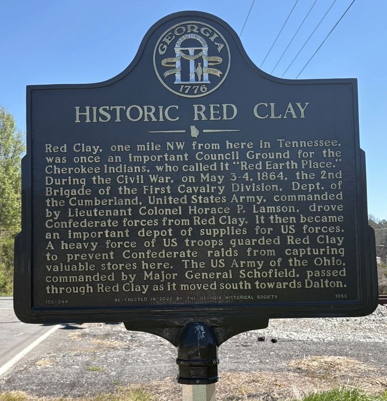
Photographed by Darren Jefferson Clay, March 28, 2026
1. Historic Red Clay Marker
Erected 1956 by The Georgia Historical Society. (Marker Number 155-34A.)
Topics. This historical marker is listed in these topic lists: Indigenous Peoples and Communities • War, US Civil. A significant historical date for this entry is May 3, 1864.
Location. 34° 59.047′ N, 84° 56.741′ W. Marker is in Cohutta, Georgia, in Whitfield County. It is at the intersection of Wilson Caldwell Road and Red Clay Road, on the right when traveling west on Wilson Caldwell Road. Touch for map.
this page online

Regionally, this marker is in the Mountains. It is also in the American South, specifically in the Deep South, in Appalachia, and specifically in Southern Appalachia. Globally, it is in North America, the Western Hemisphere, the Western World, and the Anglosphere. Historically, it finds itself in what was once the original Cherokee Nation, the territory of the Mississippian Culture, one of the original Thirteen Colonies, one of the Confederate States of America, and the Antebellum South.
Other nearby markers. At least 8 other markers are within walking distance of this marker: Blacksmith Shop (approx. 0.6 miles away in Tennessee); Inside the Farmhouse (approx. 0.6 miles away in Tennessee); Cherokee Farmstead (approx. 0.6 miles away in Tennessee); The Great Council Spring (approx. 0.6 miles away in Tennessee); Red Clay Council (approx. 0.6 miles away in Tennessee); Sleeping Huts (approx. 0.6 miles away in Tennessee); A Visitor's Account (approx. 0.6 miles away in Tennessee); The Eternal Flame (approx. 0.6 miles away in

Photographed by Darren Jefferson Clay, March 28, 2026
2. Historic Red Clay Marker
More about this marker. Re-erected in 2022.
Credits. This page was last revised on April 10, 2026. It was originally submitted on April 6, 2026, by Darren Jefferson Clay of Duluth, Georgia. This page has been viewed 25 times since then. Photos: 1, 2. submitted on April 9, 2026, by Darren Jefferson Clay of Duluth, Georgia. • Bernard Fisher was the editor who published this page.
