Clayton South in Kingston, Victoria, Australia — Oceania
The Grange
Photographed by Dean Barton-Ancliffe, April 6, 2026
1. The Grange Marker
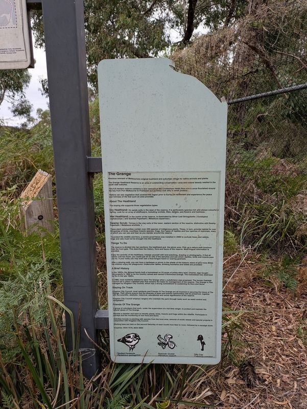
The Grange
Precious remnant of Melbourne's original bushland and suburban refuge for native animals and plants
(Excerpt)
A Brief History
In the 1850' , the McLeod family built a homestead on 23 acres of prime dairy land. Charles Jago bought the property in 1892 to be his country retreat and named it Richmond Grange. The homestead was destroyed by a fire in the late 1940's
In 1980, local residents lobbied to save The Grange when a subdivision was proposed. The former Oakleigh Council set in place a detailed plan that remains the basis for management of the reserve. The Grange is now managed by Kingston City Council, which has a strong commitment to sustaining its flora and fauna.
Erected by Kingston City Council.
Topics. This historical marker is listed in these topic lists: Colonial Era • Parks & Recreational Areas • Settlements & Settlers. A significant historical year for this entry is 1980.
Location. 37° 56.776′ S, 145° 7.912′ E. Marker is in Clayton South, Victoria, in Kingston. It can be reached from Osborne Avenue 0.2 kilometers south of Brandon Way. Touch for map. Marker is at or near
this page online

Regionally, it is in Oceania, in Australasia, in the Pacific Ocean, in South Pacific, on the Pacific Rim, in the Western World, and in the Anglosphere. Historically, it finds itself in what was once a British colony.
Other nearby markers. At least 8 other markers are within 10 kilometers of this marker, measured as the crow flies: Flying Saucer Sighting (within shouting distance of this marker); Indigenous History and Mapping the Past (approx. 7.3 kilometers away); Shire of Mulgrave Honour Roll Cenotaph (approx. 7.6 kilometers away); Honour Roll World War I (approx. 7.6 kilometers away); Honour Roll World War II (approx. 7.6 kilometers away); Glen Waverley Uniting Church (approx. 7.7 kilometers away); Rowville Carwash (approx. 9.2 kilometers away); Welcome to Shepherds Bush (approx. 9.3 kilometers away).
Also see . . . The Grange Reserve.
The Grange Reserve commemorates a momentous day in local, and universe, history.(Submitted on April 6, 2026, by Dean Barton-Ancliffe of Rowville, Victoria.)
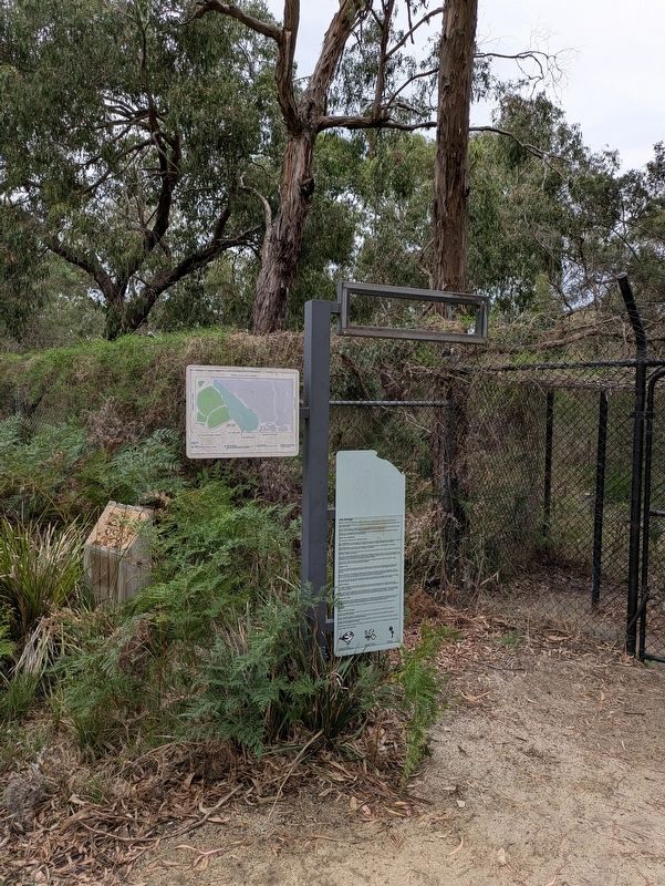
The UFO themed park was designed in honour of an event that took place on the morning of April6, 1966 when at least 90 students and teachers witnessed three 'flying saucers' hovering over their school oval.Photographed by Dean Barton-Ancliffe, April 6, 20262. The Grange Marker at the entrance to enclosed area
One of the flying objects landed at the current location of the park in a pine grove, before it would 'rise silently from the ground, turn on its side and shoot across the sky' according to one witness.
The playground's UFO doesn't fly, but contains rope ladders, and steering wheel and controls, and two slides to escape the cockpit in a hurry. There is an alien themed springboard, and various information panels about that mysterious day, as well as non-intergalactic play equipment including, swings, climbing rope and wall, and a flying fox.
Credits. This page was last revised on April 7, 2026. It was originally submitted on April 6, 2026, by Dean Barton-Ancliffe of Rowville, Victoria. This page has been viewed 13 times since then. Photos: 1, 2. submitted on April 6, 2026, by Dean Barton-Ancliffe of Rowville, Victoria. • Andrew Ruppenstein was the editor who published this page.
