City Park in New Orleans in Orleans Parish, Louisiana — The American South (West South Central)
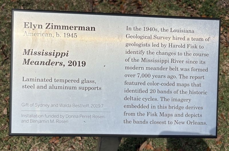
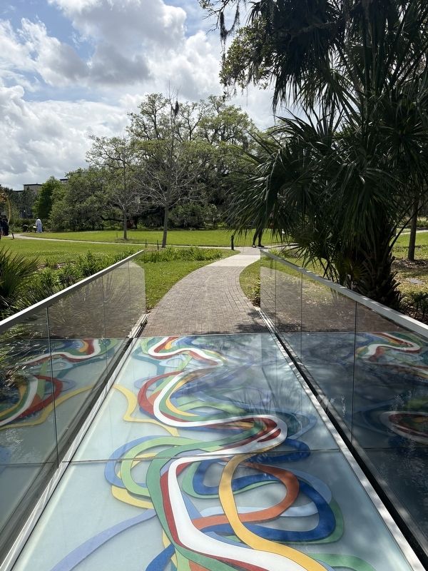
Mississippi Meanders
Elyn Zimmerman, American, b. 1945
| — | Laminated tempered glass, steel and aluminum supports | — |
Photographed by Sean P. Flynn, April 1, 2026
1. Mississippi Meanders Marker
Erected 2019.
Topics. This historical marker is listed in these topic lists: Arts, Letters, Music • Science & Medicine • Waterways & Vessels. A significant historical year for this entry is 2019.
Location. 29° 59.304′ N, 90° 5.61′ W. Marker is in New Orleans, Louisiana, in Orleans Parish. It is in City Park. It can be reached from Henry Thomas Drive, on the right when traveling north. The marker is in the sculpture garden at City Park. Touch for map. Marker is in this post office area: New Orleans LA 70124, United States of America. Touch for directions.

Regionally, this marker is in one of Louisiana’s River Parishes. It is also in the American South, specifically in the Deep South,
this page online
Other nearby markers. At least 8 other markers are within walking distance of this marker: A different marker also named Mississippi Meanders (within shouting distance of this marker); Duelling Grounds (about 600 feet away, measured in a direct line); Walter J. Cox and Wallace J. Cox (approx. 0.2 miles away); Donald Bradburn (approx. 0.2 miles away); Fritz Bultman (approx. ¼ mile away); Allard Plantation (approx. 0.4 miles away); Metairie And Gentilly Ridges (approx. 0.4 miles away); Beatles Only Concert Performance in Louisiana (approx. 0.4 miles away). Touch for a list and map of all markers in New Orleans.
Another marker is no longer nearby. General Beauregard Equestrian Statue (was approx. 0.4 miles away but has
Photographed by Sean P. Flynn, April 1, 2026
2. Mississippi Meanders Marker
The marker is on the right, partially obscured by the railing.
More about this marker. An identical sign can be found on the opposite side of the bridge.
Also see . . . Ancient Courses: Harold Fisk’s Meander Maps of the Mississippi River (1944).
Excerpt: “To represent all the water’s many shifts within this belt, Fisk hit on the brilliant idea of using overlapping colors. The current course of the river (current, that is, in 1944) is represented by a mighty blank, punctuated by islands, and crisscrossed by the serpentine green course of 1880, the salmon-pink course of 1820, and the light blue course of 1765. In addition to these relatively recent courses, one can see the color-coded traces of where the river flowed even earlier — a writhing palimpsest of meanders stretching back to prehistoric times.”(Submitted on April 7, 2026, by Sean P. Flynn of Oak Park, Illinois.)

Photographed by Sean P. Flynn, April 1, 2026
3. Mississippi Meanders bridge
Credits. This page was last revised on April 7, 2026. It was originally submitted on April 6, 2026, by Sean P. Flynn of Oak Park, Illinois. This page has been viewed 19 times since then. Photos: 1. submitted on April 6, 2026, by Sean P. Flynn of Oak Park, Illinois. 2, 3. submitted on April 7, 2026, by Sean P. Flynn of Oak Park, Illinois.
