Central Business District in New Orleans in Orleans Parish, Louisiana — The American South (West South Central)
Canal Street Under the Americans (1803)
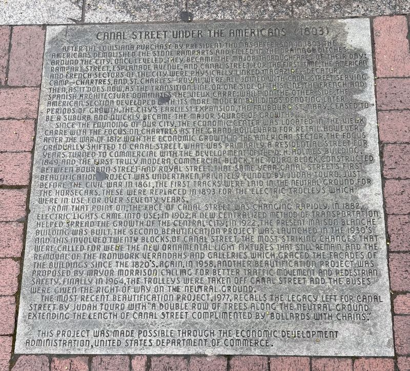
Photographed by Sean P. Flynn, March 31, 2026
1. Canal Street Under the Americans (1803) Marker
Since the founding of our city, the economic center was located in the Vieux Carre with the focus on Chartres as the grand boulevard for retail. However after the war of 1812 with the economic growth in the American sector, the focus gradually shifted to Canal Street. What was primarily a residential
this page online
From that point on the face of Canal Street was changing rapidly. In 1882, electric lights came into use; in 1902, a new centralized method of transportation helped spread the growth of the central city; in 1922, the present Maison Blanche building was built. The second beautification project was launched in the 1930's and this involved twenty blocks of canal street. The most striking changes that were called for were the new ornamental light fixtures that still remain, and the removal of the ironwork verandahs and galleries which graced the facades of the building's since the 1820's. Again, in 1958, another beautification

Photographed by Sean P. Flynn, March 31, 2026
2. Canal Street Under the Americans (1803) Marker
The most recent beautification project, 1977, recalls the legacy left for Canal Street by Judah Touro with "a double row of trees along the neutral ground extending the length of canal street complimented by bollards with chains."
This project was made possible through the Economic Development Administration, United States Department of Commerce.
Topics and series. This historical marker is listed in these topic lists: Architecture • Industry & Commerce • Roads & Vehicles • War, US Civil. In addition, it is included in the Former U.S. Presidents: #03 Thomas Jefferson series list. A significant historical year for this entry is 1803.
Location. 29° 57.236′ N, 90° 4.233′ W. Marker is in New Orleans, Louisiana, in Orleans Parish. It is in the Central Business District. It is on Canal Street west of Carondelet Street, on the right when traveling east. The marker is embedded into the sidewalk, near a store
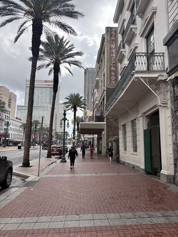
Photographed by Sean P. Flynn, March 31, 2026
3. Canal Street, New Orleans

Regionally, this marker is in one of Louisiana’s River Parishes. It is also in the American South, specifically in the Deep South, on the Gulf Coast, and in the Great River Road Region. Globally, it is in North America, a Gulf of Mexico state, the Western Hemisphere, the Western World, and the Anglosphere. Historically, it finds itself in what was once New Spain, the Viceroyalty of New France, the territory of the Mississippian Culture, the Louisiana Purchase, one of the Confederate States of America, and the Antebellum South.
Other nearby markers. At least 8 other markers are within walking distance of this marker: Canal Street Under French and Spanish Rule (1718-1803) (within shouting distance of this marker); Canal Street Milestones (within shouting distance of this marker); 127-129 Carondelet Street (within shouting distance of this marker); Immaculate Conception Church (about 300 feet away, measured in a direct line); New Orleans Slave Depot (about 500 feet away); New Orleans Massacre Of 1866 (about 600 feet away); Jefferson Highway (about 700 feet away); America's First Movie Theater / Vitascope Hall (about 700 feet away). Touch for a list and map of all markers in New Orleans.
Credits. This page was last revised on April 8, 2026. It was originally submitted on April 7, 2026, by Sean P. Flynn of Oak Park, Illinois. This page has been viewed 25 times since then. Photos: 1. submitted on April 7, 2026, by Sean P. Flynn of Oak Park, Illinois. 2, 3. submitted on April 8, 2026, by Sean P. Flynn of Oak Park, Illinois.
