Bedford in Cuyahoga County, Ohio — The American Midwest (Great Lakes)
Monumental Work
| — | Cleveland Metroparks | — |
Photographed by Craig Doda, March 7, 2026
1. Monumental Work Marker
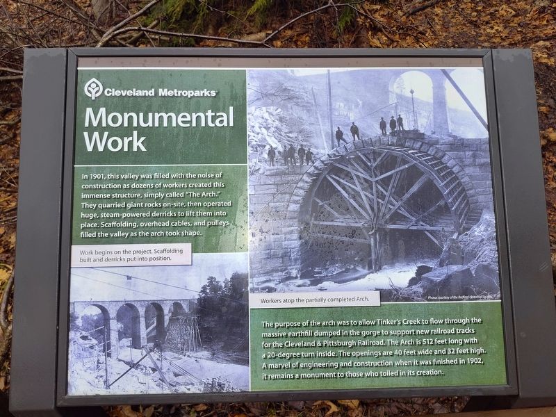
In 1901, this valley was filled with the noise of construction as dozens of workers created this immense structure, simply called "The Arch." They quarried giant rocks on-site, then operated huge, steam-powered derricks to lift them into place. Scaffolding, overhead cables, and pulleys filled the valley as the arch took shape.
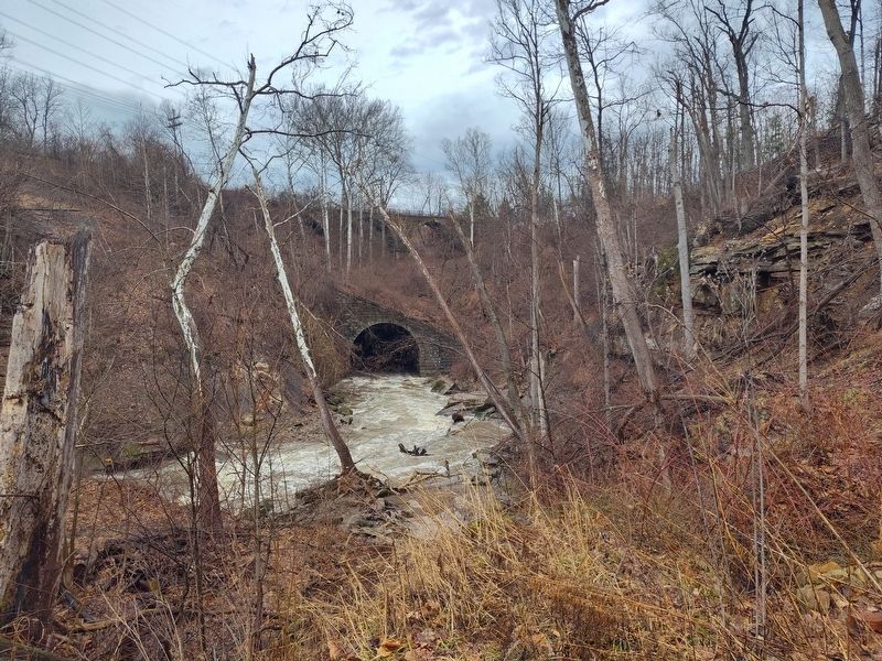
The purpose of the arch was to allow Tinker's Creek to flow through the massive earthfill dumped in the gorge to support new railroad tracks for the Cleveland & Pittsburgh Railroad. The Arch is 512 feet long with a 20-degree turn inside. The openings are 40 feet wide and 32 feet high. A marvel of engineering and construction when it was finished in 1902, it remains a monument to those who toiled in its creation.
Erected by Cleveland Metroparks.
Topics. This historical marker is listed in these topic lists: Architecture • Arts, Letters, Music • Parks & Recreational Areas • Waterways & Vessels. A significant historical year for this entry is 1901.
Location. 41° 23.044′ N, 81° 31.957′ W. Marker is in Bedford, Ohio, in Cuyahoga County. It is at the intersection of Willis Street and
this page online

Regionally, this marker is in Greater Cleveland, on the Lake Erie Shore, and in the Western Reserve. It is also in the American Midwest. Globally, it is in North America, on the Great Lakes, in the Western Hemisphere, in the Western World, and in the Anglosphere. Historically, it finds itself in what was once the Haudenosaunee (Iroquois) Confederacy, the territory of the Mississippian Culture, and the Northwest Territory.
Other nearby markers. At least 8 other markers are within walking distance of this marker: Place of Power (within shouting distance of this marker); To Get to the Other Side (about 500 feet away, measured in a direct line); Bedford Township Hall (approx. 0.4 miles away); 1837 — 1987 (approx. 0.4 miles away); In Remembrance Veterans of World War I (approx. 0.4 miles away); Bedford Railroad Depot (approx. 0.4 miles away); Bedford Civil War Memorial (approx. half a mile away); Elmer Harrison Flick
Photographed by Craig Doda, March 7, 2026
2. Monumental Work Marker
Photographed by Craig Doda, March 7, 2026
3. The Arch
Credits. This page was last revised on April 15, 2026. It was originally submitted on April 10, 2026, by Craig Doda of Napoleon, Ohio. This page has been viewed 13 times since then. Photos: 1, 2, 3. submitted on April 10, 2026, by Craig Doda of Napoleon, Ohio. • Devry Becker Jones was the editor who published this page.
