Scotland in St. Mary's County, Maryland — The American Northeast (Mid-Atlantic)
The Grace Church Cemetery Confederate Monument
April 11, 2026
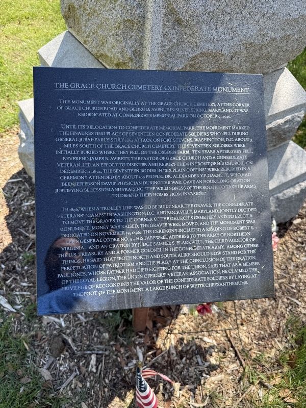
1. The Grace Church Cemetery Confederate Monument Marker
This monument was originally at the Grace Church Cemetery, at the corner of Grace Church Road and Georgia Avenue in Silver Spring, Maryland. It was rededicated at Confederate Memorial Park on October 9, 2020.
Until its relocation to Confederate Memorial Park, the monument marked the final resting place of seventeen Confederate soldiers who fell during General Jubal Early's July 1864 attack on Fort Stevens, Washington, D.C. About 3 miles south of the Grace Church Cemetery. The seventeen soldiers were initially buried where they fell on the Osborn Farm. Ten years after they fell, Reverend James B. Avirett, the Pastor of Grace Church and a Confederate veteran, led an effort to disinter and rebury them in front of his church. On Decmeber 11, 1874, the seventeen bodies in "six plain coffins" were reburied in a ceremony attended by about 300 people. Dr. Alexander Y.P. Garnett, who had been Jefferson Davis' physician during the war, gave an hour-long oration justifying secession and praising "the willingness of the South to take up arms to defend their homes from invasion."
In 1896, when a trolley line was to be built
this page online
Erected by Confederate Memorial Park, Inc.
Topics and series. This historical marker and monument is listed in these topic lists: Arts, Letters, Music
April 11, 2026
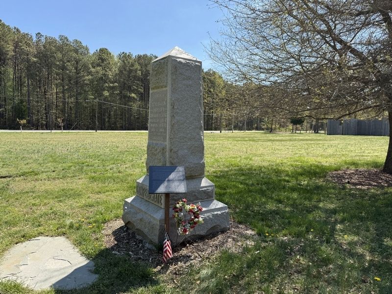
2. The Grace Church Cemetery Confederate Monument with the marker standing alongside it
Location. 38° 4.417′ N, 76° 20.434′ W. Marker is in Scotland, Maryland, in St. Mary's County. It is on Point Lookout Road (Route 5) east of St. Michaels Manor Way, on the right when traveling east. Touch for map. Marker is at or near this postal address: 11625 Point Lookout Rd, Scotland MD 20687, United States of America. Touch for directions.

Regionally, this marker and monument is in Southern Maryland. It is also in the American South, specifically in the Upper South, in the Mid-Atlantic, in the Tidewater, in the Chesapeake Bay Region, and on the Eastern Seaboard. Globally, it is in the North Atlantic Region, North America, the Western Hemisphere, the Western World, and the Anglosphere. Historically, it finds itself in what was once one of the original Thirteen Colonies and also the Antebellum South.
Other nearby markers. At least 8 other markers are within walking distance of this marker: Confederate Monument (here, next to this marker); Point Lookout Prison (a few steps from this marker); Point Lookout Prisoner-of-War Camp (a few steps from this marker); Pvt. William Hennry Laird (within shouting distance of this marker); Granite Stone (within shouting distance of this marker); Unknown Confederate Burials Memorial (within shouting distance of this marker); Sister Mary Consolata Conlan (within shouting distance of this marker); Lt. Peter Goodwin Benton (within shouting distance of this marker). Touch for a list and map of all markers in Scotland.
Credits. This page was last revised on April 12, 2026. It was originally submitted on April 12, 2026. This page has been viewed 32 times since then. Photos: 1, 2. submitted on April 12, 2026.
