Scotland in St. Mary's County, Maryland — The American Northeast (Mid-Atlantic)
A Seaside Resort at Point Lookout
Point Lookout State Park
| — | Maryland Park Service | — |
Photographed by Devry Becker Jones (CC0), April 11, 2026
1. A Seaside Resort at Point Lookout Marker
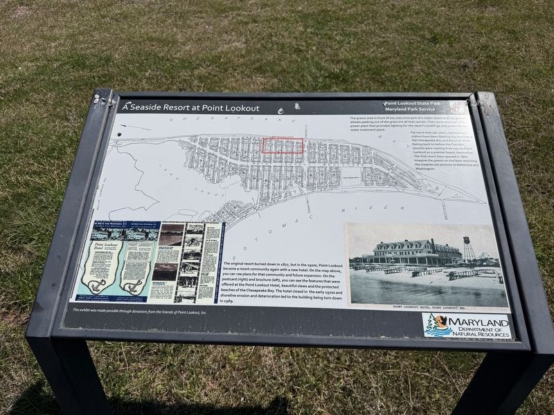
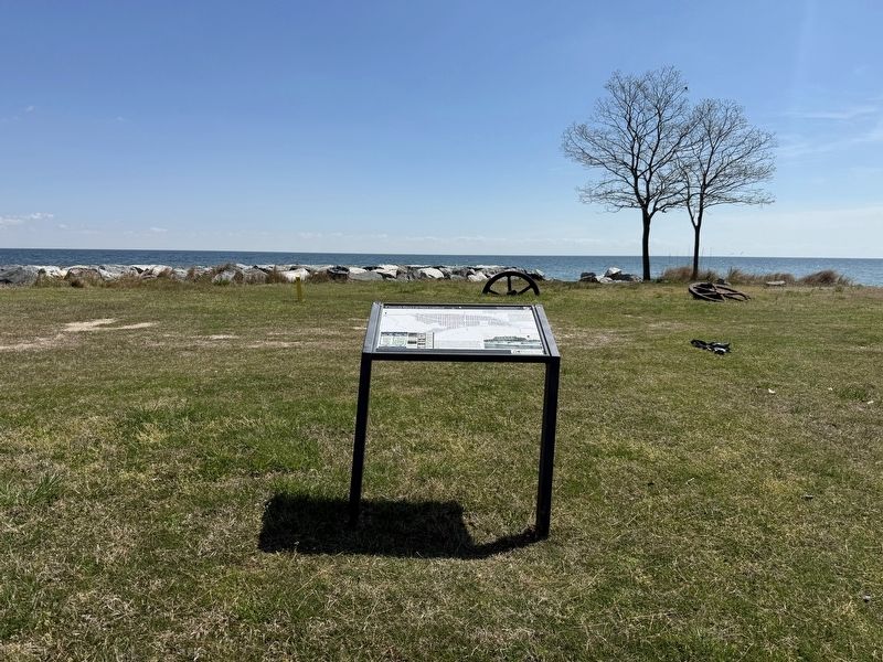
The grassy area in front of you was once part of a major resort and the geared wheels peeking out of the grass are all that remain. They were once part of a power plant that provided lighting for the resort's buildings and power for its water treatment plant.
For more than 160 years, summertime visitors have been flocking the beaches on the Chesapeake Bay and Potomac River. Dating back to before the Civil War, tourists were making their way to Point Lookout as a premier beach destination. The first resort here opened in 1860. Imagine the guests on the lawn watching the steamboats enroute to Baltimore and Washington.
The original resort burned down in 1877, but in the 1920s, Point Lookout became a resort community again with a new hotel. On the map above, you can see plans for that community and future expansion. On the postcard (right) and brochure (left), you can see the features that were offered at the Point Lookout Hotel, beautiful views and the protected beaches of the Chesapeake Bay. The hotel closed in the early 1970s and shoreline erosion and deterioration led to the building being torn down in 1989.
Erected by Maryland
this page online
Topics. This historical marker is listed in these topic lists: Industry & Commerce • Parks & Recreational Areas • Waterways & Vessels. A significant historical year for this entry is 1860.
Location. 38° 3.427′ N, 76° 19.464′ W. Marker is in Scotland, Maryland, in St. Mary's County. It is on Point Lookout Road (Maryland Route 5) south of 3rd Way, on the left when traveling south. Touch for map. Marker is in this post office area: Scotland MD 20687, United States of America. Touch for directions.

Regionally, this marker is in Southern Maryland. It is also in the American South, specifically in the Upper South, in the Mid-Atlantic, in the Tidewater, in the Chesapeake Bay Region, and on the Eastern Seaboard. Globally, it is in the North Atlantic Region, North America, the Western Hemisphere, the Western World, and the Anglosphere. Historically, it finds itself in what was once one of the original Thirteen Colonies and also the Antebellum South.
Other nearby markers. At least 8 other markers are within walking distance of this marker: Storm Blocks the Route to Freedom
Photographed by Devry Becker Jones (CC0), April 11, 2026
2. A Seaside Resort at Point Lookout Marker
Other markers no longer nearby. A Seaside Resort at Point Lookout (has been replaced with this marker); Prison Pen (was approx. 0.6 miles away but has been replaced with another marker now near it).
Credits. This page was last revised on April 12, 2026. It was originally submitted on April 12, 2026, by Devry Becker Jones of Washington, District of Columbia. This page has been viewed 46 times since then. Photos: 1, 2. submitted on April 12, 2026, by Devry Becker Jones of Washington, District of Columbia.
