Richland in Benton County, Washington — The American West (Northwest)
Hanford Irrigation Canal and Associated Laterals
1908-1943
Photographed by Clayton Pickett, April 12, 2026
1. Hanford Irrigation Canal and Associated Laterals Marker
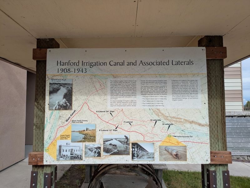
The Hanford Irrigation Canal referred to as the “Low Line Ditch” and also the “D Canal” received its water from the Coyote Rapids Pump Station at Coyote Rapids. Irrigation water was delivered from the main canal through several laterals supplying water to local agricultural producers from about 1908 until 1943. The annual irrigation season began on April 1st and continued until October 31st with the greatest demand directly associated with hot weather in July and August.
To reduce seepage of irrigation water into the soils, several segments of the canal were lined with cement while other segments remained open earthen ditches. Overall, the canal supplied irrigation water to local agricultural lands until the Manhattan Project took control of the area in 1943. The Hanford Irrigation Canal consisted of the main canal and several laterals (E, F, G and H). The main canal was approximately 25 miles long and perhaps the Coyote Rapids Pumping Plant and extended east past the town of Hanford.
• The large E-lateral was 5.1 miles long.
• The small E-lateral was 0.7 miles long.
• The F-lateral was 2.2 miles long.
•
this page online
• The H-lateral was 7,800 feet long.
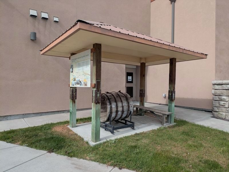
A segment of H-Lateral in this display was uncovered in December 2009 during Washington Closure Hanford’s remediation activities for the 100-D/DR Waste Site. At the time of discovery, the segment was about 10 inches under the surface of the ground. A segment about 35 feet long, constructed of tongue and groove wood, was removed from under the gravel road and a portion of the pipeline placed in this display as a representative sample of pre-Hanford irrigation system.
[Captions:]
Coyote Rapids Pumping Plant Circa 1910
Coyote Rapids Pumping Plant Circa 2009
Topics. This historical marker is listed in these topic lists: Agriculture • Settlements & Settlers • War, World II • Waterways & Vessels. A significant historical year for this entry is 1908.
Location. 46° 14.159′ N, 119° 13.006′ W. Marker is in Richland, Washington, in Benton County. It can be reached from Columbia Park Trail half a mile east of Columbia Center Boulevard, on the right when traveling east. Marker is located at the Hanford Reach Interpretive Center. Touch for map. Marker is
Photographed by Clayton Pickett, April 12, 2026
2. Recovered segment of the H Lateral.

Regionally, this marker is in the Columbia Basin and in Yakima Valley. It is also in the American Mountain West and in the Lewis & Clark Corridor. Globally, it is in North America, on the Pacific Rim, in the Western Hemisphere, in the Western World, and in the Anglosphere.
Other nearby markers. At least 8 other markers are within 4 miles of this marker, measured as the crow flies: Boomers On Wheels © (within shouting distance of this marker); First Federal Road in the Northwest (approx. 1.3 miles away); Peace And Friendship (approx. 3 miles away); Regional Veterans Memorial (approx. 3.3 miles away); Revolutionary War Patriots (approx. 3.3 miles away); Mueller's Veterans Memorial (approx. 3.3 miles away); V.F.W. Veterans Memorial (approx. 3.4 miles away); American Legion Veterans Memorial (approx. 3.4 miles away). Touch for a list and map of all markers in Richland.
Credits. This page was last revised on April 18, 2026. It was originally submitted on April 12, 2026, by Clayton Pickett of Richland, Washington. This page has been viewed 17 times since then. Photos: 1, 2. submitted on April 12, 2026, by Clayton Pickett of Richland, Washington. • James Hulse was the editor who published this page.
