Tallahassee in Leon County, Florida — The American South (South Atlantic)
Site of the Raid on Chaires Plantation
Photographed by Tim Fillmon, April 15, 2026
1. Site of the Raid on Chaires Plantation Marker
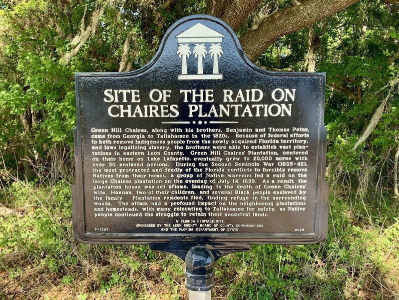
Green Hill Chaires, along with his brothers, Benjamin and Thomas Peter, came from Georgia to Tallahassee in the 1820s. Because of federal efforts to both remove Indigenous people from the newly acquired Florida territory, and laws legalizing slavery, the brothers were able to establish vast plantations in eastern Leon County. Green Hill Chaires' Plantation, centered on their home on Lake Lafayette, eventually grew to 20,000 acres with over 50 enslaved persons. During the Second Seminole War (1835-42), the most protracted and deadly of the Florida conflicts to forcibly remove Natives from their homes, a group of Native warriors led a raid on the large Chaires plantation on the evening of July 14, 1839. As a result, the plantation house was set aflame, leading to the death of Green Chaires' wife, Hannah, two of their children, and several Black people enslaved by the family. Plantation residents fled, finding refuge in the surrounding woods. The attack had a profound impact on the neighboring plantations and homesteads, with many relocating to Tallahassee for safety, as Native people continued the struggle to
this page online
A Florida Heritage Site
Erected 2024 by Leon County Board of County Commissioners and the Florida Department of State. (Marker Number F-1287.)
Topics. This historical marker is listed in these topic lists: Indigenous Peoples and Communities • Settlements & Settlers • Wars, US Indian. A significant historical date for this entry is July 14, 1839.
Location. 30° 26.617′ N, 84° 10.033′ W. Marker is in Tallahassee, Florida, in Leon County. It can be reached from South Pedrick Road 0.7 miles east of Stoney Creek Way. Marker is located almost 3/4 of a mile down J. R. Alford Greenway Trail east of the parking lot. Touch for map. Marker is at or near this postal address: 2500 S Pedrick Rd, Tallahassee FL 32317, United States of America. Touch for directions.

Regionally, this marker is in North Florida. It is also in the American South and specifically in the Deep South. Globally, it is in the North Atlantic Region, North America, a Gulf of Mexico state, the Western Hemisphere, the Western World, and the Anglosphere. Historically, it finds itself in what was once New Spain, the territory of the

Photographed by Tim Fillmon, April 15, 2026
2. Site of the Raid on Chaires Plantation Marker
Other nearby markers. At least 8 other markers are within 4 miles of this marker, measured as the crow flies: The Block-Sterns Site (approx. half a mile away); Under Cover of Corn (approx. 1½ miles away); Tallahassee National Cemetery Carillon (approx. 1.8 miles away); Tallahassee National Cemetery (approx. 1.8 miles away); The Mission Of San Pedro y San Pablo de Patale (approx. 1.9 miles away); Munree (Fleischmann) Cemetery of Welaunee Plantation (approx. 2.6 miles away); Chaires Historic District (approx. 2.8 miles away); Leon County War on Terror Memorial (approx. 3.2 miles away). Touch for a list and map of all markers in Tallahassee.
Another marker is no longer nearby. Eastern Boundary of Lafayette Land Grant (was approx. 2½ miles away but has been confirmed missing).
Also see . . . Second Seminole War. (Submitted on April 15, 2026, by Tim Fillmon of Webster, Florida.)
Credits. This page was last revised on April 15, 2026. It was originally submitted on April 15, 2026, by Tim Fillmon of Webster, Florida. This page has been viewed 49 times since then. Photos: 1, 2. submitted on April 15, 2026, by Tim Fillmon of Webster, Florida.
