Yorktown in York County, Virginia — The American South (Mid-Atlantic)
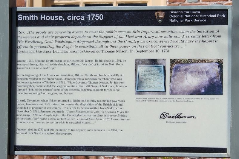
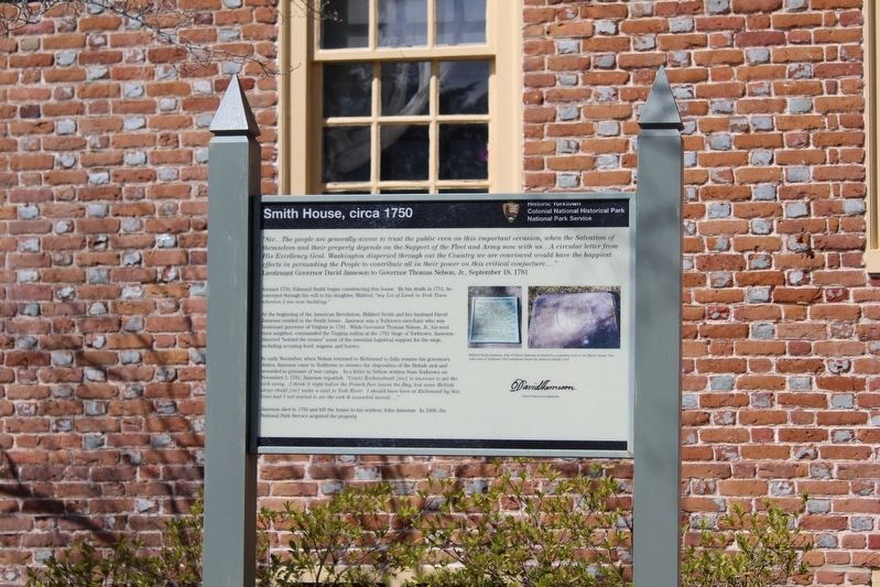
Smith House, circa 1750
Historic Yorktown
| — | Colonial National Historical Park | — |
Photographed by Evan Dwyer, March 9, 2025
1. Smith House, circa 1750 Marker
Sir... The people are generally averse to trust the public even on this important occasion, when the Salvation of themselves and their property depends on the Support of the Fleet and Army now with us... A circular letter from His Excellency Genl. Washington dispersed through out the Country we are convinced would have the happiest effects in persuading the People to contribute all in their power on this critical conjucture...."
Lieutenant Governor David Jameson to Governor Thomas Nelson, Jr., September 18, 1781
Around 1750, Edmund Smith began constructing this house. By his death in 1751, he conveyed through his will to his daughter, Mildred, "my Lot of Land in York Town whereon I am now building."
At the beginning of the American Revolution, Mildred Smith and her husband David Jameson resided in the Smith house. Jameson was a Yorktown merchant who was lieutenant governor of Virginia in 1781. While Governor Thomas Nelson, Jr., his next door neighbor, commanded the Virginia militia at the 1781 Siege of Yorktown, Jameson directed "behind the scenes" some of the essential logistical support for the siege, including securing
this page online
In early November, when Nelson returned to Richmond to fully resume his governor's duties, Jameson came to Yorktown to oversee the disposition of the British sick and wounded to prisoner of war camps. In a letter to Nelson written from Yorktown on November 5, 1781, Jameson reported: "Count Rochambault [sic] is anxious to get the sick away... I think it right before the French fleet leaves the Bay, lest some British ships shud [sic] make a visit to York River. I should have been at Richmond by this time had I not waited to see the sick & wounded moved...."
Jameson died in 1793 and left the house to his nephen, John Jameson. In 1968, the National Park Service acquired the property.
Image Captions:
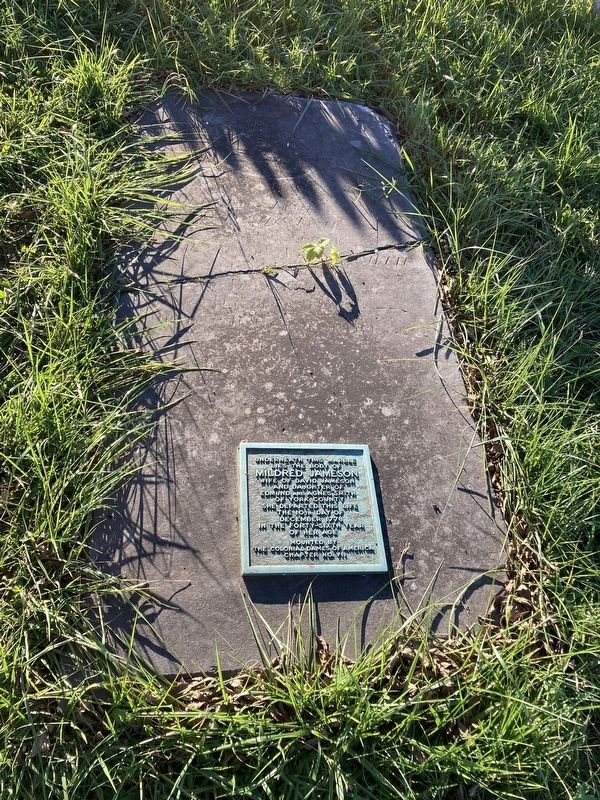
Mildred Smith Jameson, wife of David Jameson is buried in a cemetery next to the Moore House, two miles east of Yorktown. Her tombstone bears the Jameson family crest.
David Jameson's signature
Erected by National Park Service, U.S. Department of the Interior.
Topics. This historical marker is listed in these topic lists: Colonial Era • War, US Revolutionary. A significant historical year for this entry is 1750.
Location. 37° 14.025′ N,
Photographed by Evan Dwyer, March 9, 2025
2. Smith House, circa 1750 Marker

Regionally, this marker is on Virginia’s Peninsula, in Coastal Virginia, and in the Hampton Roads Metropolitan Area. It is also in the American South, specifically in the Upper South, in the Tidewater, and on the Eastern Seaboard. Globally, it is in the North Atlantic Region, North America, the Western Hemisphere, the Western World, and the Anglosphere. Historically, it finds itself in what was once the territory of the Mississippian Culture, one of the original Thirteen Colonies, one of the Confederate States of America, and the Antebellum South.
Other nearby markers. At least 8 other markers are within walking distance of this marker: Ballard House, circa 1709 (within shouting distance of this marker); Sessions-Pope-Sheild Property (within shouting
Photographed by Evan Dwyer, April 11, 2026
3. Smith House, circa 1750 Marker
& House.
Another marker is no longer nearby. Nelson House, circa 1730 (was within shouting distance of this marker but has been confirmed missing).
Regarding Smith House, circa 1750. The house is a private residence and not open to the public.
Photographed by Evan Dwyer, April 11, 2026
4. Smith House, circa 1750
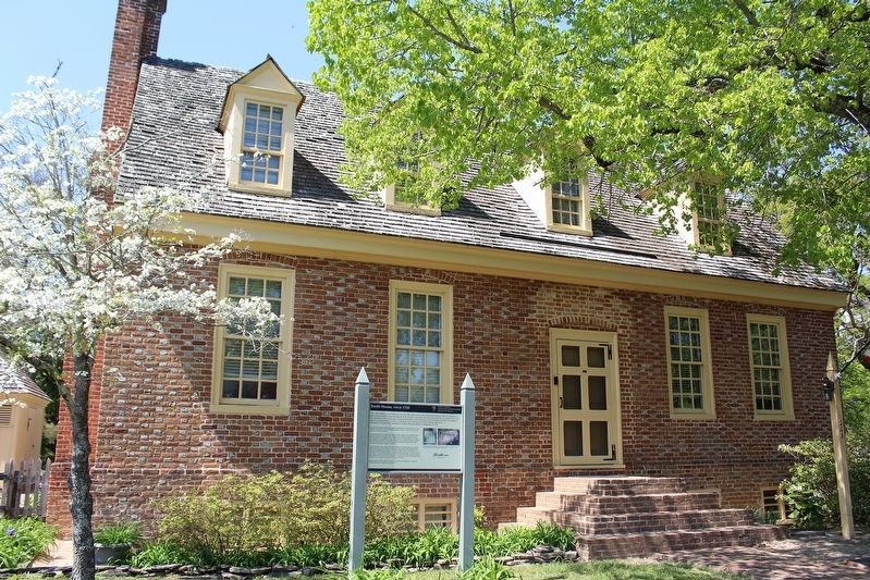
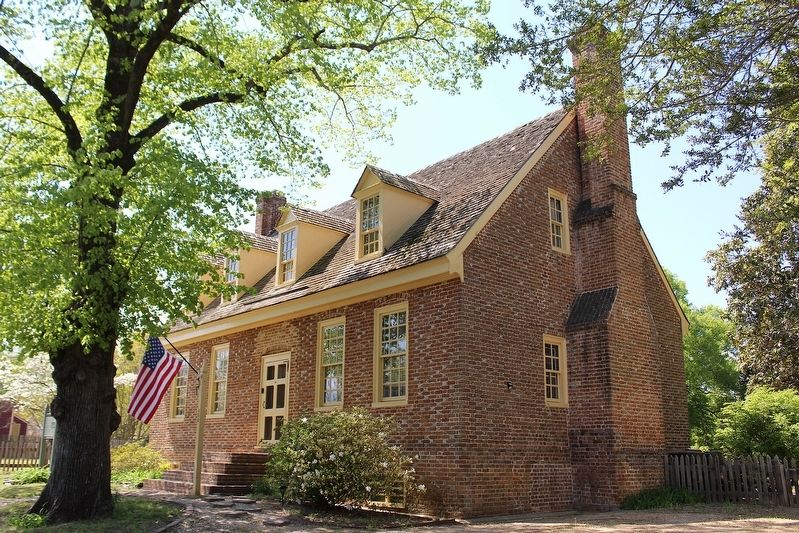
View from just northeast of the house on Nelson Street. Like the Nelson House, the Smith House was included in the Blow Family's purchase of property to form their estate "York Hall," which later became NPS property in its entirety. The 20th century buildings added by the Blows comprise the administrative complex for the park on Read Street. During the period of Blow ownership, the Smith House was converted to use as a guest cottage, and the rear of the house (facing Read Street - not visible here) was modified to be the front of the home. NPS restored it to its original configuration facing Nelson Street as shown. The interior has been modernized and storm damage has reduced how much original material remains.
Photographed by Evan Dwyer, November 4, 2023
5. Mildred Smith Jameson's Grave
At Moore House, also part of the National Park Service's holdings and located southeast of the Yorktown Battlefield Visitor Center.
Photographed by Evan Dwyer, October 25, 2025
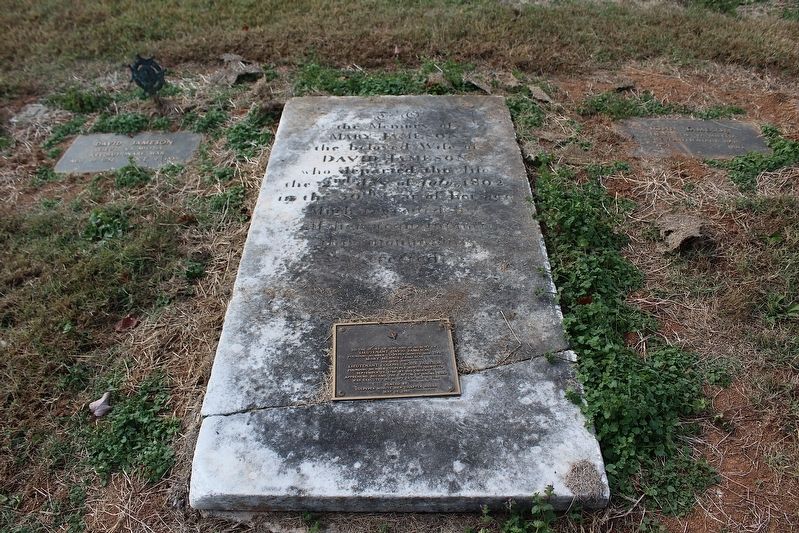
6. Jameson Family Graves in Culpeper, Virginia
John Jameson, the nephew of Lt. Gov David Jameson that inherited the Smith House on his uncle's passing, has a gravestone at upper right. His brother David, who also inherited property from his uncle Lt. Gov David Jameson, has a headstone at upper left. In the middle is this younger David's wife's stone, with a memorial tablet to this trio of Jamesons mounted on it. These people are buried in the Culpeper Masonic Cemetery, originally the family plot of Gen. Edward Stevens, the younger David Jameson's commander during the Revolutionary War.
The burial location of Lt. Gov. David Jameson is unknown. While the Smith House is listed as the John Jameson House on tax records from 1800-1810, the Culpeper Museum of History describes John Jameson as residing in Culpeper at that time and having a membership in an Alexandria Masonic Lodge - so his residence in the Smith house is hard to validate, both considering this discrepancy and the granting of over 400 acres of land in Ohio for his Revolutionary War service (which included a prominent role in the exposure of Benedict Arnold's treason) as well as land ownership in Kentucky.
Credits. This page was last revised on May 5, 2026. It was originally submitted on April 18, 2026, by Evan Dwyer of Richmond, Virginia. This page has been viewed 24 times since then. Photos: 1, 2, 3, 4, 5, 6. submitted on April 18, 2026, by Evan Dwyer of Richmond, Virginia. • Bill Pfingsten was the editor who published this page.
