Cambria in San Luis Obispo County, California — The American West (Pacific Coastal)
Santa Rosa Creek
Photographed by Jason Voigt, March 25, 2026
1. Santa Rosa Creek Marker
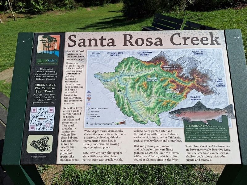
Santa Rosa Creek originates in the Santa Lucia mountain range.
Restoration of its 47-square mile watershed is an on-going Greenspace priority, including restoration plans, stream bank replanting and repair, removal of barriers to fish migration, and community education.
Santa Rosa Creek offers a wildlife corridor linked to nearby ranchland and forest tracts. This creek provides habitat for wildlife like deer, bobcats, bats and birds, as well as insects and federally protected species like steelhead trout.
Water depth varies dramatically during the year, with winter rains occasionally flooding this site. Summertime creek flow is largely underground, leaving only occasional pools.
Late 19th century photographs show little vegetation here, so the creek was usually visible.
Willows were planted later and thrived along with trees and shrubs native to riparian zones in California, such as monkeyflower and ceanothus.
Red and yellow plum, walnut, and crabapple trees were likely planted, as was the Tree of Heaven (Ailanthus altissima) which is often found at Chinese sites in the West.
Santa Rosa Creek
this page online
(inset:)
Steelhead trout are thriving in Santa Rosa Creek. When enough rain falls and the creek flows out to sea, they leave the freshwater pools they were born in to begin the saltwater phase of their lives. After a few years at sea, these native steelhead return to this very creek to spawn - but unlike other species of salmon, they can return to spawn multiple times throughout their lives.
Erected by Greenspace.
Topics. This historical marker is listed in these topic lists: Animals • Environment • Waterways & Vessels.
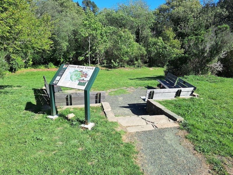
Location. 35° 33.757′ N, 121° 4.89′ W. Marker is in Cambria, California, in San Luis Obispo County. It can be reached from Hesperian Lane south of Center Street. Marker is located on the grounds of the Cambria Chinese Temple. Touch for map. Marker is at or near this postal address: 4055 Hesperian Ln, Cambria CA 93428, United States of America. Touch for directions.

Regionally, this marker is on the Central Coast
Photographed by Jason Voigt, March 25, 2026
2. Santa Rosa Creek Marker
Other nearby markers. At least 8 other markers are within walking distance of this marker: Restoration of Land and Culture (within shouting distance of this marker); Restored Chinese Temple (within shouting distance of this marker); California Native Plant Garden (about 300 feet away, measured in a direct line); Greenspace Creekside Reserve (about 300 feet away); The Guthrie-Bianchini House (about 400 feet away); Cambria Veterans' Memorial (approx. 0.8 miles away); Piedras Blancas Lighthouse Lens (approx. 0.9 miles away); Nitt Witt Ridge (approx. one mile away). Touch for a list and map of all markers in Cambria.
Another marker is no longer nearby. Preserving a Bit of History (was within shouting distance of this marker but has been permanently removed).
Also see . . . Greenspace Cambria.

Photographed by Jason Voigt, March 25, 2026
3. Santa Rosa Creek
There is a short trail that leads to access to the creek.
Credits. This page was last revised on April 19, 2026. It was originally submitted on April 19, 2026, by Jason Voigt of Glen Carbon, Illinois. This page has been viewed 29 times since then. Photos: 1, 2, 3. submitted on April 19, 2026, by Jason Voigt of Glen Carbon, Illinois.
