Anacostia Park in Southeast Washington in Washington, District of Columbia — The American Northeast (Mid-Atlantic)
Out of Segregation
Anacostia Park
| — | National Park Service, U.S. Department of the Interior | — |
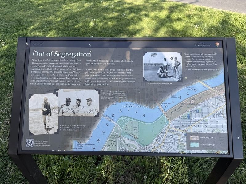
When Anacostia Park was created at the beginning of the 20th century, racial segregation was official United States policy. The park's original design divided it into two segregated spaces: Black-only area south of the 11th Street Bridge (also known as the Anacostia Bridge) and White-only area north of the bridge. By 1930, the White-only section had multiple sports fields, a nine-hole golf course, and a large clubhouse. Although planners had envisioned similar facilities for the Black-only section, they were never funded. Much of the Black-only section was ultimately given to the city for tree nurseries.
In 1933, the National Park Service (NPS) took over the park's management. At first the NPS maintained the segregated system. Black residents advocated for more access, eventually pushing the NPS to desegregated first the golf courses, then tennis courts, and finally the Anacostia Pool, desegregated in 1950.
"I can see no reason why Negroes should not be permitted to play on the golf course. They are taxpayers, they are citizens, and they have a right to play golf on public courses on the same basis as whites."
—Secretary of the Interior Harold Ickes, 1941
[Captions:]
From sandlot games to professional clubs, Anacostia's Black baseball players won fans and stoked hometown pride. Local teams included the A.C.'s and the Anacostia Aztecs.
In this circa 1920s photo, Marion Barry Avenue and the 11th Street Bridge can be seen in the background.
Erected by National
this page online
Topics. This historical marker is listed in these topic lists: African Americans • Civil Rights • Parks & Recreational Areas • Sports. A significant historical year for this entry is 1930.
Location. 38° 52.163′ N, 76° 59.458′ W. Marker is in Southeast Washington in Washington, District of Columbia. It is in Anacostia Park. It is on Anacostia Drive Southeast just south of Marion Barry Avenue Southeast, on the right when traveling south. Touch for map. Marker is at or near this postal address: 933 Marion Barry Ave SE, Washington DC 20020, United States of America. Touch for directions.

Regionally, this marker is in the Washington Metropolitan Area. It is also in the American Northeast, in the Upper South, in the Mid-Atlantic, in the Tidewater, and in the Chesapeake Bay Region. Globally, it is in North America, the Western Hemisphere, the Western World, and the Anglosphere.
Other nearby markers. At least 8 other markers are within walking distance of this marker: Assassin's Trail (within shouting distance of this marker); Armaments & Aircraft (within shouting distance

Credits. This page was last revised on April 19, 2026. It was originally submitted on April 19, 2026, by Devry Becker Jones of Washington, District of Columbia. This page has been viewed 8 times since then. Photos: 1, 2. submitted on April 19, 2026, by Devry Becker Jones of Washington, District of Columbia.
