Chesapeake City in Cecil County, Maryland — The American Northeast (Mid-Atlantic)
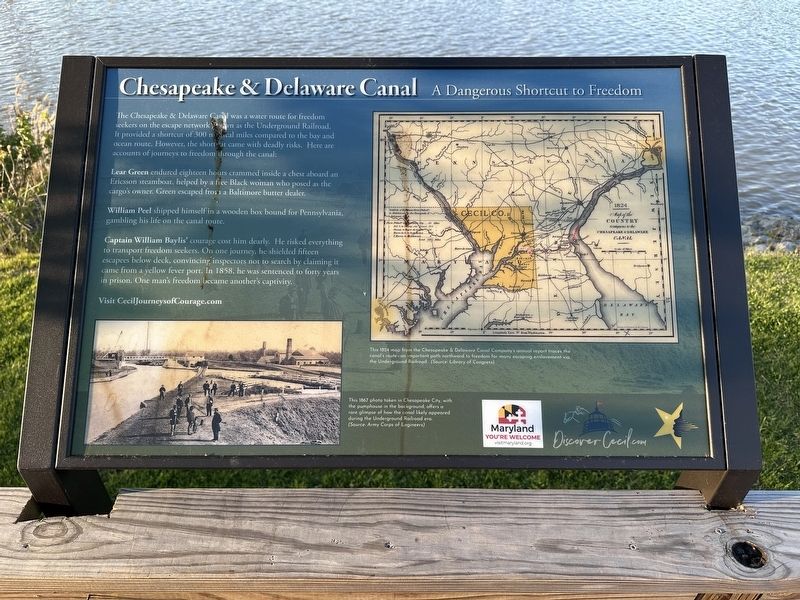
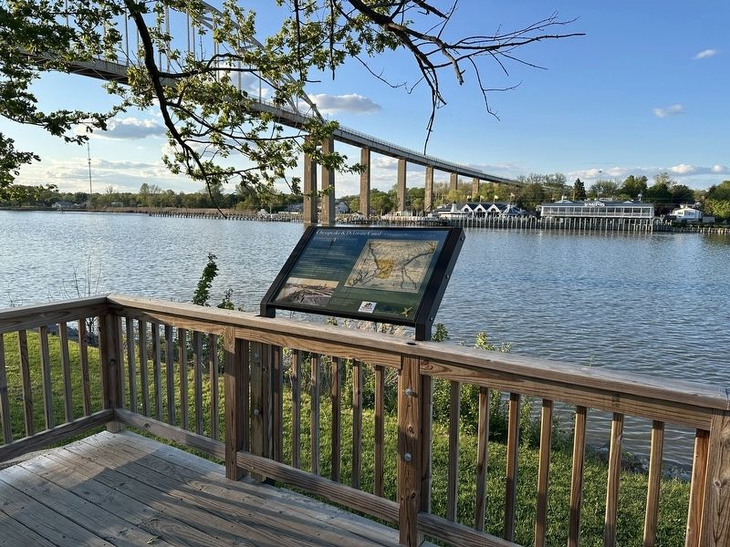
Chesapeake & Delaware Canal
A Dangerous Shortcut to Freedom
Photographed by Pete Skillman, April 20, 2026
1. Chesapeake & Delaware Canal Marker
Lear Green endured eighteen hours crammed inside a chest aboard an Ericsson steamboat, helped by a free Black woman who posed as the cargo's owner. Green escaped from a Baltimore butter dealer.
William Peel shipped himself in a wooden box bound for Pennsylvania, gambling his life on the canal route.
Captain William Baylis' courage cost him dearly. He risked everything to transport freedom seekers. On one journey, he shielded fifteen escapees below deck, convincing inspectors not to search by claiming it came from a yellow fever port. In 1858, he was sentenced to forty years in prison. One man's freedom became another's captivity.
Visit CecilJourneysofCourage.com
(Captions):
This 1824 map from the Chesapeake & Delaware Canal Company's annual report traces the canal's route--an important path northward to freedom for many escaping enslavement via the Underground Railroad. (Source: Library of Congress)
This 1867 photo taken in Chesapeake City, with the pumphouse in the background, offers a rare glimpse of how the canal likely appeared during the Underground Railroad era. (Source: Army Corps of Engineers)
Erected by Cecil
this page online
Topics. This historical marker is listed in these topic lists: Abolition & Underground RR • African Americans • Waterways & Vessels. A significant historical year for this entry is 1858.
Location. 39° 31.671′ N, 75° 48.765′ W. Marker is in Chesapeake City, Maryland, in Cecil County. It is on 1st Street, on the right when traveling west. Touch for map. Marker is at or near this postal address: 401 1st St, Chesapeake City MD 21915, United States of America. Touch for directions.

Regionally, this marker is in Greater Wilmington, on the Eastern Shore, and in Greater Philadelphia. It is also in the American Mid-Atlantic, on the Delmarva Peninsula, in the Tidewater, in the Chesapeake Bay Region, and on the Eastern Seaboard. Globally, it is in the North Atlantic Region, North America, the Western Hemisphere, the Western World, and the Anglosphere. Historically, it finds itself in what was once one of the original Thirteen Colonies and also the Antebellum South.
Other nearby markers. At least 8 other markers are within walking distance of this marker: From Creek to Canal (here, next to this marker); Shipwatch Inn
Photographed by Pete Skillman, April 20, 2026
2. Chesapeake & Delaware Canal Marker - wide view
Also see . . . CecilJourneysofCourage.com. This link was referenced on the marker.
Inequality was painfully evident for those who endured a life of slavery. Escapes were often attempted over and over again in a quest for freedom along the Underground Railroad. Cecil County’s Network to Freedom sites represent stories of those traveling through with passion in their hearts and courage in their souls, to live free and control their own destiny.(Submitted on April 20, 2026, by Pete Skillman of Wilmington, Delaware.)
Credits. This page was last revised on April 20, 2026. It was originally submitted on April 20, 2026, by Pete Skillman of Wilmington, Delaware. This page has been viewed 21 times since then. Photos: 1, 2. submitted on April 20, 2026, by Pete Skillman of Wilmington, Delaware.
