Montpelier Station in Orange County, Virginia — The American South (Mid-Atlantic)
The Backyard
Discovering Madison
Photographed by Craig Swain, September 6, 2009
1. The Backyard Marker
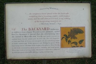
"…the sumptuous board spread under the forest oaks .... everything that a luxurious country could produce, wines, and the well filled punch bowl, to say nothing of the invigorating mountain air …"
- Mary Cutts, Memoir, c. 1840.
The Backyard barbecues so different from elegant Washington soirees, suited Dolley Madison's special flair for entertaining once she retired to Montpelier. Friends and family enjoyed the outdoor feasts that she spread under the forest oaks. The rich fragrance of lilacs and Pride of China trees mingled with the tantalizing aroma of whole roasted pigs. Tables groaned with Montpelier-grown food, impressing visitors with their lavish display of hospitality. Wine flowed as did lively conversation about politics, farming, and local gossip. When their work of serving ended, Montpelier's slaves were called on to entertain guests with fiddle playing, singing, and dancing.
Erected by Montpelier Foundation. (Marker Number 14.)
Topics. This historical marker is listed in these topic lists: African Americans • Agriculture • Entertainment • Women. A significant historical year for this entry is 1840.
Location. This marker has been replaced by another marker nearby.
this page online

Regionally, this marker was in Northern Virginia and in the Piedmont. It was also in the American South and specifically in the Upper South. Globally, it was in North America, the Western Hemisphere, the Western World, and the Anglosphere. Historically, it found itself in what was once the territory of the Mississippian Culture, one of the original Thirteen Colonies, one of the Confederate States of America, and the Antebellum South.
Other nearby markers. At least 6 other markers are within walking distance of this location: Garden (within shouting distance of this marker); Madison's Farm Complex (about 800 feet away); a different marker also named Madison's Farm Complex
Photographed by Craig Swain, September 6, 2009
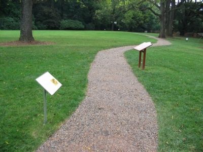
2. Markers along the Path to the Garden
Other markers no longer nearby. Homes for Enslaved Families (was here, next to this marker but has been replaced with another marker now near it); The Quarters (was within shouting distance of this marker but has been replaced with another marker now near it); The Road (was within shouting distance of this marker but has been replaced with another marker now near it); a different marker also named The Garden (was about 300 feet away, measured in a direct line but has been replaced with another marker now near it); The Blacksmith Shop (was about 500 feet away but has been replaced with another marker now near it); Madison Farm Complex (was about 700 feet away but has been replaced with another marker now near it); The African American Cemetery (was approx. ¼ mile away but has been replaced with another marker now near it); Slave Cemetery (was approx. ¼ mile away but has been replaced with another
Photographed by Craig Swain, September 6, 2009
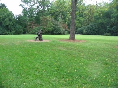
3. The Backyard
More about this marker. On the right is a illustration courtesy of special Collections Department, University of Virginia, captioned Lilac illustration by Philip Miller, an 18th-century naturalist.
Credits. This page was last revised on April 23, 2026. It was originally submitted on November 1, 2009, by Craig Swain of Leesburg, Virginia. This page has been viewed 922 times since then and 26 times this year. Last updated on April 22, 2026, by Evan Dwyer of Richmond, Virginia. Photos: 1, 2, 3. submitted on November 1, 2009, by Craig Swain of Leesburg, Virginia. • Devry Becker Jones was the editor who published this page.
