Montpelier Station in Orange County, Virginia — The American South (Mid-Atlantic)
Madison's Farm Complex
A Tobacco Plantation
Photographed by Evan Dwyer, March 28, 2026
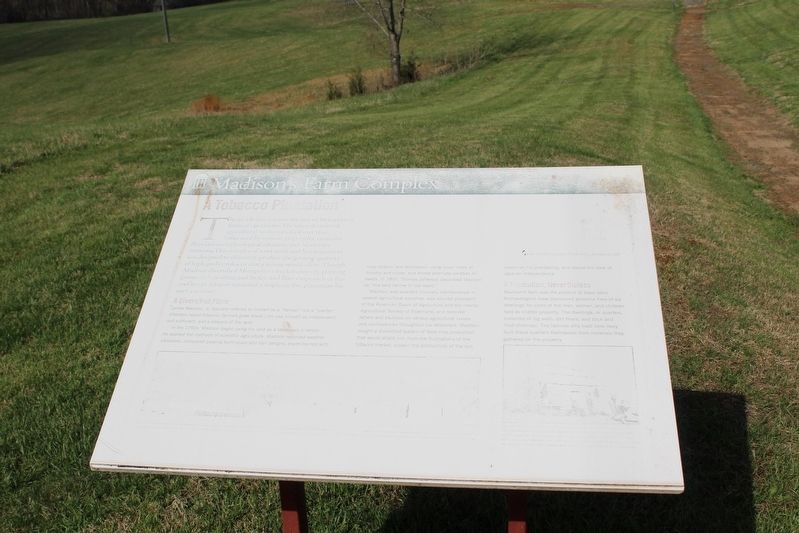
1. Madison's Farm Complex Marker
"The shortness of the crop of Corn at [my farm at] Black Meadow is a proof of the ruinous tendency of perpetual cultivation, and of the absolute necessity, of a meliorating rotation of rest, & red Clover, with all the help that manures can supply."
- James Madison to James Madison Sr., January 22, 1797
The area before you was the hub of Montpelier's farming operations. The labor of enslaved agricultural workers evolved over time, influenced by seasons, crop cycles, economic fluctuations, technological advances, and Madison's interests. This complex of work areas and living quarters was designed to efficiently produce the greatest quantity of high quality tobacco that a season would allow. Though Madison diversified Montpelier's market crops by planting grains such as wheat and barley, and fiber crops such as flax and hemp, tobacco remained a staple on this plantation for over a century.
A Diversified Farm
James Madison, Jr. typically referred to himself as a "farmer," not a "planter." (Planters raised tobacco; farmers grew wheat.) He saw himself as independent, self-sufficient, and a steward of the land.
In the
this page online
Madison was awarded honorary memberships in several agricultural societies, was elected president of the American Board of Agriculture and the nearby Agricultural Society of Albemarle, and received letters and treatises on various agricultural issues and controversies throughout his retirement. Madison sought a diversified system of food crop production that would shield him from the fluctuations of the tobacco market, sustain the productivity of the soil, maximize his profitability, and realize his ideal of agrarian independence.
A Plantation, Nevertheless
Madison's farm was the product of slave labor. Archaeologists have discovered evidence here of six dwellings for some of the men, women, and children held as chattel property. The

Photographed by Evan Dwyer, March 28, 2026
2. Madison's Farm Complex
The cabins mentioned in the marker are visible down the hill. The visitor center parking lot is off to the right.
[Captions:]
Conjectural model of the home farm complex in the 1820s. The existing log cabins are the two buildings to the far left (1 and 2). The whitewashed structure (3) is the location of the overseer's house and current archaeology dig.
Log field quarters, like this mid-19th-century example near Richmond, were far cruder than the framed domestic quarters found closer to the main house. However, with earthen floors and thick log walls, these homes were warmer in the winter months. While further from the Madisons' eyes, the families living and working here were under the watchful domain of the overseer who lived at the highest point on the landscape.
Erected by James Madison’s Montpelier.
Topics. This historical marker is listed in these topic lists: African Americans • Agriculture • Anthropology & Archaeology. A significant historical date for this entry is January 22, 1797.
Location. 38° 13.019′ N, 78° 10.215′ W. Marker has

Photographed by Evan Dwyer, March 28, 2026
3. Madison's Farm Complex Marker
Parking lot proximity visible at right.

Regionally, this marker is in Northern Virginia and in the Piedmont. It is also in the American South and specifically in the Upper South. Globally, it is in North America, the Western Hemisphere, the Western World, and the Anglosphere. Historically, it finds itself in what was once the territory of the Mississippian Culture, one of the original Thirteen Colonies, one of the Confederate States of America, and the Antebellum South.
Other nearby markers. At least 5 other markers are within walking distance of this location: A different marker also named Madison's Farm Complex (about 400 feet away, measured in a direct line); Garden (about 700 feet away); Home Farm Complex (approx. 0.2 miles away); Mount Pleasant (approx. 0.2 miles away); Dolley Madison (approx. 0.9 miles away). Touch for a list and map of all markers in Montpelier Station.
Other markers no longer nearby. Madison Farm Complex (was within shouting distance of this marker but has been replaced with another marker now near it); The Quarters (was about 600 feet away but has been replaced with another marker now near it); a different marker also named The Garden (was about 700 feet away but has been replaced with another marker now near it); Homes for Enslaved Families (was about 700 feet away but has been replaced with another marker now near it); The Backyard (was about 800 feet away but has been replaced with another marker now near it); The Road (was approx. 0.2 miles away but has been replaced with another marker now near it); The African American Cemetery (was approx. 0.2 miles away but has been replaced with another marker now near it); Mount Pleasant c. 1750s (was approx. 0.2 miles away but has been replaced with another marker now near it); Slave Cemetery (was approx. ¼ mile away but has been replaced with another marker now near it); The Blacksmith Shop (was approx. ¼ mile away but has been replaced with another marker now near it); The Madison Family Cemetery (was approx. ¼ mile away but has been replaced with another marker now near it).
Credits. This page was last revised on April 23, 2026. It was originally submitted on April 22, 2026, by Evan Dwyer of Richmond, Virginia. This page has been viewed 20 times since then. Photos: 1, 2, 3. submitted on April 22, 2026, by Evan Dwyer of Richmond, Virginia. • Devry Becker Jones was the editor who published this page.
