Pulaski in Giles County, Tennessee — The American South (East South Central)
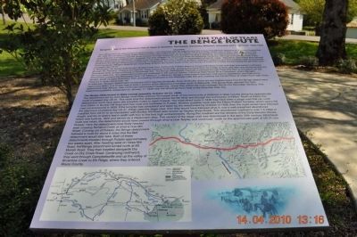
The Benge Route
The Trail of Tears
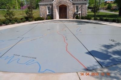
John Benge led one detachment of approximately 1100 Cherokee with 60 wagons and 600 horses that left from Alabama on about September 28, 1838 from camp in Wills Valley, approximately eight mile south of Fort Payne, Of all the routes of the Trail of Tears, Benge’s route is the most obscure. It is known that the group traveled through Huntsville and Gunter’s Landing in Alabama and Reynoldsburg on the Tennessee River in Tennessee. Evidence also suggests that they crossed the Mississippi River at Columbus, Kentucky. Although the specific route of the Benge detachment is not known, a likely route has been determined through an examination of period maps. Reports to John Ross and General Scott from Benge detachment reveal that it crossed the Tennessee River at Gunter’s Landing in Alabama and then headed north to Huntsville. From Huntsville, Benge’s detachment most likely entered Tennessee south of the community of Ardmore in Giles County along the general route of present day US 31.
In Tennessee, the Benge detachment traveled north from Ardmore to Pulaski where it crossed Richland Creek and then proceeded northwest through Mt. Pleasant, crossing the Natchez Trace, passing Centerville, crossing the Duck River by bridge or ferry, and then was ferried across the Tennessee River at Reynoldsburg on November 3rd. The Benge detachment marched northwest to Charleston and then on to Benton, south of Cape Girardeau, then proceeding southwest to the Arkansas state line and crossing the Current River at Indian Ford near Hicks Ferry on or about December 7th.
In Arkansas, Benge’s detachment continued until it reached Smithville. Form Smithville there are two logical routes that the Benge detachment might have taken. It is known that at least a portion of the detachment traveled south to Batesville. This group likely rejoined the main detachment possibly disbanded on January 17, 1839 near the Woodhall Farm west of the Arkansas state line.
The Benge Detachment in Giles County (possibly October 20-23, 1838)
The detachment led by John Benge most likely entered Tennessee south of the community of Ardmore in Giles County along the approximate route of present day US 31. This route took the detachment across the Elk River and through the community of Elkton. North of Elkton the detachment could have taken two possible routes to reach Pulaski. The most direct route in 1838 may have been a stage road that ran north from Elkton to Bunker Hill Road and then west and northwest to Pulaski. Another possible route was the Elkton-Pulaski Turnpike, which was a toll road
commissioned in 1838. If the turnpike was completed and taken by the detachment by October of 1838, then the route would have followed the alignment of present-day US 31. If they used the stage road, then they would have followed what is now a well-preserved abandoned roadbed from US 31 to its intersection with Bunker Hill Road (also known as Tarpley Shop Road). This abandoned roadbed is over 1.5 mile in length, and ten to twelve feet in width with four to five foot high embankments. Along this roadbed are the remains of the Early Benson House, which was built ca. 1820 and served as a stagecoach stop. This section of the stage road was abandoned in the early 20th century. Whichever route was taken, the detachment would have passed through what is now Tarpley and continued north on the approximate path of US 31 into Pulaski. Here the detachment most likely headed west cross Richland Creek at what is now Mill Street. Coming out of Pulaski, the Benge detachment followed a route for about 6 miles that the Bell detachment would later take. Both of these detachments traveled though Pulaski approximately two weeks apart. After heading west on Vales Mill Road, the Benge detachment turned north at Mt. Moriah Road. They then traveled alongside Dry Creek on Dry Creek Road. Continuing northward, they went through Campbellsville and up the valley of Brownlow Creek to
Elk Ridge, where they entered Maury County.
Topics and series. This historical marker is listed in these topic lists: Native Americans • Roads & Vehicles. In addition, it is included in the Trail of Tears series list. A significant historical month for this entry is January 1863.
Location. 35° 11.732′ N, 87° 1.795′ W. Marker is in Pulaski, Tennessee, in Giles County. Marker is on Stadium Street near East College Street. Located in front of Trail of Tears Interpretive Center. Touch for map. Marker is in this post office area: Pulaski TN 38478, United States of America. Touch for directions.
Other nearby markers. At least 8 other markers are within walking distance of this marker. The Trail of Tears Interpretive Center (a few steps from this marker); Giles County Trail of Tears Memorial (within shouting distance of this marker); The Bell Route (within shouting distance of this marker); Nunahi-Duna-Dlo-Hily-I (within shouting distance of this marker); Trail of Tears (within shouting distance of this marker); Count Casimir Pulaski (1747-1779) (about 300 feet away, measured in a direct line); Giles County Courthouses (about 300 feet away); Native Americans in Giles County (about 300 feet away). Touch for a list and map of all markers in Pulaski.
Credits. This page was last revised on December 15, 2019. It was originally submitted on April 15, 2010, by Sandra Hughes Tidwell of Killen, Alabama, USA. This page has been viewed 3,615 times since then and 150 times this year. Photos: 1, 2, 3. submitted on April 15, 2010, by Sandra Hughes Tidwell of Killen, Alabama, USA. • Kevin W. was the editor who published this page.


