Portsmouth in Carteret County, North Carolina — The American South (South Atlantic)
Remembering Our Ancestors
African Presence and the Middle Passage
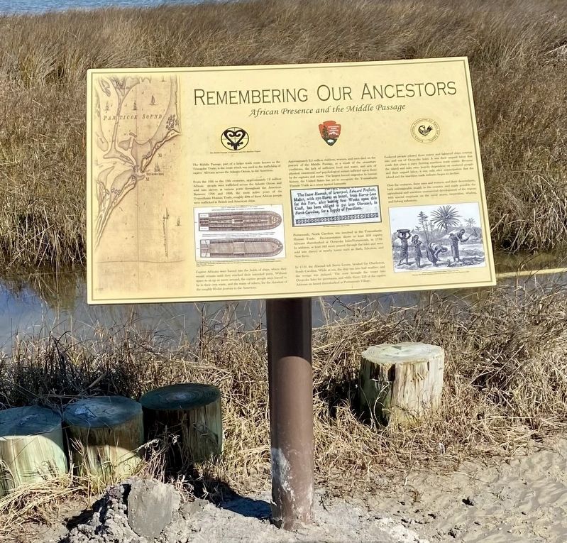
Photographed by Kaycee Michelle Hailey, February 8, 2024
1. Remembering Our Ancestors: The Middle Passage in Portsmouth Island, North Carolina Marker
The Middle Passage, part of a larger trade route known as the Triangular Trade, is the route which was used in the trafficking of captive Africans across the Atlantic Ocean to the Americas.
From the 16th to the 19th centuries, approximately 12 million African people were trafficked across the Atlantic Ocean and sold into slavery at various ports throughout the Americas. Between 1700 and 1808, the most active years of the Transatlantic Human Trade, roughly 40% of these African people were trafficked in British and American ships.
Captive Africans were forced into the holds of ships, where they would remain until they reached their intended ports. Without space to sit up or move around, the captive people were forced to lie in their own waste, and the waste of others, for the duration of the roughly 80-day journey to the Americas.
Approximately 2.5 million children, women, and men died on the journey of the Middle Passage as a result of the unsanitary conditions, the lack of sufficient food and water, and acts of physical, emotional, and psychological torture infliction upon them by the captains and crews. The
this page online
Portsmouth, North Carolina, was involved in the Transatlantic Human Trade. Documentation shows at least 258 captive Africans disembarked at Ocracoke Inlet/Portsmouth, in 1759. In addition, at least 343 more passed through the inlet and were sold into slavery at nearby towns such as Bath, Edenton, and New Bern.
In 1759, the Hannah left Sierra Leone, headed for Charleston, South Carolina. While at sea, the ship ran into bad weather, and the voyage was delayed. The crew brought the vessel into Ocracoke Inlet for provisions, and while there, 258 of the captive Africans on board disembarked at Portsmouth Village.
Enslaved people piloted these waters and lightered ships coming into and out of Ocracoke Inlet. It was their unpaid labor that made this place a once thriving maritime trade center. Because the island and inlet were heavily dependent on enslaved people and their unpaid labor, it was only after emancipation that the island and the maritime trade industry began to decline.
Over the centuries, these men and women, and their descendants, built unimaginable wealth in this country, and made possible the agricultural and maritime commercial development of the region; with special emphasis on the naval stores, turpentine, whaling, and fishing industries.
Erected 2024 by Eastern Carolina Foundation for Equity and Equality; MPCPMP contributed to the research and installation of this marker.
Topics. This historical marker is listed in these topic lists: African Americans • Colonial Era • Industry & Commerce • Waterways & Vessels. A significant historical year for this entry is 1759.
Location. 35° 4.363′ N, 76° 3.893′ W. Marker is in Portsmouth, North Carolina, in Carteret County. It is on Island Road. Touch for map. Marker is at or near this postal address: 1800 Island Road, Ocracoke NC 27960, United States of America. Touch for directions.

Regionally, this marker is in the Coastal Plain, on the Crystal Coast, and on the Outer Banks. It is also in the American South, specifically in the Upper South, in the Tidewater, and on the Eastern Seaboard. Globally, it is in the North Atlantic Region, North America, the Western Hemisphere, the Western World, and the Anglosphere. Historically, it finds itself in what was once the territory of the Mississippian Culture, one of the original Thirteen Colonies, one of the Confederate States of America, and the Antebellum South.
Other nearby markers. At least 8 other markers are within 6 miles of this marker, measured as the crow flies: Exploring Portsmouth (here, next to this marker); Through These Doors (approx. 0.2 miles away); Methodist Church (approx. 0.3 miles away); Springer’s Point Preserve (approx. 5 miles away); Growing More Resilient (approx. 5.1 miles away); Ocracoke’s Silent Sentinel (approx. 5.1 miles away); A Light for Ocracoke Inlet (approx. 5.1 miles away); Living at the Light (approx. 5.1 miles away).
Additional keywords. Middle Passage Ceremonies and Port Markers Project; Middle Passage; human trafficking; UNESCO Routes of Enslaved Peoples (Slave Route Project); Trans-Atlantic Trade; UNESCO Site of Memory; International Coalition Site of Conscience
Credits. This page was last revised on April 24, 2026. It was originally submitted on February 19, 2024, by Kaycee Hailey of Charlotte, North Carolina. This page has been viewed 296 times since then and 74 times this year. Last updated on April 24, 2026, by Kaycee Hailey of Charlotte, North Carolina. Photo 1. submitted on February 19, 2024, by Kaycee Hailey of Charlotte, North Carolina. • Devry Becker Jones was the editor who published this page.
