Sharon in Norfolk County, Massachusetts — The American Northeast (New England)
King Philip’s Cave

Photographed by G.W.Bartlett, April 23, 2026
1. King Philip’s Cave Marker
The fact that sunbeams penetrate the high crevices of this giant boulder at the winter and summer solstice sunsets must have seemed magical to Paleolithic people wandering this area which was then a treeless tundra. Evidence suggests that subsequent Late Archaic inhabitants improved the summer solstice sunbeam with the tall standing stone, which does not come from the walls and exhibits large scallops used in forming its southern face.
This site is declared archaeologically sensitive by the Massachusetts Historical Commission and eligible for the National Register of Historic Places by the Tribal Historic Preservation Officers of both the Wampanoag and Narragansett tribes.
Erected by Sharon Friends of Conservation.
Topics. This historical marker is listed in these topic lists: Anthropology & Archaeology • Indigenous Peoples and Communities • Settlements & Settlers.
Location. 42° 4.452′ N, 71° 11.263′ W. Marker is in Sharon, Massachusetts, in Norfolk County. It can be reached from Mansfield Street north of Solstice Way, on the right when traveling south.
this page online

Regionally, this marker is in Greater Boston. It is also in the American Northeast, in New England, and on the Eastern Seaboard. Globally, it is in the North Atlantic Region, North America, the Western Hemisphere, the Western World, and the Anglosphere. Historically, it finds itself in what was once one of the original Thirteen Colonies.
Other nearby markers. At least 8 other markers are within 4 miles of this marker, measured as the crow flies: King Philip’s Rock (approx. 0.3 miles away); East Foxborough (approx. 1.2 miles away); Borderland (approx. 1.4 miles away); Paineburgh-Foxvale (approx. 3.1 miles away); Union Straw Works / Birth of the Straw Hat Industry (approx. 3.2 miles away); The Lodge at Foxborough (approx. 3.2 miles away); Entering Baker Street Historic District (approx. 3.3 miles away); Memorial Hall (approx. 3.3 miles away). Touch for a list and map of all markers in

Photographed by G.W.Bartlett, April 23, 2026
2. King Philip’s Cave
More about this marker. King Philip's Cave is about a half-mile walk from the Mansfield Street parking area.
Related markers. Click here for a list of markers that are related to this marker.
Also see . . .
1. King Philip's Rock Trails. <blockquote>King Philip’s Rock Trail begins on Mansfield Street and goes northwest to King Philip’s Rock. The trails extend from Sharon into Foxborough conservation land and offer easy or rough going to suit everyone’s whims. Trail bikers and cross-country skiers can negotiate the wide Foxborough side trails with ease and enjoyment. (Submitted on April 24, 2026, by G.W.Bartlett of Hingham, Massachusetts.)
2. Sharon - King Philip Cave and King Philip Rock (astroarcheology). <blockquote>If you would like to learn more about significance of King Philip Cave and King Philip Rock here is a short presentation by Kurt Buerman. Kurt is a past president of Sharon Friends of Conservation who was involved in investigating the purpose of some of these boulders and preservation of the area. (Submitted on April 24, 2026, by G.W.Bartlett of Hingham, Massachusetts.)
3. A Midsummer Sunbeam Site in New England.

Photographed by G.W.Bartlett, April 23, 2026
3. King Philip’s Cave Closeup

Photographed by G.W.Bartlett, April 23, 2026
4. To King Philip’s Cave
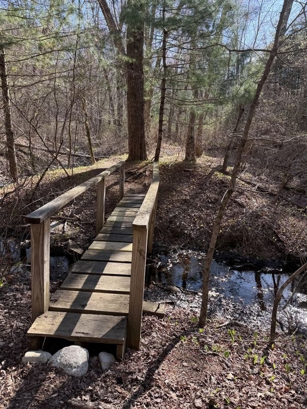
Photographed by G.W.Bartlett, April 23, 2026
5. King Philip’s Rock Trails

Photographed by G.W.Bartlett, April 23, 2026
6. Conservation Land Parking & Entrance
Credits. This page was last revised on April 28, 2026. It was originally submitted on April 24, 2026, by G.W.Bartlett of Hingham, Massachusetts. This page has been viewed 40 times since then. Photos: 1, 2, 3, 4, 5, 6. submitted on April 24, 2026, by G.W.Bartlett of Hingham, Massachusetts. • Devry Becker Jones was the editor who published this page.
