Beverly Shores in Porter County, Indiana — The American Midwest (Great Lakes)
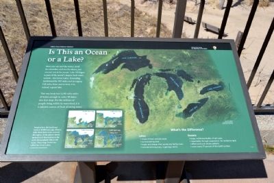
Is This an Ocean or a Lake?
Indiana Dunes National Lakeshore
| — | National Park Service, U.S. Department of the Interior | — |
Photographed by Duane Hall, April 5, 2014
1. Is This an Ocean or a Lake? Marker
Here you can surf the waves, stroll the shoreline, and see the dunes, but you are not at the ocean. Lake Michigan is part of the world’s largest fresh water system–the Great Lakes. Extending northward for 307 miles and averaging 118 miles from east to west, it is, indeed, a great lake.
This vast body has 1,180 cubic miles of water, enough to cover 48 states two fee deep. For the millions of people living within its watershed, it is a valuable source of fresh drinking water.
What’s the Difference?
Lakes:
- made of fresh and salt water.
- surrounded by land.
- larger and deeper than ponds and fed by rivers.
- considered temporary, in geologic terms.
- large, continuous bodies of salt water.
- responsible, through evaporation, for rainfall on land.
- affect wind and climate patterns.
- cover nearly 71 percent of the Earth’s surface.
Imagine how this landscape looked 14,000 years ago, when a mile-thick sheet of ice covered the region. As the glacier slowly melted it left depressions in the earth that gradually filled with water. These huge basins are called the Great Lakes.
Erected by National Park Service, U.S.
this page online
Topics. This historical marker is listed in these topic lists: Natural Features • Waterways & Vessels.
Location. Marker is missing. It was located near 41° 41.195′ N, 86° 59.747′ W. Marker was in Beverly Shores, Indiana, in Porter County. It could be reached from East Lake Front Drive west of Broadway, on the right when traveling west. Marker is located at the Lake View unit of the Indiana Dunes National Lakeshore. Touch for map. Marker was at or near this postal address: 11 W Lake Front Dr, Beverly Shores IN 46301, United States of America. Touch for directions.

Regionally, this marker was in Northwest Indiana, specifically on the Indiana Dunes and Lake Michigan Shore, and in the Calumet Region. It was also in the American Midwest and in the Corn Belt. Globally, it was in North America, on the Great Lakes, in the Western Hemisphere, in the Western World, and in the Anglosphere. Historically, it found itself in what was once the territory of the Mississippian Culture and also the Northwest Territory.
Other nearby markers. At least
Photographed by Duane Hall, April 5, 2014
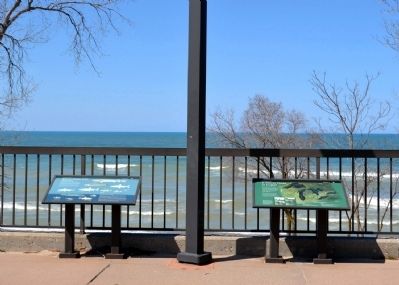
2. Whose Home Is It? and
Is This an Ocean or a Lake? Markers
Is This an Ocean or a Lake? Markers
Other markers no longer nearby. Whose Home Is It? (was here, next to this marker but has been confirmed missing); Recipe for a Sand Dune (was here, next to this marker but has been confirmed missing).
Also see . . . Indiana Dunes National Lakeshore. Official National Park Service website. (Submitted on April 6, 2014.)
Additional commentary.
1. About the marker
This marker profile was published before the guidelines became more firm about only including markers about
Photographed by Duane Hall, April 5, 2014
3. Whose Home Is It? and
Is This an Ocean or a Lake? Markers
Is This an Ocean or a Lake? Markers
— Submitted April 27, 2026, by Devry Becker Jones of Washington, District of Columbia.
Photographed by Duane Hall, April 5, 2014
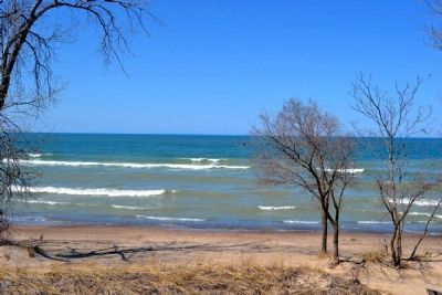
4. Lake Michigan
Credits. This page was last revised on April 27, 2026. It was originally submitted on April 6, 2014, by Duane Hall of Abilene, Texas. This page has been viewed 638 times since then and 26 times this year. Last updated on April 24, 2026, by Bob Cook of Chicago, Illinois. Photos: 1, 2, 3, 4. submitted on April 6, 2014, by Duane Hall of Abilene, Texas. • Devry Becker Jones was the editor who published this page.
