
St. John's Coalition in Pensacola in Escambia County, Florida — The American South (South Atlantic)
Welcome to St. John's Cemetery
Photographed by Cosmos Mariner, June 19, 2025
1. Welcome to St. John's Cemetery Marker
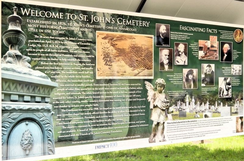
Established in 1876, St. John’s Cemetery is one of Pensacola’s most historic cemeteries and is still in use today.
The 26 acres that comprise St. John’s Cemetery were purchased on April 3, 1876 by the Masons of Escambia Lodge, No. 15, F.&A.M. to serve as a public cemetery — open to people of all faiths and races. The site was chosen because it was on the edge of Pensacola and money could be earned from its timber to help establish the cemetery.
Before the first interment in August, the land was plotted into two halves, various sections, and smaller 6’x7’ yard lots. The immediate north half was reserved by the whole-lot to families. Whereas, the immediate south half was reserved in smaller parcels. Even numbered Sections 32-44.5 were reserved for people of color. Also, special lots in the south were created exclusively for babies, sailors, indigents, and criminals. The white fenced section in the south is but one example of lots reserved for babies. St. John’s quickly became the cemetery of choice for almost 100 years, as the only other existing, smaller cemetery downtown was running out of space and frequently was clouded
this page online
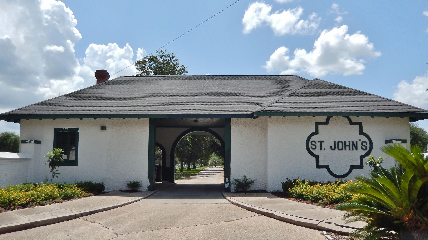
The Gatehouse was erected in 1908. Its chapel on the north side served as the city’s first non-sectarian chapel but mainly offered families the ability to allow their deceased to lay in state to receive mourners. Previously, such activity was customarily done in a person’s home. Later funeral companies would build facilities to offer this service.
The cemetery continues to serve its mission; the chapel is open for services, and spaces still are available. A board of Masonic members direct operations and is assisted by volunteers associated with the Friends of St. John’s Cemetery Foundation.
Fascinating Facts
Graves of three Civil War Confederate generals
Edward A. Perry — Section 15 | Lot 27
Samuel Gibbs French — Section 25 | Lot 27
William Miller — Section 9 | Lot 19
Grave of “Railroad Bill” the most infamous black train robber in U.S. history
Morris Slater — Section 42 | Lot 4
Grave of George Washington’s grandniece
Mary W. Willis — Section 19 | Lot 21
Grave of the first Naval aviator wife — thus earning Pensacola the title “Mother-in-law-to the Navy”
Helen Fisher McDonnell — Section 23 | Lot 14
Grave of the inventor of the shift key in a typewriter and former mayor
Charles
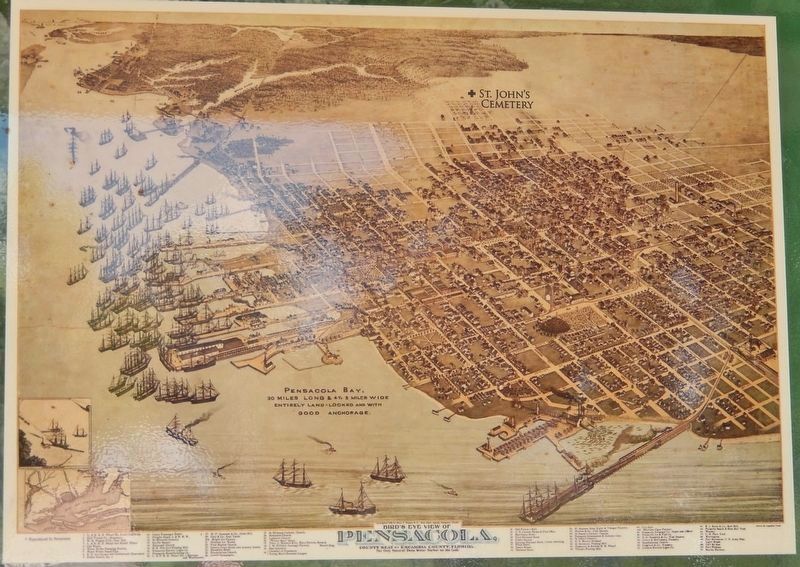
2. Marker detail: Bird’s Eye View of Pensacola
St. John's Cemetery is northeast of the historic town center.
Seeking a better love life?
Visit the grave of Madam Mollie McCoy — a Pensacola tradition
Section 22 | Lot 6
Grave of Navy Cross recipient from Battle of Midway
LCdr John C. Waldron — Section 49 | Lot 27
Largest concentration of a rare winter grapefern (botrychium lunarioides) in the Deep South. This plant is visible in January and February throughout the cemetery grounds.
St. John's Cemetery has the largest and most diverse number of gravestones and monuments in northwest Florida.
How to find a burial lot in the cemetery
St. John's Cemetery is positioned in an east-west direction. All Sections begin at the Gatehouse, which is on the far eastern part of the property. The center road through the Gatehouse divides the cemetery into two parts. All Sections to the right (north) of this road are odd numbers. Those to the left (south) are even. Each Section has a numbered marker. Information about the cemetery and those buried within are available on the cemetery's website: www.stjohnsdb.com. You can also access the walking tour from the website. St. John's continues to serve its purpose. There are many options for burials and cremation services still available. The cemetery offers family lots, half-lots and individual spaces. It is open to people of all faiths and races. For inquiries, please email [email protected] or phone 850-332-7339.
Erected 2018

Photographed by Cosmos Mariner, June 19, 2025
3. Marker detail: Fascinating Facts
Topics. This historical marker is listed in these topic lists: African Americans • Cemeteries & Burial Sites • Fraternal or Sororal Organizations • War, US Civil. A significant historical date for this entry is April 3, 1876.
Location. 30° 24.98′ N, 87° 13.972′ W. Marker is in Pensacola, Florida, in Escambia County. It is in St. John's Coalition. It can be reached from the intersection of North G Street and West Belmont Street, on the left when traveling north. The marker is just inside the St. John's Cemetery gatehouse, on the left side as you pass through the gate. Touch for map. Marker is at or near this postal address: 301 North G Street, Pensacola FL 32501, United States of America. Touch for directions.

Regionally, this marker is on the Florida Panhandle. It is also in the American South, specifically in the Deep South, and on the Gulf Coast. Globally, it is in the North Atlantic Region, North America, a Gulf of Mexico state, the Western Hemisphere, the Western World, and the Anglosphere. Historically, it finds itself in what was once New Spain,

Photographed by Cosmos Mariner, June 19, 2025
4. Welcome to St. John's Cemetery Marker
The marker is on the north side of this interpretive kiosk, just inside the St. John's Cemetery gatehouse.
Other nearby markers. At least 8 other markers are within walking distance of this marker: More to Discover... A Secret Language (here, next to this marker); Gatehouse Chapel (here, next to this marker); St. Johns Historic Cemetery (a few steps from this marker); Historic North Side (a few steps from this marker); First Interment (within shouting distance of this marker); Baby Section (within shouting distance of this marker); William F. Miller (about 300 feet away, measured in a direct line); Inventor of FSU Tomahawk Chop (about 300 feet away). Touch for a list and map of all markers in Pensacola.
Related markers. Click here for a list of markers that are related to this marker. St. John's Cemetery
Also see . . . About St. John's Cemetery (St. John’s Cemetery website).
Excerpt: On April 3, 1876, the masons of Escambia Lodge, No. 15, F.&A.M. voted to establish St. John's Cemetery as Pensacola's second public cemetery. The circumstances and background for its creation reflect the diverse nature(Submitted on April 29, 2026, by Cosmos Mariner of Cape Canaveral, Florida.)of community and the town's development. Located on a gradually sloping hill, filled with native magnolia, oak, sycamore, and pine trees, the cemetery eventually was plotted to cover some 26 acres within 10 city blocks. Proceeds from plots sold initially went to pay off the mortgage acquired to purchase the land, to cover improvements, and to establish a perpetual endowment. While the trustees were drawn from the Lodge, neither the organization or any member would receive any financial benefit from this endeavor. Later, in 1908, at its entrance on "G" Street, a gate house was constructed, which consisted of a chapel on one side and offices and storage rooms on the other. It was the largest cemetery yet constructed for a city that many Masons speculated would grow into needing such place.Photographed by Cosmos Mariner, June 19, 20255. St. John's Cemetery Gatehouse & ChapelLooking west from North G Street at West Belmont Street. The gatehouse is on the south/left side, and the chapel is on the north/right side. The marker is on the opposite/west side of the building, on the left as you pass through the archway.
Credits. This page was last revised on May 1, 2026. It was originally submitted on April 24, 2026, by Cosmos Mariner of Cape Canaveral, Florida. This page has been viewed 25 times since then. Photos: 1. submitted on April 28, 2026, by Cosmos Mariner of Cape Canaveral, Florida. 2, 3, 4, 5. submitted on April 29, 2026, by Cosmos Mariner of Cape Canaveral, Florida.
