
Lexington, Virginia — The American South (Mid-Atlantic)
Lexington
"The Wretches Galloped into Town"
| — | Hunter's Raid | — |
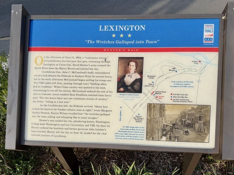
On the afternoon of June 11, 1864, a "continuous stream" of Confederate hurried past this spot, retreating through Lexington as Union Gen. David Hunter's army crossed the North River (now the Maury River) and entered the city.
Confederate Gen. John C. McCausland's badly outnumbered cavalry had delayed the Federals at Jordan's Point for several hours, but in the early afternoon McCausland began pulling his troops out. The VMI Cadets left first, passing through town "bidding adieu [to] its residents." When Union cavalry was spotted to the west, threatening to cut off his retreat, McCausland ordered the rest of his men to evacuate. Local resident Rose Pendleton watched them hurry passed. "For two hours there was one continuous stream of cavalry," she wrote, "riding at a fast trot."
As the Confederates left, the Federals arrived. "About four o'clock the head of the Yankee column came in sight," wrote Margaret Junkin Preston. Fannie Wilson recalled how "the wretches galloped into the town yelling and whooping like so many savages."
Hunter's men sacked the city, plundering homes, Washington College (now Washington
this page online
[Caption:]
An 1865 image taken at the intersection of Main Street and Washington Street, a block and a half to your right. Can you line up this historic photo with the modern view? Post your photo with #civilwartrails.
Erected by Virginia Civil War Trails.
Topics and series. This historical marker is listed in this topic list: War, US Civil. In addition, it is included in the Virginia Civil War Trails series list. A significant historical date for this entry is June 11, 1864.
Location. 37° 47.053′ N, 79° 26.432′ W. Marker is in Lexington, Virginia. It is on East Washington Street west of Varner Lane, on the right when traveling west. Touch for map. Marker is at or near this postal address: 107 E Washington St, Lexington VA 24450, United States of America. Touch for directions.

Regionally, this marker is in Virginia’s Shenandoah Valley. It is also in the American South and specifically in the Upper South. Globally, it is

Other nearby markers. At least 8 other markers are within walking distance of this marker: Lexington and the Green Book (a few steps from this marker); The Sloan House, ca. 1844-45 (within shouting distance of this marker); Gen. Samuel Houston (within shouting distance of this marker); Ruth McCulloch (within shouting distance of this marker); Campbell House, ca. 1845 (within shouting distance of this marker); Phil "Old Dixie" Nunn (within shouting distance of this marker); "The Castle" (within shouting distance of this marker); The Castle, ca. 1790 (within shouting distance of this marker). Touch for a list and map of all markers in Lexington.
Another marker is no longer nearby. Lexington (was a few steps from this marker but has been replaced with another marker now near it).
Credits. This page was last revised on April 27, 2026. It was originally submitted on April 26, 2026, by Devry Becker Jones of Washington, District of Columbia. This page has been viewed 22 times since then. Photos: 1, 2. submitted on April 26, 2026, by Devry Becker Jones of Washington, District of Columbia.
