Waterfront in Boston in Suffolk County, Massachusetts — The American Northeast (New England)
Coming From The Sea
The Middle Passage
⎯⎯⎯
The Norman B. Leventhal Walk to the Sea
Boston Harbor Islands
| — | UNESCO Site of Memory, Site of Conscience | — |
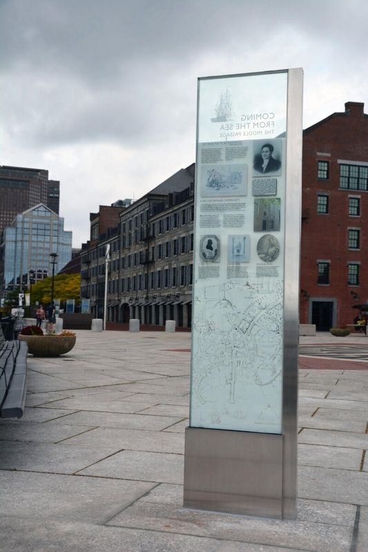
Photographed by Kaycee Hailey, October 16, 2020
1. UNESCO Site of Memory Marker
Coming from the Sea
The Middle Passage
In 1637, Massachusetts Bay colonist shipped enslaved Native Americans to Providence Island in the Caribbean on the Desire. The ship returned in 1638 with the first documented enslaved Africans in the colony. From 1638-1858 there are nearly two hundred recorded slaving voyages from Boston. This ocean journey brough enslaved Africans through the horrific Middle Passage to the Americas as part of a “triangle trade” route between West Africa, Europe, North and South America and the Caribbean.
Long Wharf served as a disembarkation point of the slave trade in Boston, and newspapers advertised enslaved Africans for sale aboard the ships docked at the wharf.
To be Sold by Henry Cafwall at his Warehoufe (on the head of the Long Wharf, Soofets, Perfians, Taffities, Lemones, Ginghams, Long Cloths, Irifh Linnens of all forts, Men & Womens Worfled & Silk Hofe, Powder, Cordage, Duck, Nails, Sweeds & Spanish Iron, with fundry other European and Eaft India Goods, lately Inported, alfo Negro Boys & Girls, and Barbados Rum. Boston Gazette, June 10, 1728
A Parcel of Likely Negros of both sexes, just imported in the Sloop Speedwell, William Dickinson Mafler lying at the upper end of the Long Wharffe, aldo a parcel of Lisbon Falt, on board a Brigantine at Clark’s Wharffe, to be sold by Charles Apthorp at his warehoufe in Merchants Row. Boston Gazette, September 13, 1731
Juft imported from Africa, and to be Sold at No. 19 on the Long Wharf, A Parcel of likely, healthy Negro Slaves. Boston Gazette, June 22, 1761
The Norman B. Leventhal Walk to the Sea
Boston Harbor Islands
Like much of the local terrain, Boston’s 34 Harbor Islands were formed by glaciers during the last Ice Age. The islands provide natural protection for the harbor. Their use dates back
this page online
To early European visitors, the islands presented both a hazard and, once charted, a help to navigation. Today, they are an important recreational asset for residents and visitors, overseen by the National Park Service, with ferries serving many of the islands.
Bostonians found various uses for the islands over the centuries. Early English settlers made homes on the islands and farmed them. Spectacle Island, one of the closest, was used in the 18th century as a quarantine area during smallpox outbreaks, and in the 19th century as a gambling resort. Boston also began to use Spectacle Island as a garbage dump in the 19th century, expanding the landmass by 32 acres before the dumping stopped.
Managing the waste of a large population became critical to Boston in the late 20th century. The construction of a sewage plant on Deer Island helped clean the harbor and increase the recreational use of the harbor and its islands.
Erected 2020.
Topics. This historical marker
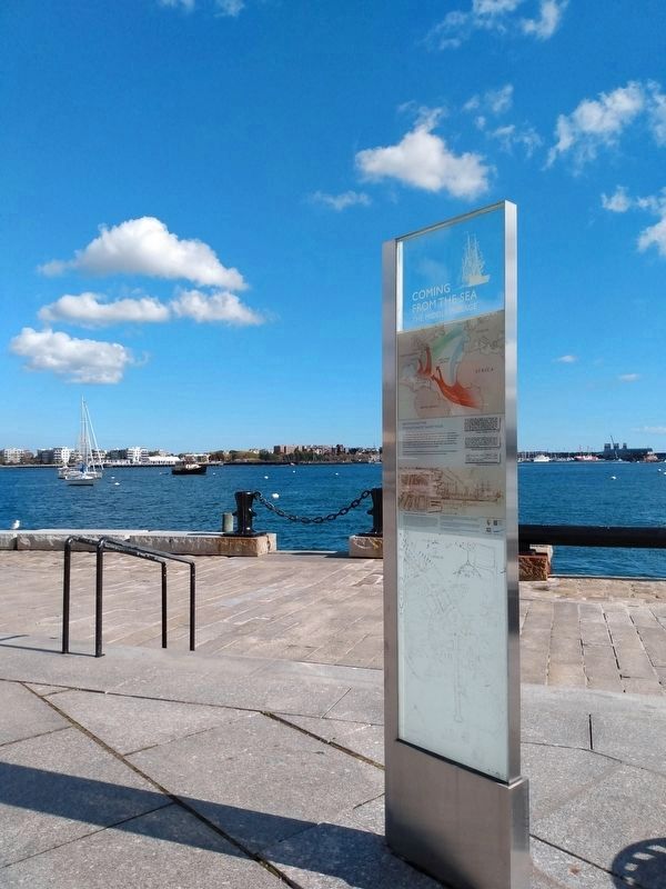
Photographed by Mary Mangan, October 19, 2023
2. Coming From The Sea / The Middle Passage Marker
View of the marker with Boston harbor behind the marker
Location. 42° 21.618′ N, 71° 2.886′ W. Marker is in Boston, Massachusetts, in Suffolk County. It is in Waterfront. It can be reached from State Street east of Old Atlantic Avenue, on the right when traveling east. The marker stands at Boston Long Wharf. Touch for map. Marker is at or near this postal address: 66 Long Wharf, Boston MA 02110, United States of America. Touch for directions.

Regionally, this marker is in Massachusetts’ Historic Boston. It is also in the American Northeast, in New England, and on the Eastern Seaboard. Globally, it is in the North Atlantic Region, North America, the Western Hemisphere, the Western World, and the Anglosphere. Historically, it finds itself in what was once one of the original Thirteen Colonies.
Other nearby markers. At least 8 other markers are within walking distance of this marker: Marine Life in Boston Harbor (about 400 feet away, measured in a direct line); California Sea Lion / Northern Fur Seal (about 400 feet away); History of the New England Aquarium (about 500 feet away); David B. Stone (about 600 feet away); Waterfront Park (approx. 0.2 miles away); The Central Artery / The Rose Kennedy Greenway (approx. 0.2 miles away); 255 State Street Sea Glass (approx. 0.2 miles away); Pollinator Garden on the Greenway (approx. 0.2 miles away). Touch for a list and map of all markers in Boston.
Additional keywords. Middle Passage Ceremonies and Port Markers Project; UNESCO Routes of Enslaved Peoples (Slave Route Project); Human trafficking; Trans-Atlantic Trade; UNESCO Site of Memory; International Coalition Site of Conscience
Credits. This page was last revised on April 27, 2026. It was originally submitted on November 16, 2024, by Kaycee Hailey of Charlotte, North Carolina. This page has been viewed 404 times since then and 70 times this year. Last updated on April 27, 2026, by Kaycee Hailey of Charlotte, North Carolina. Photos: 1. submitted on November 16, 2024, by Kaycee Hailey of Charlotte, North Carolina. 2. submitted on July 2, 2025, by Mary Mangan of Somerville, Massachusetts. • Devry Becker Jones was the editor who published this page.
