Ronald Reagan Washington National Airport in Arlington in Arlington County, Virginia — The American South (Mid-Atlantic)
The Ages of Abingdon
Abingdon Plantation
Photographed by J.T. Lambrou, July 26, 2023
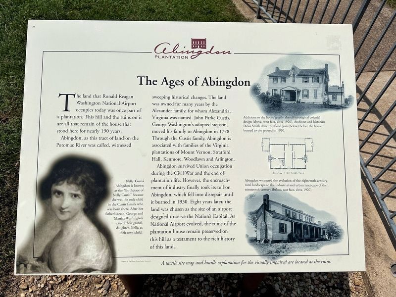
1. The Ages of Abingdon Marker
The land that Ronald Reagan Washington National Airport occupies today was once part of a plantation. This hill and the ruins on it are all that remain of the house that stood here for nearly 190 years.
Abington, as this tract of land on the Potomac River was called, witnessed sweeping historical changes. The land was owned for many years by the Alexander family, for whom Alexandria, Virginia was named. John Parke Custis, George Washington’s adopted stepson, moved his family to Abingdon in 1778. Through the Custis family, Abingdon is associated with families of the Virginia plantations of Mount Vernon, Stratford Hall, Kenmore, Woodlawn and Arlington.
Abingdon survived Union occupation during the Civil War and the end of plantation life. However, the encroachment of industry finally took its toll on Abingdon, which fell into disrepair until it burned in 1930. Eight years later, the land was chosen as the site of an airport designed to serve the Nation’s Capital. As National Airport evolved, the ruins of the plantation house remain preserved on this hill as a testament to the rich history of this land.
Erected by Metropolitan
this page online
Topics. This historical marker is listed in these topic lists: Agriculture • Air & Space • Settlements & Settlers • War, US Civil. A significant historical year for this entry is 1778.
Location. 38° 51.098′ N, 77° 2.643′ W. Marker is in Arlington, Virginia, in Arlington County. It is in Ronald Reagan Washington National Airport. It can be reached from National Avenue near Smith Boulevard, on the left when traveling north. The marker stands between the parking garages at Ronald Reagan National Airport. Touch for map. Marker is at or near this postal address: 2400 National Ave, Arlington VA 22202, United States of America. Touch for directions.

Regionally, this marker is in the Washington Metropolitan Area and in Northern Virginia. It is also in the American South, specifically in the Upper South, in the Mid-Atlantic, and on the Eastern Seaboard. Globally, it is in the North Atlantic Region, North America, the Western Hemisphere, the Western World, and the Anglosphere. Historically, it finds itself in what was once the territory of the Mississippian Culture, one of the original
Photographed by J. Makali Bruton
2. The Ages of Abingdon Marker
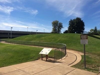
The hill mentioned in the text is behind the marker.
Other nearby markers. At least 8 other markers are within walking distance of this marker: Becoming Visible - Meet the Enslaved at Abingdon Plantation (here, next to this marker); The Alexander Family (within shouting distance of this marker); The Dress (within shouting distance of this marker); The Stable Manager - Rented to George Washington (within shouting distance of this marker); Abingdon (within shouting distance of this marker); Abingdon Plantation Restoration (within shouting distance of this marker); The Industrial Age (within shouting distance of this marker); Abingdon and John Alexander (within shouting distance of this marker). Touch for a list and map of all markers in Arlington.
Also see . . . Abingdon Plantation. (Submitted on July 11, 2011, by Bernard H. Berne of Arlington, Virginia.)
Photographed by Kevin W., June 12, 2008
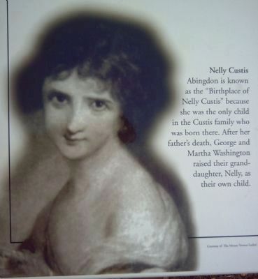
3. Nelly Custis
Abingdon is known as the “Birthplace of Nelly Custis” because she was the only child in the Custis family who was born there. After her father’s death, George and Martha Washington raised their granddaughter, Nelly, as their own child.
Photographed by Kevin W., June 12, 2008
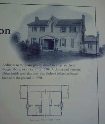
4. The Abingdon House
Additions to the house greatly altered its original colonial design (above, west face, circa 1920s). Architect and historian Delos Smith drew this floor plan (below before the house burned to the ground in 1930.
Photographed by Kevin W., June 12, 2008
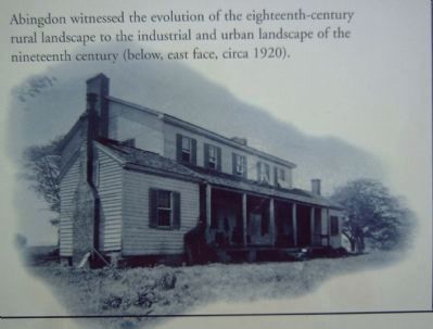
5. The Abingdon House
Abingdon witnessed the evolution of the eighteenth-century rural landscape to the industrial and urban landscape of the nineteenth century (below, east face, circa 1920s).
Credits. This page was last revised on April 28, 2026. It was originally submitted on June 17, 2008, by Kevin W. of Stafford, Virginia. This page has been viewed 3,009 times since then and 64 times this year. Last updated on April 28, 2026, by Bernard H. Berne of Arlington, Virginia. Photos: 1. submitted on September 22, 2023, by J.T. Lambrou of New Boston, Michigan. 2. submitted on October 10, 2015, by J. Makali Bruton of Washington, District of Columbia. 3, 4, 5. submitted on June 17, 2008, by Kevin W. of Stafford, Virginia. • Devry Becker Jones was the editor who published this page.
