Hampstead in Carroll County, Maryland — The American Northeast (Mid-Atlantic)
Spring Garden
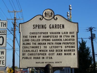
Photographed by William Pfingsten, October 14, 2007
1. Spring Garden Marker
Erected 1969 by Maryland Historical Society.
Topics and series. This historical marker is listed in these topic lists: Indigenous Peoples and Communities • Roads & Vehicles • Settlements & Settlers. In addition, it is included in the Maryland Historical Trust series list. A significant historical year for this entry is 1786.
Location. 39° 36.448′ N, 76° 51.055′ W. Marker is in Hampstead, Maryland, in Carroll County. It is at the intersection of Main Street (Maryland Route 30) and Black Rock Road, on the right when traveling north on Main Street. Touch for map. Marker is in this post office area: Hampstead MD 21074, United States of America. Touch for directions.

Regionally, this marker is in the Baltimore Metro Region and in Central Maryland. It is also in the American Mid-Atlantic. Globally, it is in North America, the Western Hemisphere, the Western World,
this page online
Other nearby markers. At least 8 other markers are within walking distance of this marker: Gold Star Mothers/Members (here, next to this marker); Korean and Vietnam Wars Memorial (a few steps from this marker); World War I and Vietnam War Memorial (a few steps from this marker); Hampstead District (a few steps from this marker); World War II and Korean War Memorial (a few steps from this marker); Veterans Memorial (a few steps from this marker); Disabled American Veterans Memorial (a few steps from this marker); a different marker also named Veterans Memorial (a few steps from this marker). Touch for a list and map of all markers in Hampstead.
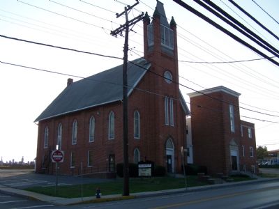
Photographed by William Pfingsten, October 14, 2007
2. St. John's Methodist Church
Church is located across Black Rock Road near the marker.
Credits. This page was last revised on December 23, 2024. It was originally submitted on October 15, 2007, by Bill Pfingsten of Bel Air, Maryland. This page has been viewed 2,339 times since then and 46 times this year. Photos: 1, 2. submitted on October 15, 2007, by Bill Pfingsten of Bel Air, Maryland. • J. J. Prats was the editor who published this page.
