Staunton, Virginia — The American South (Mid-Atlantic)
Germany, 1750s
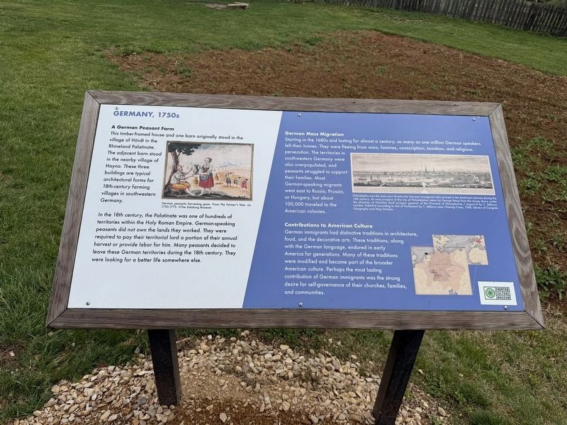
A German Peasant Farm
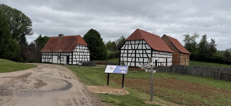
This timber-framed house and one barn originally stood in the village of Hördt in the Rhineland Palatinate. The adjacent barn stood in the nearby village of Hayna. These three buildings are typical architectural forms for 18th-century farming villages in southwestern Germany.
In the 18th century, the Palatinate was one of hundreds of territories within the Holy Roman Empire. German-speaking peasants did not own the lands they worked. They were required to pay their territorial lord a portion of their annual harvest or provide labor for him. Many peasants decided to leave these German territories during the 18th century. They were looking for a better life somewhere else.
German Mass Migration
Staring in the 1680s and lasting for almost a century, as many as one million German speakers left their homes. They were fleeing from wars, famines, conscription, taxation, and religious persecution. The territories in southwestern Germany were also overpopulated, and peasants struggled to support their families. Most German-speaking migrants went east to Russia, Prussia, or Hungary, but about 100,000
this page online
Contributions to American Culture
German immigrants had distinctive traditions in architecture, food, and the decorative arts. These traditions, along with the German language, endured in early America for generations. Many of these traditions were modified and became part of the broader American culture. Perhaps the most lasting contribution of German immigrants was the strong desire for self-governance of their churches, families, and communities.
[Caption:]
Philadelphia was the main port of entry for German immigrants who arrived in the American colonies during the 18th century. An east prospect of the city of Philadelphia; taken by George Heap from the Jersey shore, under the direction of Nicholas Scull surveyor general of the Province of Pennsylvania / engrav'd by T. Jefferys. London: Publish'd according to Act of Parliament by T. Jefferys near Charing Cross, 1768. Library of Congress Geography and Map Division
Erected by Frontier Culture Museum.
Topics. This historical marker is listed in these topic lists: Anthropology & Archaeology • Communications • Immigration
Location. 38° 7.396′ N, 79° 2.905′ W. Marker is in Staunton, Virginia. It can be reached from Frontier Drive north of Barterbrook Road, on the right when traveling north. Touch for map. Marker is at or near this postal address: 1290 Richmond Rd, Staunton VA 24401, United States of America. Touch for directions.

Regionally, this marker is in the Shenandoah Valley. It is also in the American South and specifically in the Upper South. Globally, it is in North America, the Western Hemisphere, the Western World, and the Anglosphere. Historically, it finds itself in what was once the territory of the Mississippian Culture, one of the original Thirteen Colonies, one of the Confederate States of America, and the Antebellum South.
Other nearby markers. At least 8 other markers are within walking distance of this marker: Ireland, 1750s (about 400 feet away, measured in a direct line); The Virginia Frontier (about 500 feet away); American Indians, 1600s (about 600 feet away); a different marker also named Ireland, 1750s (about 700 feet away); American Inidians, 1600s (about 800 feet away); The Great Road (approx. 0.2 miles away); Frontier Culture Museum (approx. 0.2 miles away); Valley of Virginia, 1760s (approx. 0.2 miles away). Touch for a list and map of all markers in Staunton.
Credits. This page was last revised on May 4, 2026. It was originally submitted on May 1, 2026, by Devry Becker Jones of Washington, District of Columbia. This page has been viewed 18 times since then. Photos: 1, 2. submitted on May 1, 2026, by Devry Becker Jones of Washington, District of Columbia.
