
Marker Logo
THE HISTORICAL
MARKER DATABASE
“Bite-Size Bits of Local, National, and Global History”
Gold Hill in Rowan County, North Carolina — The American South (South Atlantic)
 

Chilean Ore Mill

Named for Immigrant Workers from Chile in the Gold Mining Industry
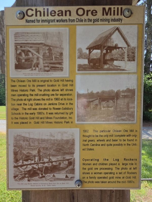
 
 
Chilean Ore Mill Marker image. Click for full size.
Photographed by Mark Parker, April 25, 2026
1. Chilean Ore Mill Marker
Inscription. The Chilean Ore Mill is original to Gold Hill having been moved to its present location in Gold Hill Mines Historic Park. The photo above left shows men operating the mill crushing ore for separation. The photo at right shows the mill in 1960 at its location near the Log Cabins on Jenkins Drive in the village. The mill was donated to Rowan-Salisbury Schools in the early 1980's. It was returned by gift to the Historic Gold Hill and Mines Foundation, Inc. It was placed in Gold Hill Mines Historic Park in 1992. This particular Chilean Ore Mill is thought to be the only mill complete with original gears, wheels and base to be found in North Carolina and quite possibly in the United States.

Operating the Log Rockers Women and children played large role in the gold ore processing. The photo at left shows a woman operating a set of Rockers on a family operated gold mine at Gold Hill. The photo was taken around the mid-1880's.
 
Topics. This historical marker is listed in these topic lists: ImmigrationIndustry & CommerceWomen.
 
Location. 35° 30.659′ N, 80° 20.703′ W.
Paid Advertisement
Click or scan to see
this page online
Marker is in Gold Hill, North Carolina, in Rowan County. It can be reached from Saint Stephens Church Road 0.2 miles north of Old Beatty Ford Road, on the right when traveling north. Location of the marker is the Gold Hill Mines Historic Park. Touch for map. Marker is at or near this postal address: 775 St Stephens Church Rd, Gold Hill NC 28071, United States of America. Touch for directions.

Regionally, this marker is in North Carolina’s Piedmont. It is also in the American South and specifically in the Upper South. Globally, it is in the North Atlantic Region, North America, the Western Hemisphere, the Western World, and the Anglosphere. Historically, it finds itself in what was once the territory of the Mississippian Culture, one of the original Thirteen Colonies, one of the Confederate States of America, and the Antebellum South.

Other nearby markers. At least 8 other markers are within walking distance of this marker: The 19th Century View from the Miller Shaft (within shouting distance of this marker); Gold Hill Jail & English Dry-Stack Rock Wall (within shouting distance of this marker); Russell-Rufty Shelter
Chilean Ore Mill, Shelter and Marker image. Click for full size.
Photographed by Mark Parker, April 25, 2026
2. Chilean Ore Mill, Shelter and Marker
(within shouting distance of this marker); The Barnhardt Shaft (about 300 feet away, measured in a direct line); Gold Hill, North Carolina Est. 1843 (about 300 feet away); Gold Hill Mining District (about 300 feet away); The Village of Gold Hill (about 300 feet away); Gold Hill Methodist Church Bell (about 400 feet away). Touch for a list and map of all markers in Gold Hill.
 
Also see . . .  Historic Gold Hill. (Submitted on May 6, 2026.)
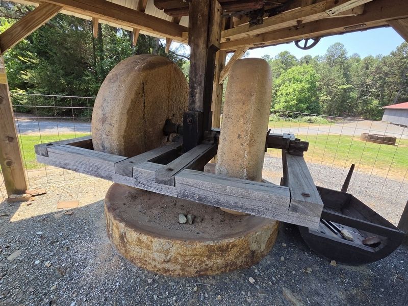
 
Chilean Ore Mill image. Click for full size.
Photographed by Mark Parker, April 25, 2026
3. Chilean Ore Mill
 
 
Credits. This page was last revised on May 6, 2026. It was originally submitted on May 6, 2026, by Mark Parker of Hickory, North Carolina. This page has been viewed 12 times since then. Photos:   1, 2, 3. submitted on May 6, 2026, by Mark Parker of Hickory, North Carolina. • Bernard Fisher was the editor who published this page.

m=299203

CeraNet Cloud Computing sponsors the Historical Marker Database.
This website earns income from purchases you make after using our links to Amazon.com. We appreciate your support.
Paid Advertisement
Jul. 12, 2026
