Near Allerton in Edgar County, Illinois — The American Midwest (Great Lakes)
Pontiac's Conspiracy
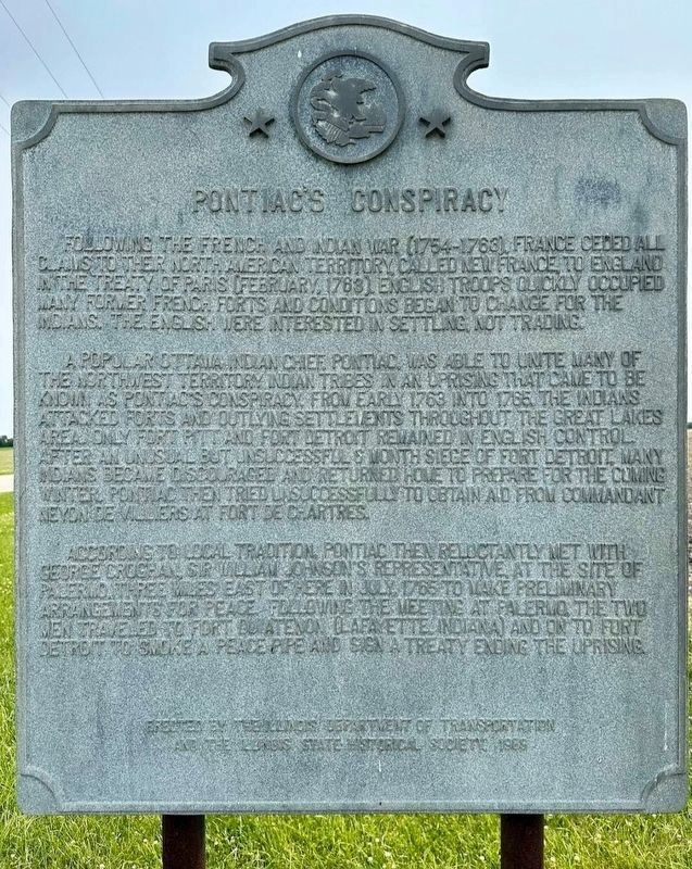
Photographed by Lacey E. Teter, July 5, 2026
1. Pontiac's Conspiracy Marker
Erected 1935 by State of Illinois.
Topics and series. This historical marker is listed in these topic lists: Colonial Era • Wars, US Indian. In addition, it is included in the Illinois State Historical Society series list. A significant historical month for this entry is July 1765.
Location. This marker has been replaced by another marker nearby. It was located near 39° 51.685′ N, 87° 56.239′ W. Marker was near Allerton, Illinois, in Edgar County. It was at the intersection of Illinois Route 49 and Palermo Road (County Road 1425) on Illinois Route 49. Touch for map. Marker was at or near this postal address: 2828 Route 49, Allerton IL 61810, United States of America. Touch for directions.

Regionally, this marker was in Central Illinois and in the Wabash Valley.
this page online
Other nearby markers. At least 8 other markers are within 8 miles of this location, measured as the crow flies: A different marker also named Pontiac's Conspiracy (within shouting distance of this marker); Croghan Treaty with Pontiac (approx. 3 miles away); The Streibich Blacksmith Shop (approx. 5 miles away); Newman Veterans Memorial (approx. 5.1 miles away); Detroit - Kaskaskia Indian Trail (approx. 5.7 miles away); Community Honor Roll of Those Who Served (approx. 6.9 miles away); Sidell Veterans War Memorial (approx. 7 miles away); Former Site of Orizaba IL (approx. 7.2 miles away). Touch for a list and map of all markers in Allerton.
Credits. This page was last revised on July 25, 2026. It was originally submitted on May 7, 2026, by Rick D Williams of Mahomet, Illinois. This page has been viewed 42 times since then. Photo 1. submitted on July 5, 2026, by Lacey E. Teter of Atwood, Illinois. • Devry Becker Jones was the editor who published this page.
Editor’s want-list for this marker. A photo of the marker before its removal. • Can you help?
