Saint George's Hundred in Middletown in New Castle County, Delaware — The American Northeast (Mid-Atlantic)
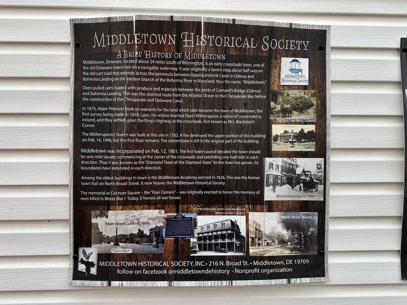
A Brief History of Middletown
| — | Middletown Historical Society | — |
Photographed by Pete Skillman, May 9, 2026
1. A Brief History of Middletown Marker
Oxen pulled carts loaded with produce and materials between the ports of Cantwell's Bridge (Odessa) and Bohemia Landing. This was the shortest route from the Atlantic Ocean to the Chesapeake Bay before the construction of the Chesapeake and Delaware Canal.
In 1675, Adam Peterson took on warrants for the land which later became the town of Middletown, the first survey being made in 1678. Later, his widow married David Witherspoon, a native of Londonderry, Ireland, and they settled upon the King's Highway at the crossroads, first known as Mrs. Blackston's Corner.
The Witherspoon's Tavern was built at this site in 1762. A fire destroyed the upper portion of this building on Feb. 14, 1946, but the first floor remains. The cornerstone
this page online
Middletown was incorporated on Feb. 12, 1861. The first town council decided the town should be one mile square, commencing at the corner of the crossroads and extending one-half mile in each direction. Thus it was known as the "Diamond Town of the Diamond State. As the town has grown, its boundaries have extended in each direction.
Among the oldest buildings in town is the Middletown Academy, erected in 1826. This was the former town hall on North Broad Street. It now houses the Middletown Historical Society.
The memorial at Cochran Square-the "Four Corners"-was originally erected to honor the memory of men killed in World War I. Today, it honors all war heroes.
Middletown Historical Society, Inc. • 216 N. Broad St. • Middletown, DE 19709
follow on facebook @middletowndehistory Nonprofit organization
[Captions]:
Christmas Trees Being Delivered
Cochran Square
Blizzard December 26, 1909
Main Street Looking West
The Middletown Hotel also known as Witherspoon's Tavern
West Main Street
Erected by Middletown Historical Society.
Topics. This historical
Photographed by Pete Skillman, May 9, 2026
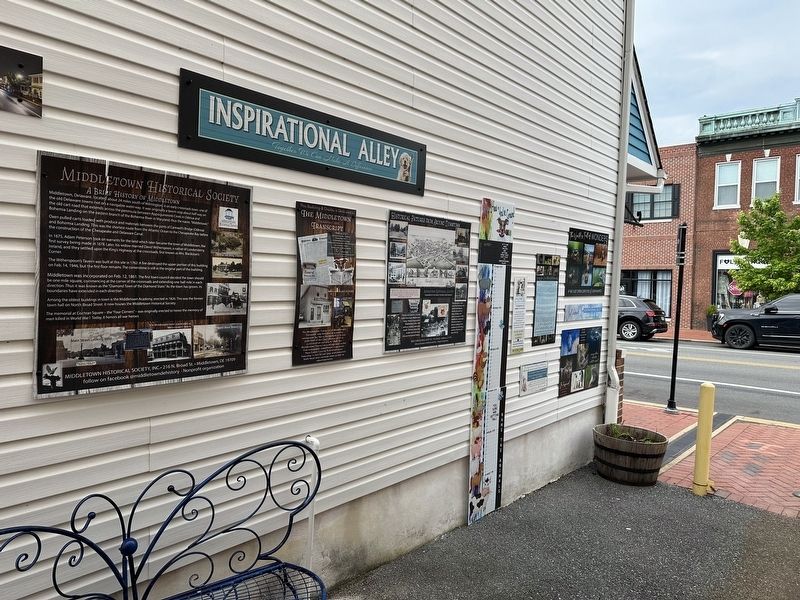
2. A Brief History of Middletown Marker - wide view
Location. 39° 26.969′ N, 75° 43.054′ W. Marker is in Middletown, Delaware, in New Castle County. It is in Saint George's Hundred. It can be reached from Delaware 299. Touch for map. Marker is at or near this postal address: 22 DE-299, Middletown DE 19709, United States of America. Touch for directions.

Regionally, this marker is in Southern New Castle County, in Greater Wilmington and in Greater Philadelphia. It is also in the American Mid-Atlantic, on the Delmarva Peninsula, and on the Eastern Seaboard. Globally, it is in the North Atlantic Region, North America, the Western Hemisphere, the Western World, and the Anglosphere. Historically, it finds itself in what was once New Netherland and also one of the original Thirteen Colonies.
Other nearby markers. At least 8 other markers are within walking distance of this marker: The Middletown Transcript (here, next to this marker); Historical Pictures from Around Downtown (here, next to this marker); Witherspoon Tavern (within shouting distance of this marker); Middletown (within shouting distance of this marker); Middletown World War I Memorial (within shouting distance of this marker); Forest Presbyterian Church (within shouting distance of this marker); School Bell (about 300 feet away, measured in a direct line); 123 West Main St. (about 600 feet away). Touch for a list and map of all markers in Middletown.
Credits. This page was last revised on May 15, 2026. It was originally submitted on May 9, 2026, by Pete Skillman of Wilmington, Delaware. This page has been viewed 35 times since then. Photos: 1, 2. submitted on May 9, 2026, by Pete Skillman of Wilmington, Delaware.
