Jackson Square in Weymouth in Norfolk County, Massachusetts — The American Northeast (New England)
Herring Run Time Line
Wessagusset Settlement
| — | Back River Trail | — |

Photographed by G.W.Bartlett, May 10, 2026
1. Herring Run Timeline Marker
1622 • Wessagusset Settlement
1648 • First mention of herring in town records.
1724 • Alewife Committee established to protect and utilize the alewife. 5 shilling fine for blocking passage of alewives.
1734 • Tax abatement to Samuel Bates' gristmill for permitting fish to pass up river.
1743 • Mills providing passage of alewives are tax exempt.
1788 • Massachusetts becomes the sixth state in the United States of America.
1816 • Proceeds from alewife fishery support the school system.
1846 • Board of Selectmen sells rights to alewife fishery to Weymouth Iron Company.
1861 | American -
1865 | Civil War
1917 • Town repurchases rights to herring run.
1935 | Fish donated to welfare department for distribution -
1943 | to needy families.
1950 | Mass. Dept. of Marine Fisheries constructs present system -
1971 | of fish ladders.
1982 • Back River & Herring Run Designated area of Environmental Concern.
2000 • Town converts to Mayor/Town Council form of government.
2006 • Division of Marine Fisheries enacts moratorium on taking river herring.
Erected by Weymouth Historical Commission.
Topics. This historical
this page online
Location. 42° 12.897′ N, 70° 55.417′ W. Marker is in Weymouth, Massachusetts, in Norfolk County. It is in Jackson Square. It is at the intersection of Water Street and Commercial Street, on the left when traveling north on Water Street. Touch for map. Marker is in this post office area: Weymouth MA 02088, United States of America. Touch for directions.

Regionally, this marker is in Greater Boston. It is also in the American Northeast, in New England, and on the Eastern Seaboard. Globally, it is in the North Atlantic Region, North America, the Western Hemisphere, the Western World, and the Anglosphere. Historically, it finds itself in what was once one of the original Thirteen Colonies.
Other nearby markers. At least 8 other markers are within 2 miles of this marker, measured as the crow flies: Herring Run Pool (a few steps from this marker); The Greenbush Line in Weymouth (approx. 0.3 miles away); Osprey Overlook Park (approx. half a mile away);

Photographed by G.W.Bartlett, May 10, 2026
2. Herring Run Time Line Marker
Regarding Herring Run Time Line. In season, the pools and runs connected to this park can be found full of herring running upstream to Whitman's Pond. Another three-panel marker is included at this site which details the history of the herring pool and other scientific or natural elements of the Herring Run not directly related to the history of this location.
Once Forsythia are in full bloom and Lilacs have started blooming is a good way to estimate the right time to visit the pool to see herring in the run.
Related marker. Click here for another marker that is related to this marker.
Also see . . .
1. Herring Run Pool Park - North and South Rivers Watershed Association.
Herring Run Pool Park is a very small pocket park, located in Weymouth’s Jackson Square, at the corner of Water and Commercial Streets. Stop by in the(Submitted on May 13, 2026, by G.W.Bartlett of Hingham, Massachusetts.)springtime to see the herring run. Stop by anytime to learn more about herring in general. The park is located on Herring Run Brook, a major tributary to the Weymouth Back River.Photographed by G.W.Bartlett, May 10, 20263. Herring Run Time Line MarkerThe resting pool, full of herring, is visible in the shaded area of the background.

2. Back River Trail - North and South Rivers Watershed Association.
The paved Back River Trail currently (2026) extends along the Back River in Weymouth from Bridge Street (Route 3A) through Great Esker Park and Osprey Overlook Park, for about 2 miles.... ...and then along Wharf Street, through the Durante Property, and south to Lovell Field, the Stephen Rennie Herring Run Park, Herring Run Pool Park, Iron Hill Park and Whitman’s Pond. The trail runs alongside the Back River, the Mill River, and Herring Run Brook.(Submitted on May 13, 2026, by G.W.Bartlett of Hingham, Massachusetts.)
3. See the Herring Run on the South Shore!.
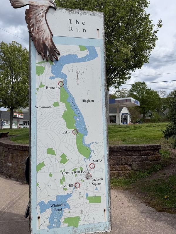
Spring means flowers, songbirds, and the annual upstream migration of river herring to spawn in the streams and ponds they were born in! These historically large migrations of fish into our freshwater streams, rivers, and ponds once supported(Submitted on May 16, 2026, by G.W.Bartlett of Hingham, Massachusetts.)the Native Americans, the Pilgrims, and the colonists who came after them. Where Can You See a Herring Run Near You?Photographed by G.W.Bartlett, May 8, 20264. The Run (panel 2)Panel 2 provides an overview of the herring run from the entrance of Back River to the end-point in Whitman’s Pond identifying some key access points.
4. Iron Hill Park Herring Runs.
Weymouth’s Iron Hill Park is a small town park at the edge of Whitman’s Pond. It features a very long, 2-part fish ladder and a viewing platform for the South Shore’s only waterfall, Iron Hill Falls (also known as Whitman’s Falls).(Submitted on May 17, 2026, by G.W.Bartlett of Hingham, Massachusetts.)
5. Stephen Rennie Herring Run Park. The Stephen Rennie Herring Run Park is a very small property in Weymouth’s Jackson Square. It features benches, picnic tables and views of the fish ladder on Herring Run Brook. It is located right next door to Lovell Field, and around the corner from Herring Run Pool Park... (Submitted on May 17, 2026, by G.W.Bartlett of Hingham, Massachusetts.)

Photographed by G.W.Bartlett, May 8, 2026
5. The Eels and Smelt (panel 3)
Panel 3 provides additional detail about other creatures that may be seen in the herring pool.

Photographed by G.W.Bartlett, May 8, 2026
6. The Herring Pool

Photographed by G.W.Bartlett, May 8, 2026
7. Iron Hill Herring Ladders
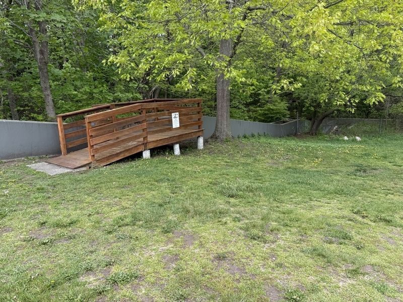
At nearby Iron Hill Street, the first herring ladder is on the left side and descends down to the brook from a resting pool. Herring are visible entering the resting pool here.
Photographed by G.W.Bartlett, May 8, 2026
8. Viewing Platform at Iron Hill Park
There is a viewing platform at Iron Hill Park at the final ladder up to Whitman’s Pond. However, viewing is better at the old mill site a shower walk down the hill.

Photographed by G.W.Bartlett, May 8, 2026
9. Iron Hill Park Herring Ladder & Waterfall
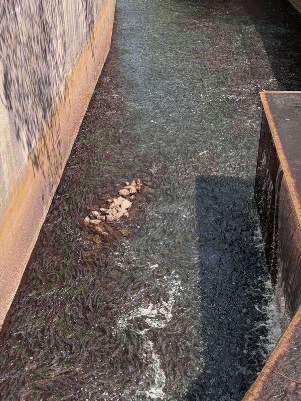
Further up Iron Hill Street to the right is available parking leading to a viewing platform for the final ladder up to Whitman's Pond and the natural waterfall.
Photographed by G.W.Bartlett, May 8, 2026
10. Stephen Rennie Park
Herring are packed tightly waiting their turn to climb their first ladder at Stephen Rennie Herring Run Park (downstream and across Broad Street from Weymouth Herring Pool Park). This viewing point is adjacent to Lovell Field. Best parking is Lovell Field parking lot or alternately Niko's Restaurant.
Photographed by G.W.Bartlett, May 8, 2026
11. Bridge across Herring Brook at East Weymouth MBTA
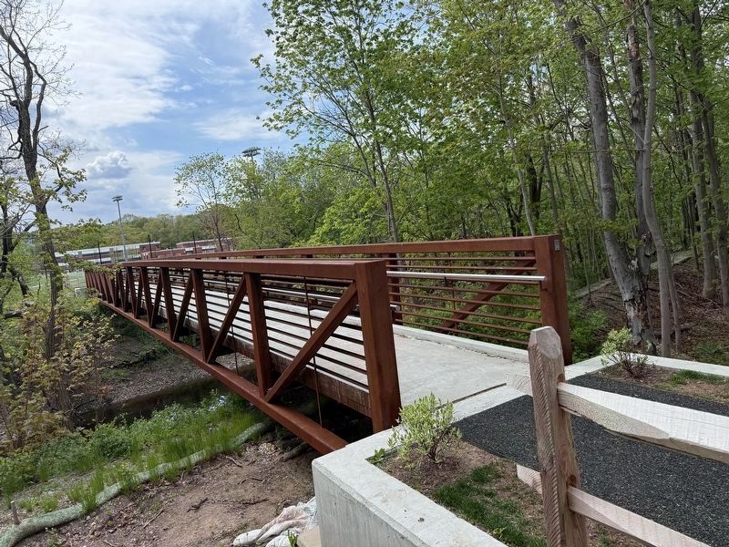
A pedestrian bridge crosses the Herring Brook between East Weymouth MBTA parking lot and Lovell Field north of Jackson Square where herring can be seen advancing towards the ladders.
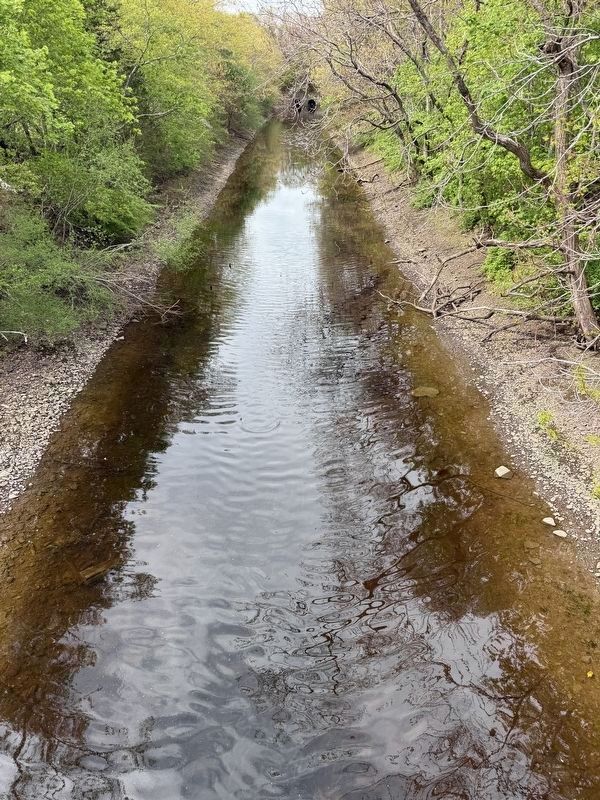
Photographed by G.W.Bartlett, May 8, 2026
12. View from the Bridge at East Weymouth MBTA
The view north from the bridge between Lovell Field and East Weymouth MBTA parking lot, looking towards the viaduct for the commuter rail and entry point from Back River.
Credits. This page was last revised on July 9, 2026. It was originally submitted on May 10, 2026, by G.W.Bartlett of Hingham, Massachusetts. This page has been viewed 40 times since then. Photos: 1, 2, 3, 4, 5, 6. submitted on May 10, 2026, by G.W.Bartlett of Hingham, Massachusetts. 7. submitted on May 17, 2026, by G.W.Bartlett of Hingham, Massachusetts. 8. submitted on June 8, 2026, by G.W.Bartlett of Hingham, Massachusetts. 9, 10. submitted on May 17, 2026, by G.W.Bartlett of Hingham, Massachusetts. 11, 12. submitted on June 8, 2026, by G.W.Bartlett of Hingham, Massachusetts. • Michael Herrick was the editor who published this page.
