Tangier in Accomack County, Virginia — The American South (Mid-Atlantic)
Tangier Beach
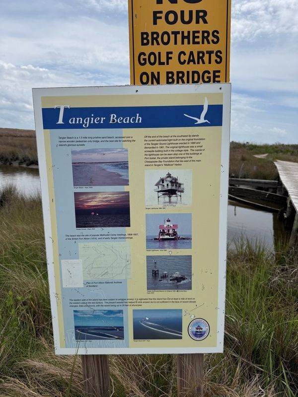
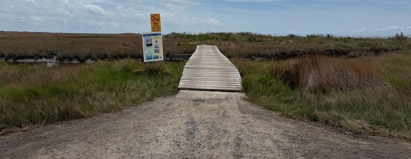
Tangier Beach is a 1.5 mile long pristine sand beach, accessed over a narrow wooden pedestrian only bridge, and the best site for watching the island's glorious sunsets
Off the end of the beach at the southwest tip stands the current automated light built on the original foundation of the Tangier Sound Lighthouse erected in 1890 and dismantled in 1961. The original lighthouse was a small screwpile building built in the cottage style. The cupola of the lighthouse can be seen atop one of the buildings at Port Isobel, the private island belonging to the Chesapeake Bay Foundation that lies east of the main island in Tangier's "Mailboat" Harbor.
The beach was the site of popular Methodist Camp meetings, 1808-1857, of the British Fort Albion (1814), and of early Tangier Homecomings.
The western side of the island has been subject to extreme erosion; it is estimated that the island has lost at least a mile of land on the western side in the last century. The present seawall has helped to slow erosion but is not sufficient in the face of recent climate changes, tides and storms, with the island losing up to 35 feet of
this page online
Erected by Tangier History Museum & Interpretive Cultural Center.
Topics and series. This historical marker is listed in these topic lists: Communications • Environment • Religion & Religious Structures • Waterways & Vessels. In addition, it is included in the Virginia, Tangier History Museum & Interpretive Cultural Center series list. A significant historical year for this entry is 1890.
Location. 37° 49.087′ N, 75° 59.814′ W. Marker is in Tangier, Virginia, in Accomack County. It is on Hog Ridge Road 0.2 miles south of Factory Road, in the median. Touch for map. Marker is at or near this postal address: 16707 Hog Ridge Rd, Tangier VA 23440, United States of America. Touch for directions.

Regionally, this marker is on the Eastern Shore. It is also in the American South, specifically in the Upper South, on the Delmarva Peninsula, in the Tidewater, and on the Eastern Seaboard. Globally, it is in the North Atlantic Region, North America, the Western Hemisphere, the Western World, and the Anglosphere. Historically, it finds itself in what was once the territory of the Mississippian Culture,
Other nearby markers. At least 8 other markers are within walking distance of this marker: Muddy Toes (about 400 feet away, measured in a direct line); Old Shirt Factory (approx. 0.2 miles away); The Miss Minnie & Capt. Charlie Pruitt House (approx. ¼ mile away); Wading Birds (approx. ¼ mile away); Tangier Treasures (approx. ¼ mile away); Hoistin' Bridge (approx. ¼ mile away); Banty's Wharf (approx. 0.3 miles away); Tangier Volunteer Fire Department (approx. 0.4 miles away). Touch for a list and map of all markers in Tangier.
Credits. This page was last revised on May 10, 2026. It was originally submitted on May 10, 2026, by Devry Becker Jones of Washington, District of Columbia. This page has been viewed 14 times since then. Photos: 1, 2. submitted on May 10, 2026, by Devry Becker Jones of Washington, District of Columbia.
