Near Spotsylvania Courthouse in Spotsylvania County, Virginia — The American South (Mid-Atlantic)
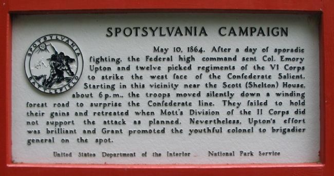
Spotsylvania Campaign
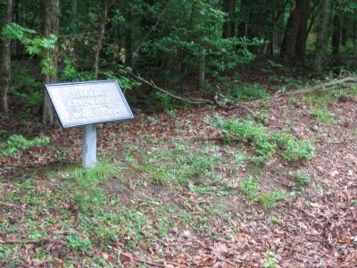
Photographed by Craig Swain, July 6, 2008
1. Spotsylvania Campaign Marker
Erected by National Park Service, U.S. Department of the Interior.
Topics. This historical marker is listed in this topic list: War, US Civil. A significant historical date for this entry is May 10, 1848.
Location. This marker has been replaced by another marker nearby. It was located near 38° 13.42′ N, 77° 36.385′ W. Marker was near Spotsylvania Courthouse, Virginia, in Spotsylvania County. It was on Grant Drive, on the right when traveling north. Located at tour stop two (Upton's Road) on the driving tour of Spotsylvania Battlefield unit of the Fredericksburg
this page online

Regionally, this marker was in the Washington Metropolitan Area, in Northern Virginia, and in the Piedmont. It was also in the American South, specifically in the Upper South, in the Mid-Atlantic, and on the Eastern Seaboard. Globally, it was in the North Atlantic Region, North America, the Western Hemisphere, the Western World, and the Anglosphere. Historically, it found itself in what was once the territory of the Mississippian Culture, one of the original Thirteen Colonies, one of the Confederate States of America, and the Antebellum South.
Other nearby markers. At least 8 other markers are within walking distance of this location: Upton’s Trail (a few steps from this marker); Forming for the Attack (about 600 feet away, measured in a direct line); Upton's Charge (approx. 0.2 miles away); Confederate Counterattack (approx. ¼ mile away); Upton’s Assault (approx. ¼ mile away); The Muleshoe Salient (approx. ¼ mile away); Attack on the Muleshoe (approx.
Photographed by Craig Swain, July 6, 2008
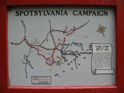
2. Spotsylvania Campaign Map
Upton's Attack About 6 p.m. May 10, 1864
A quarter of a mile beyond this point, their bayonets fixed, Upton's lines broke silence with a wild cheer as they burst from the piney woods across a 200-yard clearing to the Confederate trenches. Though thrown back by counterattack and losing some 1,000 men in killed, wounded and missing, Upton brought off over 1,000 prisoners. Mott's division had been expected to attack from the north, but Confederate artillery around the apex of the Salient swept a wide open field and easily kept Mott at bay. Meanwhile, Federal attacks along the Brock Road front also failed.
Double click on the photo to see an enlarged view of the map.
A quarter of a mile beyond this point, their bayonets fixed, Upton's lines broke silence with a wild cheer as they burst from the piney woods across a 200-yard clearing to the Confederate trenches. Though thrown back by counterattack and losing some 1,000 men in killed, wounded and missing, Upton brought off over 1,000 prisoners. Mott's division had been expected to attack from the north, but Confederate artillery around the apex of the Salient swept a wide open field and easily kept Mott at bay. Meanwhile, Federal attacks along the Brock Road front also failed.
Double click on the photo to see an enlarged view of the map.
Other markers no longer nearby. Spotsylvania Campaign (was here, next to this marker but has been permanently removed); Doles Salient (was approx. ¼ mile away but has been permanently removed); a different marker also named Spotsylvania Campaign (was approx. ¼ mile away but has been permanently removed); a different marker also named Spotsylvania Campaign (was approx. ¼ mile away but has been permanently removed).
More about this marker. This marker was replaced by a new one named Upton’s Trail (see nearby markers).
Photographed by Craig Swain, July 6, 2008
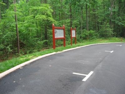
3. Tour Stop Two
Upton's Road tour stop has a marker and a map detailing the action at this phase.
Photographed by Craig Swain, July 6, 2008
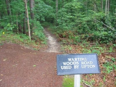
4. Wartime Woods Road Used by Upton
The road is now a foot trail which connects to Doles Salient.
Photographed by Craig Swain, July 6, 2008
5. Warren's Corps Trenches
Trenches for Warren's V Corps were just to the south of the road. Others trenches in the area are marked as used by Wright's VI Corps.

via National Park Service, unknown
6. Upton's Road
National Park Service Fredericksburg & Spotsylvania National Military Park website entry
Click for more information.
Click for more information.
Credits. This page was last revised on May 19, 2026. It was originally submitted on August 15, 2008, by Craig Swain of Leesburg, Virginia. This page has been viewed 1,243 times since then and 28 times this year. Last updated on May 19, 2026, by Evan Dwyer of Richmond, Virginia. Photos: 1, 2, 3, 4, 5. submitted on August 15, 2008, by Craig Swain of Leesburg, Virginia. 6. submitted on November 21, 2024, by Larry Gertner of New York, New York. • Devry Becker Jones was the editor who published this page.
