
Near Independence in Inyo County, California — The American West (Pacific Coastal)
Oak Creek Community Park
Fort Independence Reservation
| — | Paiute People | — |
Photographed by Craig Baker, May 13, 2026
1. Oak Creek Community Park Marker
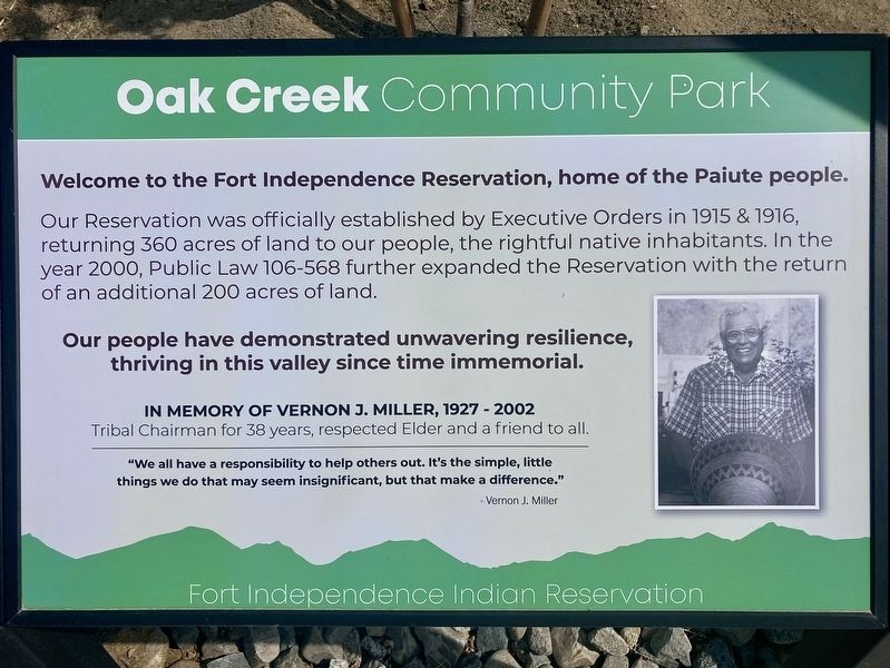
Welcome to the Fort Independence Reservation, home of the Paiute people. Our Reservation was officially established by Executive Orders in 1915 & 1916, returning 360 acres of land to our people, the rightful native inhabitants. In the year 2000, Public Law 106-568 further expanded the Reservation with the return of an additional 200 acres of land.
Our people have demonstrated unwavering resilience, thriving in this valley since time immemorial.
In Memory of Vernon J. Miller, 1927-2002, Tribal Chairman for 38 years, respected Elder and a friend to all. "We all have a responsibility to help others out. It's the simple, little things we do that may seem insignificant, but that make a difference." - Vernon J. Miller
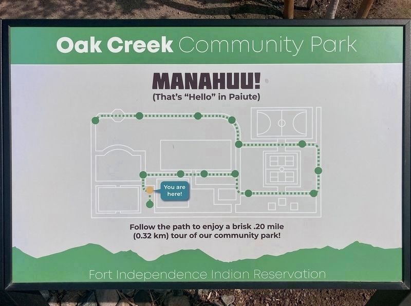
Manahuu! (That's "Hello" in Paiute)
Follow the path to enjoy a brisk .20 mile tour of our community park!
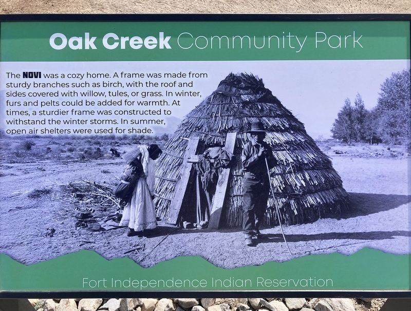
The Novi was a cozy home. A frame was made from sturdy branches
this page online
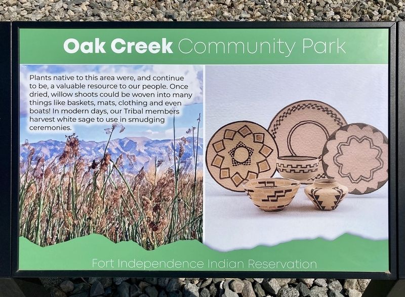
Plants native to this area were, and continue to be, a valuable resource to our people. Once dried, willow shoots could be woven into many things like baskets, mats, clothing and even boats! In modern days, our Tribal members harvest white sage to use in smudging ceremonies.
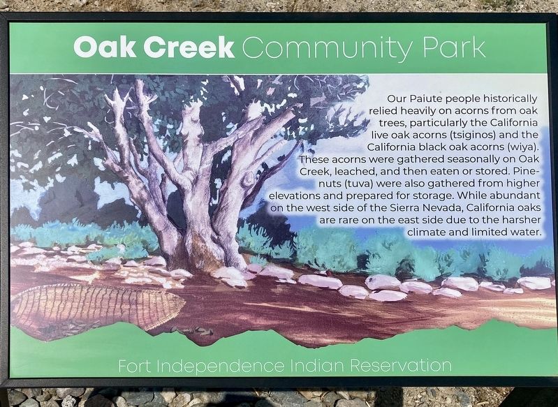
Our Paiute people historically relied heavily on acorns from oak trees, particularly the California live oak acorns (tsiginos) and the California black oak acorns (wiya).These acorns were gathered seasonally on Oak Creek, leached, and then eaten or stored. Pine-nuts (tuva) were also gathered from higher elevations and prepared for storage. While abundant on the west side of the Sierra Nevada, California
Photographed by Craig Baker, May 13, 2026
2. Oak Creek Community Park Map
Follow the path to enjoy a brisk .20 mile tour of our community park! [Interpretive sign locations shown]
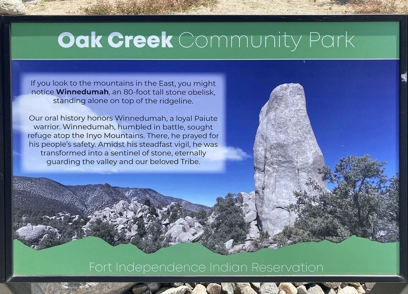
If you look to the mountains in the East, you might notice Winnedumah, an 80-foot tall stone obelisk, standing alone on top of the ridgeline.Our oral history honors Winnedumah, a loyal Paiute warrior. Winnedumah, humbled in battle, sought refuge atop the Inyo Mountains. There, he prayed for his people's safety. Amidst his steadfast vigil, he was transformed into a sentinel of stone, eternally guarding the valley and our beloved Tribe.
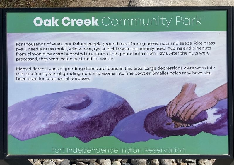
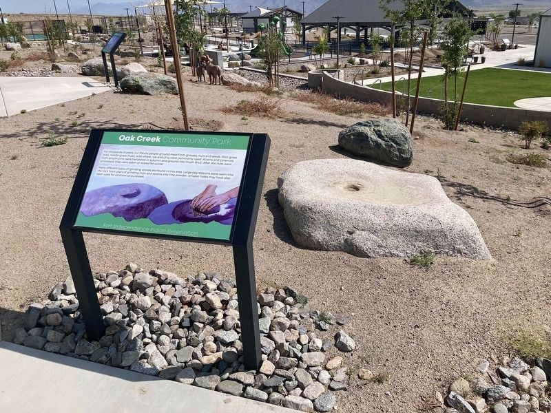
For thousands of years, our Paiute people ground meal from grasses, nuts and seeds. Rice grass (wai), needle grass (huki), wild wheat, rye and chia were commonly used. Acorns and pinenuts from pinyon pine were harvested in autumn and ground into mush (kivi). After the nuts were processed, they were eaten or stored foMany different types of grinding stones are found in this area. Large depressions were worn into
Photographed by Craig Baker, May 13, 2026
3. Oak Creek Community Park Markers
Erected 2025 by Fort Independence Indian Reservation.
Topics. This historical marker is listed in these topic lists: Indigenous Peoples and Communities • Parks & Recreational Areas. A significant historical year for this entry is 1915.
Location. 36° 50.457′ N, 118° 13.843′ W. Marker is near Independence, California, in Inyo County. It can be reached from Frontage Road west of U.S. 395, on the left when traveling north. Touch for map. Marker is at or near this postal address: 301 Ft Independence, Independence CA 93526, United States of America. Touch for directions.

Regionally, this marker is in California’s Sierra Nevada. It is also in the American Mountain West. Globally, it is in North America, on the Ring of Fire, in the Pacific Rim, in the Western Hemisphere, in the Western World,
Photographed by Craig Baker, May 13, 2026
4. Oak Creek Community Park Marker
Other nearby markers. At least 8 other markers are within 4 miles of this marker, measured as the crow flies: Camp Independence (approx. 0.7 miles away); Mt. Whitney Fish Hatchery (approx. one mile away); Historic Independence (approx. 2.9 miles away); Mining in Inyo County (approx. 3.1 miles away); Hydroelectric Power From Bishop Creek (approx. 3.1 miles away); Inyo County Courthouse (approx. 3.1 miles away); Putnam’s Stone Cabin (approx. 3.1 miles away); Engine #18 (approx. 3.1 miles away). Touch for a list and map of all markers in Independence.
Photographed by Craig Baker, May 13, 2026
5. Oak Creek Community Park Marker
Photographed by Craig Baker, May 13, 2026
6. Oak Creek Community Park Marker
Photographed by Craig Baker, May 13, 2026
7. Oak Creek Community Park Marker
Photographed by Craig Baker, May 13, 2026
8. Oak Creek Community Park Marker
Photographed by Craig Baker, May 13, 2026
9. Marker and Grinding Stone
Photographed by Craig Baker, May 13, 2026
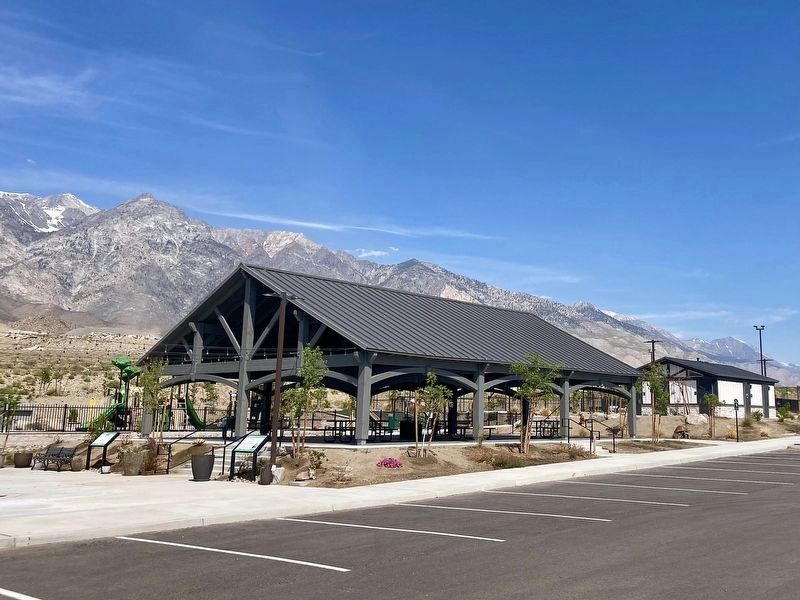
10. Oak Creek Community Park
Photographed by Craig Baker, May 13, 2026
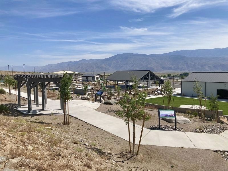
11. Oak Creek Community Park
Credits. This page was last revised on June 13, 2026. It was originally submitted on May 22, 2026, by Craig Baker of Sylmar, California. This page has been viewed 20 times since then. Photos: 1, 2, 3, 4, 5, 6, 7, 8, 9, 10, 11. submitted on May 22, 2026, by Craig Baker of Sylmar, California.
