Near Annville in Lebanon County, Pennsylvania — The American Northeast (Mid-Atlantic)
"Indiantown"

Photographed by Paul Crumlish, April 4, 2010
1. "Indiantown" Marker
The native village from which, in turn, the Creek, Gap, and great Military Reservation derived their names, formerly stood near here. The Delaware Indians took this route to Shamokin, upon their removal from the Schuylkill region.
Erected 1947 by Pennsylvania Historical and Museum Commission.
Topics and series. This historical marker is listed in these topic lists: Indigenous Peoples and Communities • Military • Natural Features • Settlements & Settlers. In addition, it is included in the Pennsylvania Historical and Museum Commission (PHMC) series list.
Location. 40° 24.104′ N, 76° 34.551′ W. Marker is near Annville, Pennsylvania, in Lebanon County. It is on Bellegrove Road (State Road 934) south of Jonestown Road, on the left when traveling south. Touch for map. Marker is in this post office area: Annville PA 17003, United States of America. Touch for directions.

Regionally, this marker is in South-Central Pennsylvania, specifically in Pennsylvania Dutch Country, and in Greater Harrisburg. It is also in the American Northeast, in the Mid-Atlantic,
this page online
Other nearby markers. At least 8 other markers are within 2 miles of this marker, measured as the crow flies: Blue Mountain Forts (approx. 0.2 miles away); Lindley Murray (approx. 0.6 miles away); Reed's Fort (approx. one mile away); Address by President Lincoln (approx. 1.3 miles away); Pennsylvania Veterans' Memorial (approx. 1.4 miles away); Indiantown Gap Military Reservation (approx. 1½ miles away); US Merchant Marines (approx. 1½ miles away); Red Horse (approx. 1½ miles away). Touch for a list and map of all markers in Annville.
Also see . . . MarkerQuest - Indiantown and Indiantown Gap Military Installation. (Submitted on March 10, 2020, by Laura Klotz of Northampton, Pennsylvania.)
Photographed by Paul Crumlish, April 4, 2010
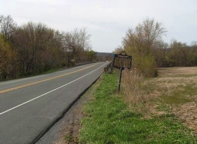
2. Wide view of the "Indiantown" Marker
Looking north across the Swatara Creek toward Harper's Tavern.
Credits. This page was last revised on October 9, 2026. It was originally submitted on April 24, 2010, by PaulwC3 of Northern, Virginia. This page has been viewed 1,614 times since then and 53 times this year. Photos: 1, 2. submitted on April 24, 2010, by PaulwC3 of Northern, Virginia.
