Stilwell in Adair County, Oklahoma — The American South (West South Central)
End of the Journey
Stilwell and the Trail of Tears
Trail of Tears National Historic Trail
| — | Trail of Tears Association; National Park Service | — |
Photographed by Marc Hayot, May 24, 2026
1. End of the Journey Marker
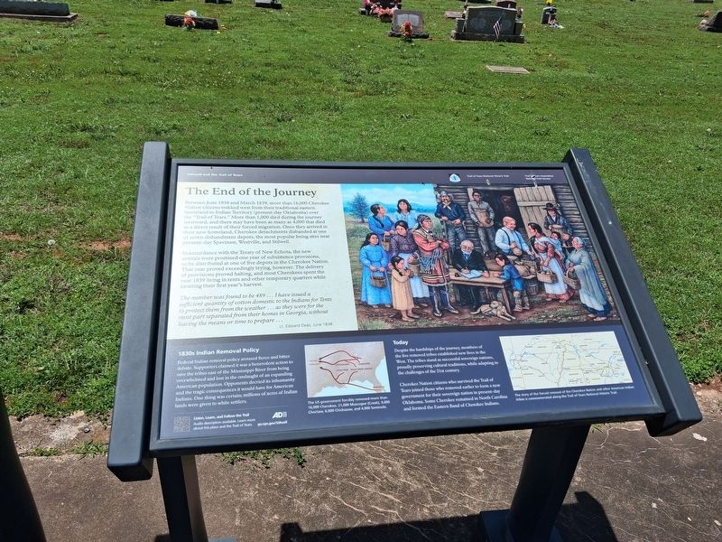
Between June 1839 and March 1839, more than 16,000 Cherokee Nation citizens trekked west from their traditional eastern homeland to Indian Territory (present-day Oklahoma) over the "Trail of Tears." More than 1,000 died during the journey westward and there may have been as many as 4,000 that died as a result of their forced migration. Once they arrived in their new homeland, Cherokee detachments disbanded at one of seven disbandment depots, the most popular being the sites near present-day Spavinaw, Westville and Stilwell.
In accordance with the Treaty of New Echota, the new arrivals were promised one of substinence provisions, to be distributed at one of five depots in the Cherokee Nation. That year proved exceedingly trying, however. The delivery of provisions proved halting, and most Cherokees spent the year 1839 living in tents and other temporary quarters while awaiting their first year's harvest.
"The number was found to be 489 ... I have issued a sufficient quantity of cotton domestic to Indians for Tents to protect them from the weather ... as they were for the most part separated from their homes in Georgia without having the means or time to prepare" ...
Lt.Edward Deas, June 1838
Click or scan to see
this page online
1830s Indian Removal Policy
Federal Indian removal policy aroused fierce and bitter debate. Supporters claimed it was a benevolent action to save the tribes east of the Mississippi River from being overwhelmed and lost in the onslaught of an expanding American population. Opponents decried its inhumanity and the tragic consequences it would have for American Indians. One thing was certain; millions of acres of Indian land were given to white settlers.
Today
Despite the hardships of the journey, members of the five civilized tribes established new lives in the West. The tribes stand as successful sovereign nations, proudly preserving cultural traditions, while adapting to the challenges of the 21st Century.
Cherokee Nation citizens who survived the Trail of Tears joined those who removed earlier to form a new government for their sovereign nation in present-day Oklahoma. Some Cherokee remained in North Carolina and formed the Eastern Band of Cherokee Indians.
Erected by Trail of Tears Association; National Park Service, U.S. Department of the Interior.
Topics. This historical marker is listed
Photographed by Marc Hayot, June 28, 2026
2. End of the Journey Marker
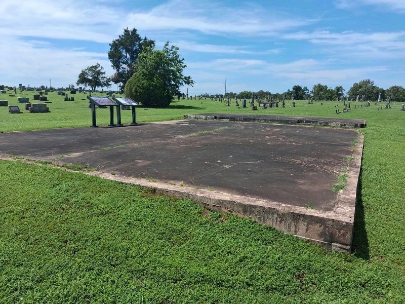
Location. 35° 49.317′ N, 94° 38.519′ W. Marker is in Stilwell, Oklahoma, in Adair County. It is on Cemetery Road north of West Doyle Avenue, on the left when traveling north. The marker is located in Stilwell Cemetery. Touch for map. Marker is at or near this postal address: 1029 W Doyle Ave, Stilwell OK 74960, United States of America. Touch for directions.

Regionally, this marker is in the Cherokee Nation and in Northeast Oklahoma—Green Country. It is also in the American South, specifically in the Ozarks, on the prairies, and on the Southern Plains. Globally, it is in North America, the Western Hemisphere, the Western World, and the Anglosphere. Historically, it finds itself in what was once the territory of the Mississippian Culture and also the Louisiana Purchase.
Other nearby markers. At least 7 other markers are within 11 miles of this marker, measured as the crow flies: KCS Railway Depot (approx. 1.1 miles away); a different marker also named The End of the Journey (approx. 1.1 miles away); Almost The End Of The Cherokee's Sad Journey Westward (approx. 8.3 miles away in Arkansas); R. L. Leach Grocery Store (approx. 9.2 miles away in Arkansas); Hermannsburg-Dutch Mills (approx. 9.3 miles away in Arkansas); Bethlehem Methodist-Episcopal Church South (approx. 10.7 miles away in Arkansas); Bethlehem Cemetery (approx. 10.7 miles away in Arkansas).
Regarding End of the Journey. This site is managed by the Adair County Historical and Genealogical Association.
Additional keywords. genocide
Credits. This page was last revised on July 9, 2026. It was originally submitted on May 25, 2026, by Marc Hayot of Siloam Springs, Arkansas. This page has been viewed 32 times since then. Photos: 1. submitted on May 25, 2026, by Marc Hayot of Siloam Springs, Arkansas. 2. submitted on June 28, 2026, by Marc Hayot of Siloam Springs, Arkansas. • Devry Becker Jones was the editor who published this page.
