Richfield in Hennepin County, Minnesota — The American Midwest (Upper Plains)
Pvt. John O. Dolson
Co. A, 2nd US Sharpshooters
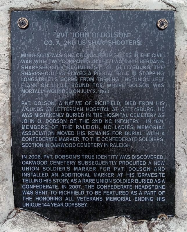
Photographed by McGhiever, November 3, 2024
1. Pvt. John O. Dolson Marker
Minnesota was one of only four states in the Civil War with two companies in the two elite Berdan's Sharpshooter Regiments. At Gettysburg the Sharpshooters played a pivotal role in stopping Longstreet's Corps from turning the Union left flank on Little Round Top, where Dolson was mortally wounded on July 2, 1863.
Pvt. Dolson, a native of Richfield, died from his wounds at Letterman Hospital at Gettysburg. He was mistakenly buried in the hospital cemetery as John O. Dobson of the 2nd NC Infantry. In 1871, members of the Raleigh, NC Ladies Memorial Association moved his remains for burial, with a Confederate marker, to the Confederate soldiers' section in Oakwood Cemetery in Raleigh.
In 2006, Pvt. Dobson's true identity was discovered. Oakwood Cemetery subsequently procured a new Union soldier's marker for Pvt. Dolson and installed an additional marker at his gravesite telling his story, as a rare Union soldier buried as a Confederate. In 2007, the Confederate headstone was sent to Richfield to be featured as a part of the Honoring All Veterans Memorial ending his unique 144 year odyssey.
Topics. This historical
this page online
Location. 44° 53.18′ N, 93° 16.016′ W. Marker is in Richfield, Minnesota, in Hennepin County. It can be reached from the intersection of Portland Avenue and E. 64th Street, on the left when traveling south. The marker is just north of the Honoring All Veterans Memorial in Veterans Park. Touch for map. Marker is at or near this postal address: 6401 Portland Avenue, Minneapolis MN 55423, United States of America. Touch for directions.

Regionally, this marker is in the Twin Cities Metropolitan Area. It is also in the American Midwest, in the Corn Belt, and in the Great River Road Region. Globally, it is in North America, the Western Hemisphere, the Western World, and the Anglosphere. Historically, it finds itself in what was once Rupert’s Land, the territory of the Mississippian Culture, and the Louisiana Purchase.
Other nearby markers. At least 8 other markers are within 2 miles of this marker, measured as the crow flies: World War Memorial (here, next to this marker); The Honoring All Veterans Memorial

Photographed by McGhiever, November 3, 2024
2. Pvt. John O. Dolson marker and erroneous gravestone

Photographed by McGhiever
3. Pvt. John O. Dolson Marker (right) in Veterans Park
Credits. This page was last revised on May 27, 2026. It was originally submitted on May 27, 2026, by McGhiever of Minneapolis, Minnesota. This page has been viewed 18 times since then. Photos: 1, 2, 3. submitted on May 27, 2026, by McGhiever of Minneapolis, Minnesota.
