South of Broad in Charleston in Charleston County, South Carolina — The American South (South Atlantic)
Magwood-Moreland House
39 South Battery
| — | circa 1827 | — |
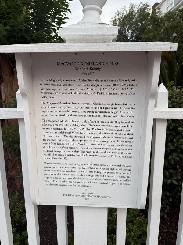
Samuel Magwood, a prosperous Ashley River planter and native of Ireland, built this two-and-one-half story house for his daughter, Susan (1807-1904), before her marriage to Irish-born Andrew Moreland (1789-1863) in 1827. The Morelands are buried at Old Saint Andrew's Parish churchyard, west of the Ashley River.
The Magwood-Moreland house is a typical Charleston single house built on a crib of crisscrossed palmetto logs in a bed of sand and pluff mud. The palmetto log foundation allows the house to sway during earthquakes and gale-force winds; thus it has survived the destructive earthquake of 1886 and major hurricanes.
The Magwood-Moreland house is a significant antebellum dwelling located on a lot that once fronted the Ashley River. The house narrowly escaped demolition on two occasions. In 1855 Mayor William Porcher Miles announced a plan to create a large park beyond White Point Garden, at the time only about one-third of its current size. The city purchased the Magwood-Moreland house and filled the marshes that bordered the property to create a 15 acre park on the waterfront west of the house. The Civil War
this page online
Notable features are the two fanlights over the piazza screen entrance and the main private entrance to the center stair hall. Elaborate Regency style wood carving adorns the two frontispiece elements surrounding the piazza entrance and entrance to the main house. The house originally had a one-story piazza, the upper piazza having been added later to catch the sea breezes from the Ashley River. The sizeable rooms are adorned with original Regency interiors and elaborate fireplace mantles and moldings.
Erected 2013 by Preservation Society of Charleston.
Topics. This historical marker is listed in these topic lists: Architecture • Immigration • War, US Civil. A significant historical year for this entry is 1827.
Location. 32° 46.231′ N, 79° 55.956′ W. Marker is in Charleston, South Carolina, in Charleston County. It is in South


Regionally, this marker is in Historic Charleston and in the Lowcountry. It is also in the American South, specifically in the Deep South, and on the Eastern Seaboard. Globally, it is in the North Atlantic Region, North America, the Western Hemisphere, the Western World, and the Anglosphere. Historically, it finds itself in what was once the territory of the Mississippian Culture, one of the original Thirteen Colonies, one of the Confederate States of America, and the Antebellum South.
Other nearby markers. At least 8 other markers are within walking distance of this marker: The Colonel James English House (within shouting distance of this marker); The John Blake House (about 400 feet away, measured in a direct line); Ingraham-Forrest House (about 400 feet away); USS Hobson Tribute (about 400 feet away); Thomas Lamboll House 19 King Street (about 500 feet away); Still On Patrol (about 500 feet away); Stevens-Lather House / Birthplace of Preservation (about 500 feet away); 23 King Street (about 600 feet away). Touch for a list and map of all markers in Charleston.
Credits. This page was last revised on May 27, 2026. It was originally submitted on May 27, 2026, by Devry Becker Jones of Washington, District of Columbia. This page has been viewed 30 times since then. Photos: 1, 2. submitted on May 27, 2026, by Devry Becker Jones of Washington, District of Columbia.
