Caherbarnagh in Knockevin in County Clare, Munster, Ireland — Irish South-West ((Éire) North Atlantic Ocean)
Suíomh Geopháirc Aillte an Mhothair
⎯⎯⎯
Cliffs of Moher Geopark Site
Photographed by Ian Lefkowitz, May 14, 2026
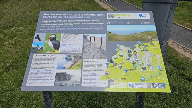
1. Suíomh Geopháirc Aillte an Mhothair / Cliffs of Moher Geopark Site Marker
 Suíomh Geopháirc Aillte an Mhothair
Cliffs of Moher Geopark Site
Imeall an Atlantaigh: Tá Aillte an Mhothair níos mó ná 200 méadar ar airde agus níos mó ná 3,000 ciliméadar ón gcéad talamh eile, i dTalamh an Éisc, Ceanada. Tá na haillte déanta as gaineamh agus láib a scuab abhainn mhór isteach i bhfarraige ársa 315 milliún bliain ó shin. Cruthaíonn na haillte tar éis na mílte bliain de chreimeadh stoirmeacha agus tonnta.
Atlantic Edge: The Cliffs of Moher are more than 200 metres high and more than 3,000 kilometres from the next land, in Newfoundland, Canada. The cliffs are made from sand and mud that was washed into an ancient sea by a large river, 315 million years ago. The cliffs have formed due to thousands of years of erosion by storms and waves.
Téid gach Éan lena Alt Féin
Is Limistéar faoi Chosaint Speisialta le haghaidh éan iad Aillte an Mhothair. Bíonn 30,000 éan ann ag mairseáil lóid ar na leaca gaineamhchloiche nó sna fánaí féaracha feadh an aille. Tá níos mó ná 20 speiceas ann. Tagann go leor de na héin ansin díreach le haghaidh an shéasúr pórúcháin amháin sular bhfilleann siad
this page online
Birds of a Feather
The Cliffs of Moher are a Special Protection Area for birds. 30,000 nesting birds make their home on the sandstone ledges or in the grassy slopes along the cliffs. There are more than 20 species. Many of the birds only come here for the breeding season before returning to the sea for the winter. The Puffin is probably the most popular.
Aghaidh na nAillte atá ag Athrú
Túr Uí Bhriain a thugtar ar an túr ag barr Aillte an Mhothair. Thóg an tiarna talún áitiúil Cornelius O’Brien é sa bhliain 1835. Thóg sé mar thúr amhairc dá chuairteoirí, agus anois is iad Aillte an Mhothair an suíomh turasóireachta amuigh faoin aer is mó a dtugtar cuairt air in Éirinn.
Tá imeall na haille éagobhsaí mar sin ná téigh go dlí an t-imeall. Mar gheall ar na briseacha ingearacha sa charraig, bíonn an charraig scaoilte agus bíonn an ghaoth agus na tonnta de shíor ag creimeadh aghaidh na haille — is é sin an fáth a bhfuil sí ingearach.
The Changing Face of the Cliffs
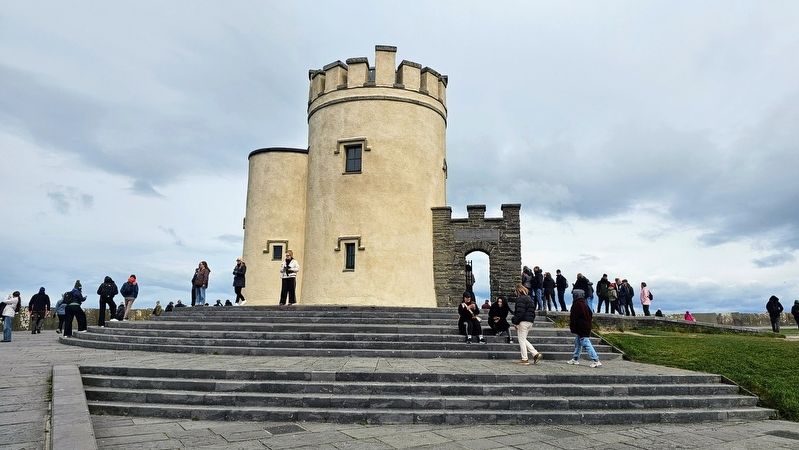
The tower at the top of the Cliffs of Moher is called O’Brien’s Tower. It
Photographed by Ian Lefkowitz, May 14, 2026
2. O'Brien's Tower
The tower was built as a viewing site in 1835 for guests.
The cliff edge is unstable so do not go to the edge. Vertical fractures in the rock mean the rock is loose and the wind and waves are constantly eroding the cliff face, that is why it is vertical.
Raonta Iontaise Ársa
Tá patrúin chasta ag cuid de na carraigeacha sna haillte. Sí uachais ainmhí bhig a bhíodh ag crúbadach tríd an ngaineamh ar ghrinneall na farraige 315 milliún bliain ó shin. Cúladaíodh na huchóigí agus d’iompaigh siad go mall isteach ina gcarraig. Tá na leaca carraigeacha á gcairéalú sa cheantar le breis agus 150 bliain agus úsáidtear iad mar leaca pábhála.
Ancient Fossil Trails
Some of the rocks in the cliffs have complex patterns. These are the burrows of a small animal that was crawling through the sand on the seabed–315 million years ago. The burrows were buried and slowly turned to rock. The rock slabs have been quarried in the area for over 150 years and are used as paving stones.
Topics. This historical marker
Photographed by Ian Lefkowitz, May 14, 2026
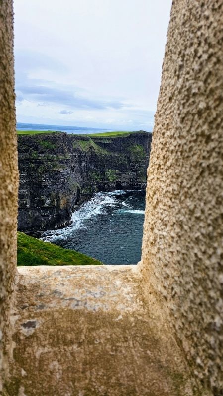
3. Cliffs of Moher
A view of Ireland's famed natural feature from atop O'Brien's Tower.
Location. 52° 58.297′ N, 9° 25.606′ W. Marker is in Knockevin, Munster, in County Clare. It is in Caherbarnagh. It is at the intersection of Moher Road and Ballard Road, on the left when traveling west on Moher Road. Touch for map. Touch for directions.

Regionally, this marker is in the Hidden Heartlands. Globally, it is on the Atlantic Ocean, in the North Atlantic Region, in Europe, on the Island of Ireland, on the Celtic Fringe, in the European Union, in Atlantic Europe, on one of the British Isles, in the Western World, and in the Anglosphere.
Other nearby markers. At least 3 other markers are within walking distance of this marker: Buskers Pitch (about 150 meters away, measured in a direct line); a different marker also named Buskers Pitch (about 180 meters away); a different marker also named Buskers Pitch (about 210 meters away).
Photographed by Ian Lefkowitz, May 14, 2026
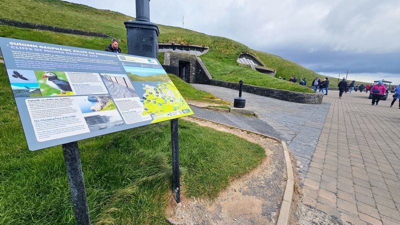
4. Suíomh Geopháirc Aillte an Mhothair / Cliffs of Moher Geopark Site Marker
The marker is located next to the geopark's visitor center.
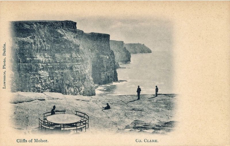
Photographed by Lawrence, Photo, Dublin, circa 1910
5. Cliffs of Moher
Credits. This page was last revised on May 28, 2026. It was originally submitted on May 27, 2026, by Ian Lefkowitz of New York, New York. This page has been viewed 12 times since then. Photos: 1, 2, 3, 4. submitted on May 27, 2026, by Ian Lefkowitz of New York, New York. 5. submitted on May 28, 2026. • Andrew Ruppenstein was the editor who published this page.
