
Bunratty East in County Clare, Munster, Ireland — Irish South-West ((Éire) North Atlantic Ocean)
Landscape and River
| — | Bunratty Village Heritage Trail | — |
Photographed by Ian Lefkowitz, May 14, 2026
1. Landscape and River Marker

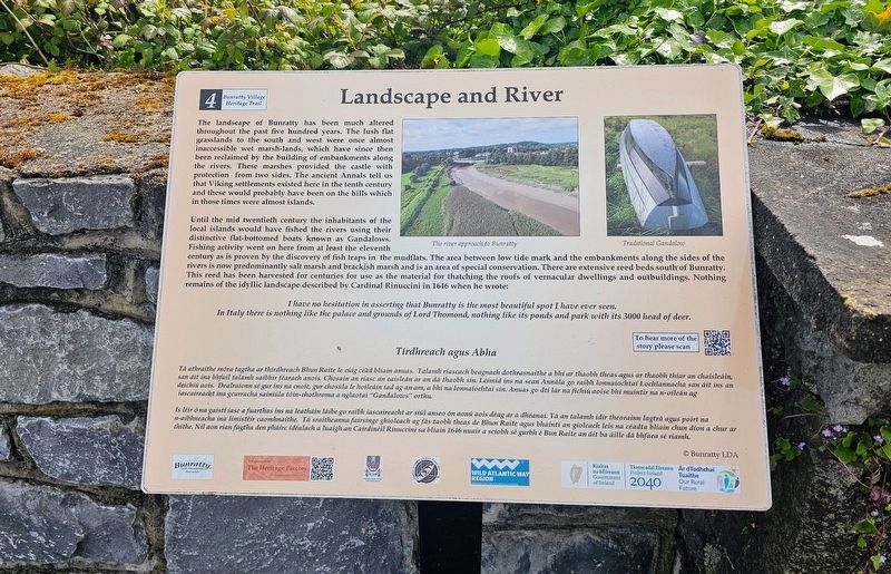
Landscape and River
The landscape of Bunratty has been much altered throughout the past five hundred years. The lush flat grasslands to the south and west were once almost inaccessible wet marsh-lands, which have since then been reclaimed by the building of embankments along the rivers. These marshes provided the castle with protection from two sides. The ancient Annals tell us that Viking settlements existed here in the tenth century and these would probably have been on the hills which in those times were almost islands.
Until the mid twentieth century the inhabitants of the local islands would have fished the rivers using their distinctive flat-bottomed boats known as Gandalows. Fishing activity went on here from at least the eleventh century as is proven by the discovery of fish traps in the mudflats. The area between low tide mark and the embankments along the sides of the rivers is now predominantly salt marsh and brackish marsh and is an area of special conservation. There are extensive reed beds south of Bunratty. This reed has been harvested for centuries for use as the material for thatching the
this page online
I have no hesitation in asserting that Bunratty is the most beautiful spot I have ever seen. In Italy there is nothing like the palace and grounds of Lord Thomond, nothing like its ponds and park with its 3000 head of deer.
Tírdhreach agus Abha
Tá athraithe móra tagtha ar thírdhreach Bhun Raite le cúig céad bliain anuas. Talamh riascach beagnach dothrasnaíthe a bhí ar thaobh theas agus ar thaobh thiar an chaisleáin, san áit ina bhfuil talamh saibhir féarach anois. Chosain an riasc an caisleán ar an dá thaobh sin. Léimid ins na sean Annála go raibh lonnaíochtaí Lochlannacha san áit ins an deichiú aois. Dealraíonn sé gur ins na cnoic, gur chosúla le hoileáin iad ag an am, a bhí na lonnaíochtaí sin. Anuas go dtí lár na fichiú aoise bhí muintir na n-oileán ag iascaireacht ina gcurracha sainiúla tóin-chothroma a nglaotaí “Gandalows” orthu.
Is léir ó na gaistí iasc a fuarthas ins na leathán láibe go raibh iascaireacht ar siúl anseo ón aonú aois déag ar a dhéanaí. Tá an talamh idir theorainn
Photographed by Ian Lefkowitz, May 14, 2026
2. Landscape and River Marker
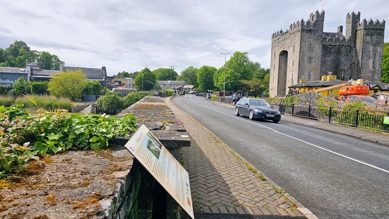
The marker seen in relation to Bunratty Castle.
(Captions)
The river approach to Bunratty • Traditional Gandalow
© Bunratty LDA
Erected by Bunratty Local Development Association. (Marker Number 4.)
Topics. This historical marker is listed in these topic lists: Environment • Waterways & Vessels.
Location. 52° 41.755′ N, 8° 48.671′ W. Marker is in Bunratty, Munster, in County Clare. It is in Bunratty East. It is on Old Bunratty Road east of Bunratty West, on the left when traveling west. Touch for map. Marker is at or near this postal address: L3126, Bunratty, Munster, Ireland. Touch for directions.

Regionally, this marker is in the Hidden Heartlands. Globally, it is on the Atlantic Ocean, in the North Atlantic Region, in Europe, on the Island of Ireland, on the Celtic Fringe, in the European Union, in Atlantic Europe, on one of the British Isles, in the Western World, and in the Anglosphere.
Other nearby markers. At least 8 other markers are within 13 kilometers of this marker, measured as the crow flies: Military Events (a few steps from this marker); Bunratty Bridge (within shouting distance of this marker); Caiseal Óir (about 120 meters away, measured in a direct line); Bunratty Castle (about 120 meters away); Bunratty House (about 180 meters away); Sarsfield Bridge (approx. 12.7 kilometers away); Sóivéid Luimní / Limerick Soviet (approx. 12.7 kilometers away); Dockers Monument (approx. 12.7 kilometers away). Touch for a list and map of all markers in Bunratty.
Credits. This page was last revised on May 28, 2026. It was originally submitted on May 28, 2026, by Ian Lefkowitz of New York, New York. This page has been viewed 12 times since then. Photos: 1, 2. submitted on May 28, 2026, by Ian Lefkowitz of New York, New York. • Andrew Ruppenstein was the editor who published this page.
