Calvert City in Marshall County, Kentucky — The American South (East South Central)
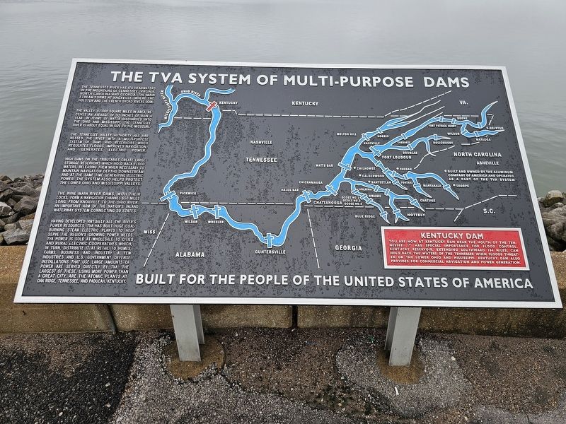
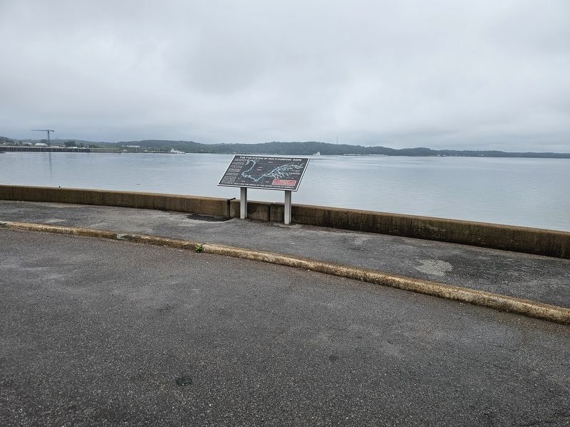
The TVA System of Multi-Purpose Dams
Kentucky Dam
Photographed by Cajun Scrambler, May 23, 2026
1. The TVA System of Multi-Purpose Dams Marker
The Tennessee River has its headwaters in the mountains of Tennessee, Virginia, North Carolina and Georgia. The main stream forms at Knoxville, where the Houston and the French Broad Rivers join.
The valley, 41,000 square miles in area, receives an average of 52 inches of rain a year. In terms of water discharged into the Ohio and Mississippi, the Tennessee River is about equal in size to the Missouri.
The Tennessee Valley Authority has harnessed the river with a multi-purpose system of dams and reservoirs which regulates floods, improves navigation, and generates electric power.
High dams on the tributaries create large storage reservoirs which hold back flood waters, releasing them when necessary to maintain navigation depths downstream, and at the same time generating electric power. The system also helps protect the lower Ohio and Mississippi Valleys.
The nine main river dams, with their locks, form a navigable channel 650 miles long, from Knoxville to the Ohio River, an important arm of the nation's inland waterway system connecting 20 states.
Having developed virtually all the river's power resources,
this page online
You are now at Kentucky Dam near the mouth of the Tennessee. It has special importance for flood control. Kentucky Reservoir extending southward 184 wiles, can hold back the waters of the Tennessee when floods threaten on the Lower Ohio and Mississippi. Kentucky Dam also provides for commercial navigation and power generation.
Built for the people of the United States of America.
Erected by Tennessee Valley Authority.
Topics. This historical marker is listed in these topic lists: Industry & Commerce • Man-Made Features • Waterways & Vessels.
Location. 37° 0.611′ N, 88° 16.377′ W.
Photographed by Cajun Scrambler, May 23, 2026
2. The TVA System of Multi-Purpose Dams Marker

Regionally, this marker is in Kentucky’s Jackson Purchase. It is also in the American Midwest, in the South, and specifically in the Upper South. Globally, it is in North America, the Western Hemisphere, the Western World, and the Anglosphere. Historically, it finds itself in what was once the territory of the Mississippian Culture and also the Antebellum South.
Other nearby markers. At least 8 other markers are within 7 miles of this marker, measured as the crow flies: Kentucky Dam (approx. 0.4 miles away); Propelling The Water (approx. 0.4 miles away); Grand Rivers Iron Furnace (approx. 1.7 miles away); Grand Rivers Furnace / Iron Made in Kentucky (approx. 2 miles away); "Oak Hill" (approx. 4.4 miles away); Andrew Jackson Smith / Medal of Honor (approx. 4.6 miles away); Andrew Jackson Smith (approx. 4.6 miles away); (Kelly Furnace) (approx. 6.4 miles away).
Credits. This page was last revised on May 29, 2026. It was originally submitted on May 29, 2026, by Cajun Scrambler of Assumption, Louisiana. This page has been viewed 27 times since then. Photos: 1, 2. submitted on May 29, 2026, by Cajun Scrambler of Assumption, Louisiana.
