
Near Mathews in Mathews County, Virginia — The American South (Mid-Atlantic)
Kingston Parish
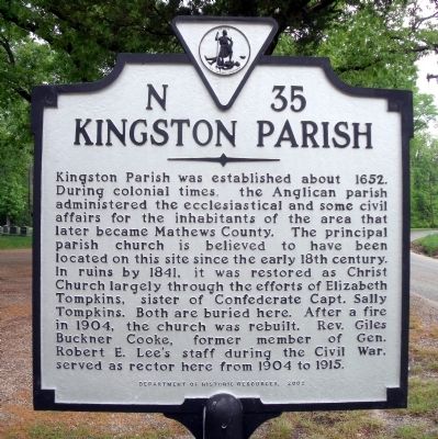
Photographed by Bernard Fisher, April 25, 2010
1. Kingston Parish Marker
Erected 2002 by Department of Historic Reources. (Marker Number N-35.)
Topics and series. This historical marker is listed in these topic lists: Colonial Era • Religion & Religious Structures • War, US Civil. In addition, it is included in the Virginia Department of Historic Resources (DHR) series list. A significant historical year for this entry is 1652.
Location. 37° 24.596′ N, 76° 20.103′ W. Marker is near Mathews, Virginia, in Mathews County. It is on Williams
this page online

Regionally, this marker is on the Middle Peninsula and in the Hampton Roads Metropolitan Area. It is also in the American South, specifically in the Upper South, in the Tidewater, in the Chesapeake Bay Region, and on the Eastern Seaboard. Globally, it is in the North Atlantic Region, North America, the Western Hemisphere, the Western World, and the Anglosphere. Historically, it finds itself in what was once the territory of the Mississippian Culture, one of the original Thirteen Colonies, one of the Confederate States of America, and the Antebellum South.
Other nearby markers. At least 8 other markers are within 2 miles of this marker, measured as the crow flies: Captain Sally L. Tompkins, C.S.A. Monument (within shouting distance of this marker); Tompkins Cottage, circa 1820 (approx. 1.8 miles away); Fort Cricket Hill (approx. 1.8 miles away); Civil War In Mathews County (approx.
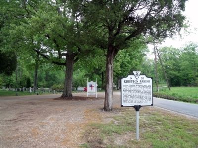
Photographed by Bernard Fisher, April 25, 2010
2. Williams Wharf Rd (facing east)
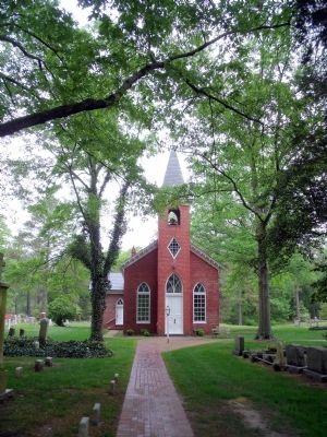
Photographed by Bernard Fisher, April 25, 2010
3. Christ Episcopal Church, c1904
Credits. This page was last revised on June 16, 2016. It was originally submitted on April 26, 2010, by Bernard Fisher of Richmond, Virginia. This page has been viewed 2,616 times since then and 119 times this year. Photos: 1, 2, 3. submitted on April 26, 2010, by Bernard Fisher of Richmond, Virginia.
