Hardeeville in Jasper County, South Carolina — The American South (South Atlantic)
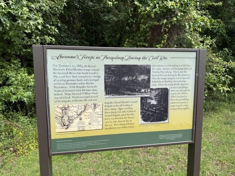
Sherman's Troops in Purrysburg During the Civil War
Photographed by Devry Becker Jones (CC0), May 23, 2026
1. Sherman's Troops in Purrysburg During the Civil War Marker
On January 17, 1865, the first of Sherman's Third Division troops crossed the Savannah River into South Carolina. The 123rd New York crossed over a bridge of swaying pontoon boats and encamped at Cheves Plantation and/or Hardee Plantations. With Brigadier General's National Jackson's First Division close behind, Major General William Ward moved inland. Ward encamped several of his brigades at Hardeeville and sent Brigadier Daniel Dustin's Second Brigade to the old landing at Purrysburg. Upon reaching Purrysburg, Col. John Coburn's Second Brigade noted that the town was deserted, the houses were in ruin, but not due to the war. Purrysburg had been abandoned years before (exact date unknown) and nothing was left but a few ruins. Jackson and his troops followed Ward to Purrysburg. There, just like General Prevost during the Revolutionary War, the troops' progress was temporarily halted due to flooding rains and deep mud. When the troops finally departed to burn and pillage their way through the county, the Thirty-Third remained at Purrysburg building substantial quarters, improving the camp, and guarding supplies.
Further Recommended Reading:
"History of the Thirty-Third Indiana Veteran Volunteer Infantry During Four Years of Civil War" by John R. McBridge (1900).
"Facing Sherman in South Carolina March Through the Swamps" by Christopher G. Crabb (2010).
"South Carolina Civilians in Sherman's Path Stories of Courage Amid Civil War Destruction" by Karen Strokes (2012).
"Sherman's March Through the Carolinas" by John G. Barrett (1956).
Erected by William
this page online
Topics and series. This historical marker is listed in these topic lists: War, US Civil • Waterways & Vessels. In addition, it is included in the Daughters of the American Revolution (DAR), and the William G. Pomeroy Foundation series lists. A significant historical date for this entry is January 17, 1865.
Location. 32° 17.209′ N, 81° 7.072′ W. Marker is in Hardeeville, South Carolina, in Jasper County. It is on Millstone Landing Road. Touch for map. Marker is at or near this postal address: 55 Millstone Landing Rd, Hardeeville SC 29927, United States of America. Touch for directions.

Regionally, this marker is in the Lowcountry. It is also in the American South, specifically in the Deep South, and on the Eastern Seaboard. Globally, it is in the North Atlantic Region, North America, the Western Hemisphere, the Western World, and the Anglosphere. Historically, it finds itself in what was once New Spain, the territory of the Mississippian Culture, one of the original Thirteen Colonies, one of the Confederate States of America, and the Antebellum
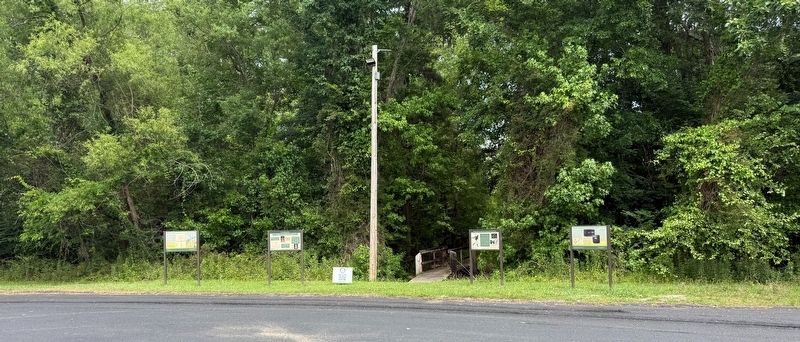
Other nearby markers. At least 8 other markers are within 3 miles of this marker, measured as the crow flies: Maroons of the Savannah River During the Revolutionary War (here, next to this marker); Battle of Purrysburg (a few steps from this marker); Purrysburg Township (a few steps from this marker); Savannah National Wildlife Refuge (within shouting distance of this marker); Nearby Skirmish (about 500 feet away, measured in a direct line); a different marker also named Purrysburg Township (approx. 1.3 miles away); Narrow Gauge Locomotive No. 7 (approx. 2.3 miles away); Hardeeville United Methodist Church (approx. 2.4 miles away). Touch for a list and map of all markers in Hardeeville.
Credits. This page was last revised on May 31, 2026. It was originally submitted on May 31, 2026, by Devry Becker Jones of Washington, District of Columbia. This page has been viewed 25 times since then. Photos: 1, 2. submitted on May 31, 2026, by Devry Becker Jones of Washington, District of Columbia.
