
Dighton in Bristol County, Massachusetts — The American Northeast (New England)
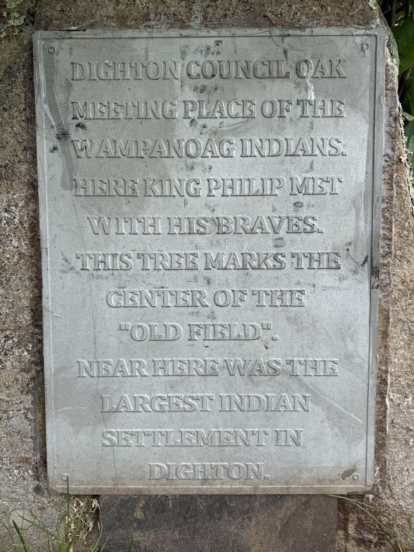
Dighton Council Oak
Meeting Place of the Wampanoag Indians
Photographed by G.W.Bartlett, May 31, 2026
1. Dighton Council Oak Marker
Dighton Council Oak
Meeting Place of the Wampanoag Indians
Here King Philip met with his braves. This tree marks the center of the “old field”. Near here was the largest Indian settlement in Dighton.
Erected by Town of Dighton.
Topics and series. This memorial is listed in these topic lists: Anthropology & Archaeology • Indigenous Peoples and Communities. In addition, it is included in the Historic Trees, and the King Philip's War 1675-1676 series lists. A significant historical date for this entry is March 23, 1663.
Location. 41° 49.158′ N, 71° 8.117′ W. Memorial is in Dighton, Massachusetts, in Bristol County. It can be reached from 1996 Elm Street. Touch for map. Memorial is in this post office area: Dighton MA 02715, United States of America. Touch for directions.

Regionally, this memorial is in Greater Providence. It is also in the American Northeast, in New England, and on the Eastern Seaboard. Globally, it is in the North Atlantic Region, North America, the Western Hemisphere, the Western World, and the Anglosphere. Historically, it finds itself in what was once one of the original Thirteen Colonies.
this page online
Other nearby markers. At least 8 other markers are within 5 miles of this marker, measured as the crow flies: Dighton Community Church (approx. 0.4 miles away); Edward Bobbett Slain Here (approx. 2.1 miles away); Hornbine School (approx. 3.7 miles away); Freetown Village School (approx. 3.8 miles away); Hathaway Library (approx. 3.8 miles away); Freetown Town Hall (approx. 3.8 miles away); Freetown Honor Roll (approx. 3.9 miles away); Bad Luck Pond (approx. 4.1 miles away).
Regarding Dighton Council Oak. On March 23, 1663 a group gathered at the Council Oak to complete the South Purchase of Taunton (plantation) in Plymouth County granted to Captain William Pool, Mr. John Gilbert, Henry Andrews, John Dean, Walter Dean. Signers: Philip The Sachem, John Sassamon (interpreter), Pemichason (aka Nimrod), Capt. Thomas Willett. History of Dighton, Chapter 2 "The South Purchase", pg. 8.
Related markers. Click here for a list of markers that are related to this marker.
Also see . . .
1. Council Oak Tribal Meeting Place (with historical photos). The Council Oak in Dighton, Massachusetts is the location where the Pokanonket

Photographed by G.W.Bartlett, May 31, 2026
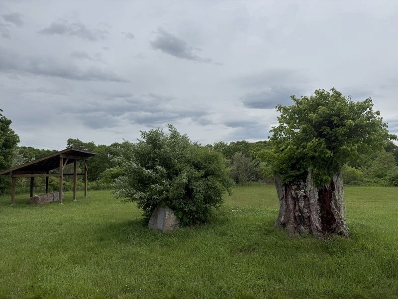
2. Dighton Council Oak Marker (wide)
Marker nestled under a bush (L) and Council Oak stump (R) in the foreground. Dirt road to the right alongside an active field of non-native wheat grown by a local farmer.
Photos: 1930, 1978, 1994, 2010, 2022 (Submitted on June 1, 2026, by G.W.Bartlett of Hingham, Massachusetts.)
2. History of Dighton - Chapter 1: Land of the Wampanoags Pg.2. Note: A free account at Internet Archive is required to view this reference.
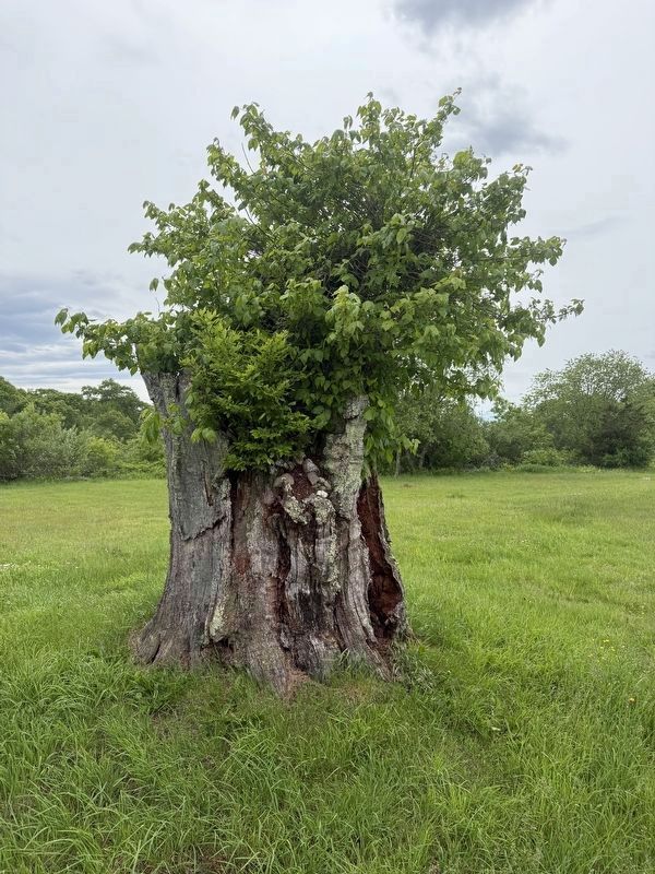
In the center stood the Council Oak, under whose branches the Wampanoags are said to have met for councils or caucuses. The size of the trunk, about 16 feet in circumference, proves the great age of the tree, at least five centuries as each foot in diameter of a white oak trunk indicates one hundred years in age. The wide-spreading branches, as shown in photographs taken before the last group of hurricanes show that the tree has always grown in an open place.(Submitted on June 1, 2026, by G.W.Bartlett of Hingham, Massachusetts.)
On the cleared land around the tree were small farms cultivated by the Indian women. Many Indian relics have been picked up on this clearing. Arrow heads of quartz andsandstone, fragments of tomahawks, stone pestles, and other implements used in hunting and for domestic purposes...Photographed by G.W.Bartlett, May 31, 20263. Dighton Council OakA healthy clump of poison ivy grows out from the top of the stump of the Council Oak.
3. Sowams Ancestral Homeland of the Pokanoket Tribe.
The Pokanoket (anglicized) meaning "land at the clearing". At the time of the first contact with Europeans, the Pokanoket were the headship tribe of a confederation of more than 60 tribes, bands, and clans throughout Southern New England. Under the inherited leadership of the Massasoit, or "great leader" Massasoit Ousamequin, the Pokanoket welcomed the English at Plymouth.(Submitted on June 1, 2026, by G.W.Bartlett of Hingham, Massachusetts.)
However, after devastating epidemics weakened the confederacy, the Pokanoket were forced from their lands by encroachment and war.
Photographed by G.W.Bartlett, May 31, 2026
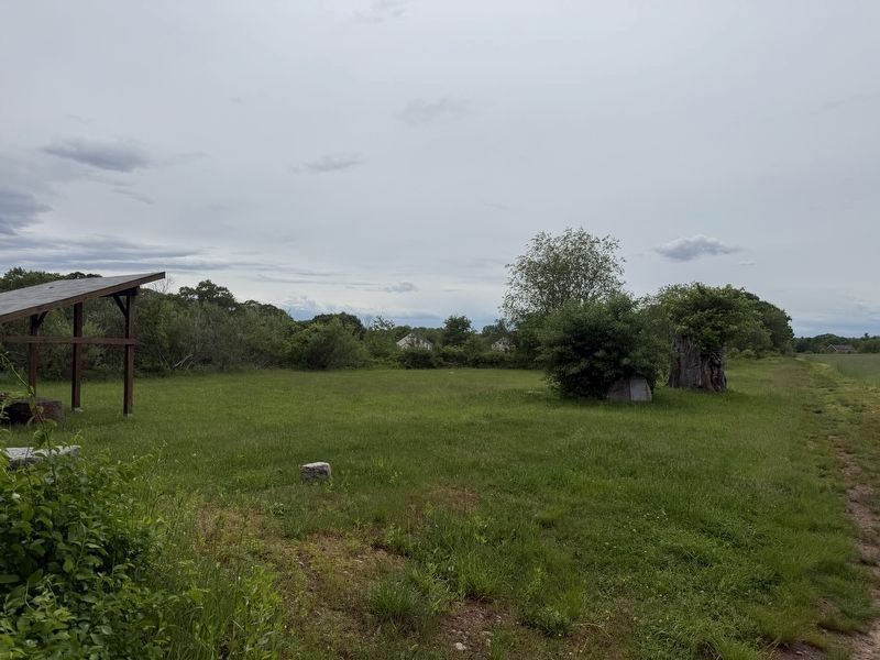
4. Dighton Council Oak Grounds
A shaded seating area has been set up for visitors to the town-owned Council Oak grounds.
Photographed by G.W.Bartlett, May 31, 2026
5. Granite markers at the Council Oak
Several granite markers on the grounds delineate various archaeological zones.
Photographed by G.W.Bartlett, May 31, 2026
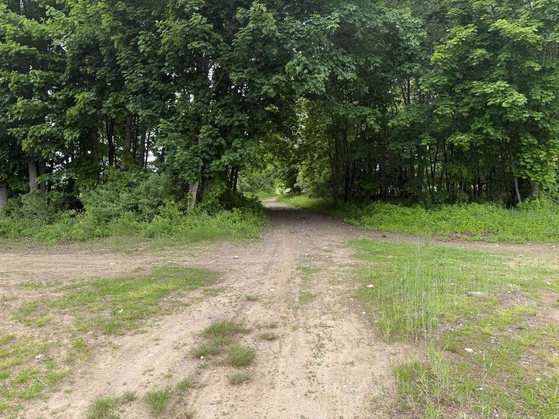
6. Path to the Council Oak Marker
Follow the path straight back from 1996 Elm Street entrance, through the wooded area to arrive at the Council Oak (there are no signs).
Credits. This page was last revised on June 4, 2026. It was originally submitted on June 1, 2026, by G.W.Bartlett of Hingham, Massachusetts. This page has been viewed 34 times since then. Photos: 1, 2, 3, 4, 5, 6. submitted on June 1, 2026, by G.W.Bartlett of Hingham, Massachusetts. • Andrew Ruppenstein was the editor who published this page.
