Skippers in Greensville County, Virginia — The American South (Mid-Atlantic)
Like to Eat?
Thank a Pollinator!
| — | Virginia Department of Transportation Pollinator Habitat Program | — |
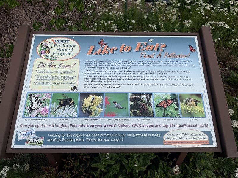
Did You Know?
• One out of every three mouthfuls of food we eat is delivered to us by pollinators.
• Three-fourths of global crop plants grown for food, spices, beverages, condiments and medicines is pollinated by animals.
• Pollination services to U.S. crops is valued at $10 Billion every year.
Natural habitats are becoming increasingly rare because of the spread of development. We have become accustomed to and comfortable with "managed" landscapes that consist of mowed turf grasses and flowering plants that are pretty to us but may not be so valuable for animals and insects. Because of all this, pollinators and other species are in trouble.
VDOT knows the importance of these habitats and species and has a unique opportunity to be able to create connected habitat corridors along the over 57,000 road miles in Virginia.
The Pollinator Habitat Program began in 2014 and our goal is to create naturalized habitats for these important creatures. The habitats also reduce emissions from mowing, help retain stormwater and sequester carbon and nutrients.
We can all help by creating natural habitats where we live
this page online
Erected by Virginia Department of Transportation.
Topics. This historical marker is listed in these topic lists: Animals • Environment • Horticulture & Forestry • Roads & Vehicles. A significant historical year for this entry is 2014.
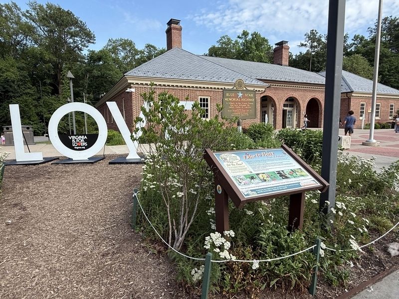
Location. 36° 32.791′ N, 77° 34.512′ W. Marker is in Skippers, Virginia, in Greensville County. It is on Welcome Center Drive north of Interstate 95, on the right when traveling north. The marker stands on the grounds of the Virginia Welcome Center just north of the state line with North Carolina. Touch for map. Marker is at or near this postal address: 25 Welcome Ctr Dr, Skippers VA 23879, United States of America. Touch for directions.

Regionally, this marker is in Southside Virginia and specifically in Central Virginia. It is also in the American South and specifically in the Upper South. Globally, it is in North America, the Western Hemisphere, the Western World, and the Anglosphere. Historically, it finds itself in what was once the territory of the Mississippian Culture, one of the original
Other nearby markers. At least 8 other markers are within 7 miles of this marker, measured as the crow flies: Cornwallis (approx. 2½ miles away in North Carolina); First Kraft Pulp in United States (approx. 6.2 miles away in North Carolina); Batteaux and Batteauxmen (approx. 6.4 miles away in North Carolina); Roanoke Canal (approx. 6.4 miles away in North Carolina); The Batteaux (approx. 6.4 miles away in North Carolina); A Lock in Action – Step By Step (approx. 6.4 miles away in North Carolina); The Batteauxmen (approx. 6.4 miles away in North Carolina); a different marker also named Roanoke Canal (approx. 6.4 miles away in North Carolina).
Another marker is no longer nearby. Roanoke Canal (was approx. 6.4 miles away in North Carolina but has been confirmed missing).
Credits. This page was last revised on June 3, 2026. It was originally submitted on June 3, 2026, by Devry Becker Jones of Washington, District of Columbia. This page has been viewed 18 times since then. Photos: 1, 2. submitted on June 3, 2026, by Devry Becker Jones of Washington, District of Columbia.
