Goshen in Elkhart County, Indiana — The American Midwest (Great Lakes)
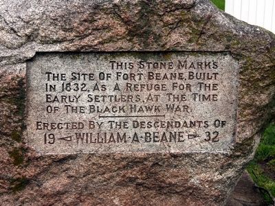
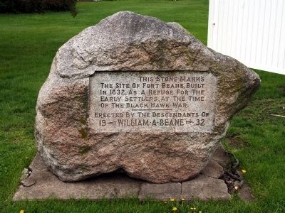
The Site of Fort Beane
Erected 1932 by the Descendants of William A. Beane.
Topics. This historical marker is listed in these topic lists: Forts and Castles • Native Americans • Settlements & Settlers • Wars, US Indian. A significant historical year for this entry is 1832.
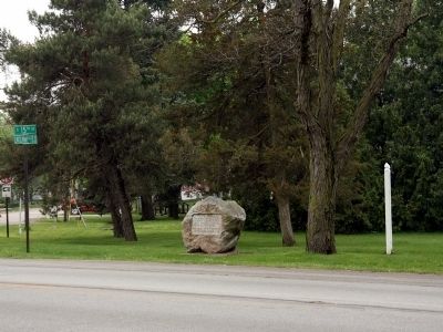
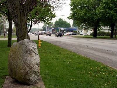
Location. 41° 34.683′ N, 85° 49.114′ W. Marker is in Goshen, Indiana, in Elkhart County. Marker is at the intersection of Lincolnway East (U.S. 33) and Reynolds Street, on the right when traveling south on Lincolnway East. Touch for map. Marker is in this post office area: Goshen IN 46526, United States of America. Touch for directions.
Other nearby markers. At least 8 other markers are within one mile of this marker, measured as the crow flies. Madison Street School and Chandler School (approx. half a mile away); The Old Goshen High School (approx. 0.8 miles away); Goshen’s Carnegie Library (approx. 0.8 miles away); Howard W. Hawks (approx. 0.8 miles away); Buffalo & Mississippi Railroad (approx. 0.9 miles away); Goshen World War I Memorial (approx. 0.9 miles away); Shanklin Park (approx. 0.9 miles away); The Historic Goshen Police Booth (approx. one mile away). Touch for a list and map of all markers in Goshen.
More about this marker. US Hwy 33 carries heavy traffic and there is no parking place at the marker. If you visit the marker consider parking on Reynolds Street and walking to the stone from there.
Also see . . . Goshen's Lincoln Highway - Fort Beane. (Submitted on May 4, 2010.)
Additional commentary.
1. Heritage
What a shame. I contacted you before. I have a picture of my mother when this stone was dedicated. She was a young girl. I just recently drove to Goshen and visited Mary L. Deahl's grave and her sister, Lucy Bullock, who is buried next to her and was my mothers grandmother. I went to visit the home that Mary L. Deahl had owned and left to my mother, Mary L. Ennis, and her brother David William Studebaker, at the time of her death in 1963. The owners at this time are selling the property and gave me new information of my family's heritage.
When I drove this distance (October 21st, through October 24th) from Arkansas, I brought with me several scrapbooks that Aunt Min (Mary L. Deahl) had personally made, dating from way before the 1900's. My mother, her beneficiary, had taken them from the residence and has had them all of these years, until her passing in 2010. I her daughter, brought them with me to Arkansas, and have now delivered them to Goshen, Indiana. As soon as the family who now live in 312 S. 5th St. Goshen, are finished reading them, they may possibly turn them over to the Historical Society. Who seem highly impressed. I do think they are quite impressive, and more historical than this stone. Of course, this is just my opinion!!! Thank you, hopefully, for reading this. Any contact can be made through : [email protected]
— Submitted October 30, 2013, by Susan E. Bryant of Bentonville, Arkansas.
Credits. This page was last revised on June 16, 2016. It was originally submitted on April 27, 2010, by Dave Zollinger of Goshen, Indiana. This page has been viewed 1,966 times since then and 100 times this year. Photos: 1, 2, 3, 4. submitted on April 27, 2010, by Dave Zollinger of Goshen, Indiana. • Kevin W. was the editor who published this page.


