
Historic Old Town in Niagara-on-the-Lake in Niagara Region, Ontario — Central Canada (North America)
Landsdowne Pond Wetland Biodiversity Enhancement Project
One Mile Creek

Photographed by Kevin Westell, June 5, 2026
1. Landsdowne Pond Wetland Biodiversity Enhancement Project Marker
One Mile Creek watershed drains mainly through the "Old Town" of Niagara-on-the-Lake and outlets to Lake Ontario. The small watershed is highly urbanized, with a rich cultural and archaeological history dating back to the War of 1812.
Urbanization has impacted One Mile Creek. Loss of natural areas has contributed to poor water quality and reduced biodiversity. One Mile Creek and the Landsdowne Pond wetland located at the mouth of the creek, represent one of the last remaining natural areas in the watershed.
Protecting and enhancing wetlands is important. Wetlands are nature's purification system, filtering pollutants before they enter our creeks, streams, rivers and lakes which supply us with recreational opportunities and drinking water. Wetlands reduce flooding, replenish groundwater, prevent soil erosion and provide essential habitat to a diversity of plants, animals and insects.
2011-2012 Project Implementation
The goal of the project is to remove invasive species and replace them with more appropriate native species. Invasive species can grow out of control, displacing native populations
this page online
Yellow flag irises (Iris pseudacorus) is a non-native invasive species historically used for ornamental gardening purposes. It is not native to Niagara. Although esthetically pleasing, its aggressive nature tends to dominate and clog small streams, and shallow wetlands such as Landsdowne Pond. It will displace native vegetation that beneficial aquatic species such fish, turtles, frogs, and other wildlife depend on for survival.
During fall of 2011 and spring of 2012 local residents volunteered to remove over 27 tons of yellow flag irises from the highest infestation areas of the One Mile Creek watershed, including Landsdowne Pond. Where removed the invasive iris was replaced with over 7000 native aquatic plants, trees, shrubs, and wildflowers.
The largest portion of the planting was done in and around Landsdowne Pond.
As the new plantings mature, you will see trees and shrubs such as oaks, maples, white pine, elderberry, buttonbush, pussy willow and dogwood. As well as, wildflowers and grasses such
Photographed by Kevin Westell, June 5, 2026
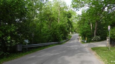
2. Landsdowne Pond Wetland Biodiversity Enhancement Project - Marker in context
Photo faces west along Niagara Blvd, across the low causeway over One Mile Creek. Marker (far left) is behind the safety barrier.
The site will be monitored to ensure the establishment and health of the vegetation. Remedial work and plantings will be incorporated as necessary.
Notable Wildlife Sightings in Landsdowne Pond:
- blue spotted salamander (Ambystoma laterale)
- green heron (Butorides virescens)
- snapping turtle (Chelydra serpentina) - one of Ontario's species at risk.
The following partners have contributed toward the success of this project: Niagara Restoration Council, Friends of One Mile Creek, Niagara Peninsula Conservation Authority, Town of Niagara-on-the-Lake, Government of Ontario, EcoAction - Environment Canada.
Topics. This historical marker is listed in these topic lists: Charity & Public Work • Horticulture & Forestry • Parks & Recreational Areas. A significant historical year for this entry is 1812.
Location. 43° 15.651′ N, 79° 5.529′ W. Marker is in Niagara-on-the-Lake, Ontario, in Niagara Region. It is in Historic Old Town. It is on Niagara Boulevard, on the right when traveling east. The marker is on the east side of the causeway over One Mile Creek, beside the south side of the road. Touch for map. Marker is at or near this postal address: 369 Niagara Blvd, Niagara-on-the-Lake ON L0S 1J0, Canada. Touch for directions.

Regionally, this marker is on Ontario’s Golden Horseshoe and in Niagara Canada. It is also in Central Canada. Globally, it is in North America, on the Great Lakes, in the Western Hemisphere, in the Western World, and in the Anglosphere. Historically, it finds itself in what was once a British colony, the Viceroyalty of New France, the Haudenosaunee (Iroquois) Confederacy, and Rupert’s Land.
Other nearby markers. At least 8 other markers are within walking distance of this marker: Chautauqua Park (approx. 0.4 kilometers away); The Battle of Fort George (approx. 0.6 kilometers away); The Remains of Three Soldiers (approx. 0.6 kilometers away); William and Susannah Steward House (approx. one kilometer away); Butler's Burial Ground (approx. 1.1 kilometers away); Action at Butler's Farm (approx. 1.1 kilometers away); Lieutenant-Colonel John Butler 1725-1796 (approx. 1.1 kilometers away); The Claus Family Crypt / La crypté de la famille Claus (approx. 1.1 kilometers away). Touch for a list and map of all markers in Niagara-on-the-Lake.
Regarding Landsdowne Pond Wetland Biodiversity Enhancement Project. During settlement in the late 1700s, when lake transport was the easiest, many creeks along Lake Ontario's south shore were numbered based on "miles west of the Niagara River".
Credits. This page was last revised on June 5, 2026. It was originally submitted on June 5, 2026, by Kevin Westell of St. Catharines, Ontario. This page has been viewed 11 times since then. Photos: 1, 2. submitted on June 5, 2026, by Kevin Westell of St. Catharines, Ontario.
