Old Wethersfield in Capitol Region, Connecticut — The American Northeast (New England)
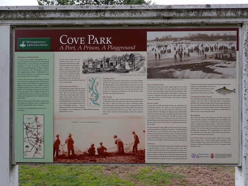
Cove Park
A Port, A Prison, A Playground
| — | Wethersfield Heritage Walk | — |
Photographed by Conrad Ward, May 25, 2025
1. Cove Park Marker
Welcome to Wethersfield!
We invite you to explore Wethersfield’s story as you travel through the centuries. The Wethersfield Heritage Walk is a three mile long, self-guided tour consisting of a series of twenty-two interpretive markers that highlight points of historical significance throughout Old Wethersfield, Connecticut’s largest historic district. Wethersfield has a rich cultural, historical and architectural heritage stretching back over four centuries.
As you walk, run, drive or bike along our streets you can learn the intriguing stories of Wangunks, settlers, farmers, ship builders, sea captains, slaves, soldiers, seed merchants, onion maidens, patriots, diplomats, prisoners, home builders and preservationists. You will observe the growth and change of our community from a frontier settlement, to a bustling colonial port, to a thriving agricultural village, a growing suburb and to a leader in historic preservation.
There is a map on each of the panels to guide your tour. Enjoy our rich history which is uniquely ours and at the same time the story of America.
Visit http://www.wethersfieldct.com for more
this page online
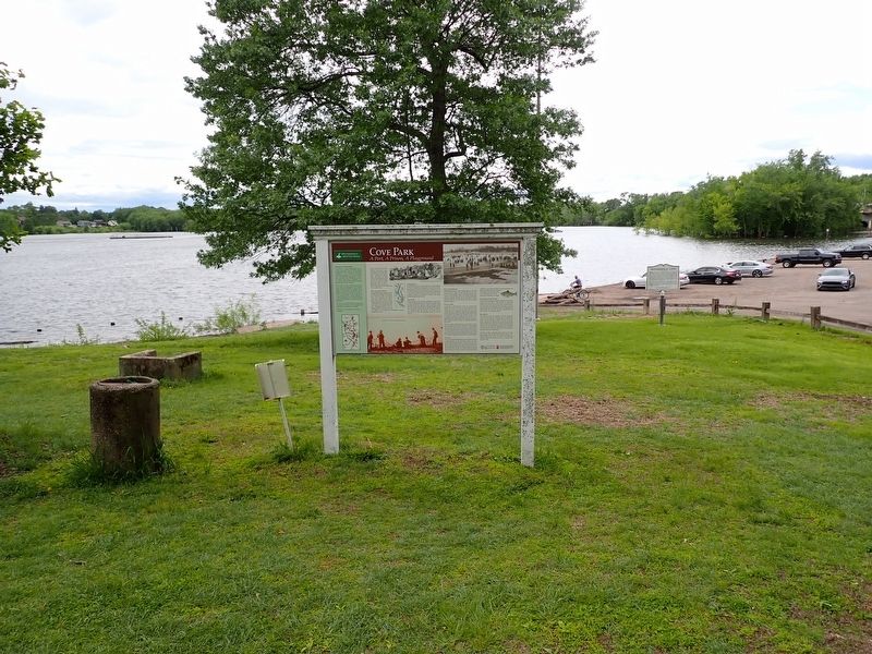
You are next at Cove Park, the northern most point on your exploration of the Heritage Walk. Here you will see the Cove Warehouse, walking trails, playing fields, a boat launch and docks as well as the Wethersfield Yacht Club and the Solomon Welles House. Cove Park was first a flourishing harbor, became the home of the Connecticut State Prison and is now a public park.
The Connecticut River
The Algonquian people originally named the river Quinnehtukqut, the “long tidal river”. The river was the main highway of the time, connecting native communities. Large vessels could not advance further up the river than the oxbow bend at Wethersfield due to the shallow waters to the north. As the deepest inland river port, Wethersfield became a hub for shipping and trade. The Connecticut River was integral to the development of Wethersfield’s prosperity and growth as a town.
Landing Place
Along this bend in the river, which today is a cove, John Oldham and the Ten Adventurers built shelters for the winter of 1634. Shortly thereafter, an area was dedicated as a common, to be used as a public landing area and natural deep water
Photographed by Conrad Ward, May 25, 2025
2. Cove Park Marker
The Tryall
Thomas Deming, a ship carpenter, established a shipyard here in 1648 and built the Connecticut Colony’s first seafaring vessel, the Tryall, in 1649. The Tryall soon sailed to Barbados loaded with local produce and established a thriving shipbuilding and period of maritime trading with the West Indies. The shipyard was maintained here until the early 19th century, but the 17th century was the most prosperous period for maritime activity.
Port of Distribution
Wethersfield became the central supply depot for the entire Connecticut River Valley. The river connected the town and its farm, forest and fishery products with the shoreline, other colonies, and the broader world of the Atlantic. Warehouses, wharves, a shipyard, sawmills, sail and rope makers, a blacksmith shop and ice and fish houses were built to support maritime commerce.
Flood of 1692
A huge flood in 1692 destroyed all but one warehouse and dramatically altered the course of the Connecticut River creating the Cove you see here today. The river’s new course created additional challenges for shipping from Wethersfield as the river had become more accessible to points farther north. Local merchants and sailors were still able to remain active in maritime commerce by shifting its port and much of the shipbuilding and maritime trade back to the main channel of the river at the end of River Road or to Stepney (present-day Rocky Hill).
The flood exposed a large ledge outcrop next to the surviving warehouse referred to locally as “the Rocks.” In 1871 fossilized dinosaur tracks were found here and several museums have obtained fine specimens from this location. The tracks are those of a small bipedal theropod dinosaur dating to the Triassic period. Dinosaur tracks are especially important as they provide a rich source of scientific information about an extinct species.
Fisheries
In the earliest days of settlement the Connecticut River provided a superabundance of fish, particularly salmon and shad. Tradition states that these fish were so plentiful that they were stacked in piles for sale. In the springime, alewives would travel upriver to spawn and fishermen would catch fish in the nets set out across the Cove. The Buck and Hanmer families set up fish houses along the cove where as many as one-thousand barrels of alewives were packed and salted in barrels before they were shipped to market. Before the decline in water quality in the late 20th century, ice was harvested from the Cove and stored in icehouses on its banks.
Connecticut State Prison
The waterfront has long been home to more than the maritime industry, and from 1827 to 1963 the State of Connecticut operated the Connecticut State Prison from a sprawling forty-four acre facility built along the edge of the water. The site of this impressive brownstone edifice is today the Department of Motor Vehicles and Cove Park. The prison was demolished in 1967 and only a few remnants remain.
Recreation
Even when the prison was standing in the 19th century, the Cove has been a popular recreational spot for residents and visitors. The park includes a maritime museum at the warehouse, walking trails, playing fields, a boat launch and the Solomon Welles House at the corner of State Street and Hartford Avenue. The Cove has long been a safe haven for recreational sailboats and motorboats. The Wethersfield Cove Yacht Club has called the Cove home since 1908, and the town provides a public boat launch and dock system.
Cove Park is today a community space where you can enjoy soccer games, fairs, vintage baseball games, parties at the Solomon Welles House, tours of the historic Cove Warehouse museum, boating and fishing in the Cove or a pleasant stroll along the water.
(image captions)
— Artist’s illustration of the busy port, drawn by William J. McKee.
— Ice skating at the Wethersfield Cove, c. 1900, Courtesy of Wethersfield Historical Society.
— Buck fishermen, c. 1900, Courtesy of Wethersfield Historical Society.
Erected 2016 by Town of Wethersfield, Wethersfield Historical Society, Webb-Deane-Stevens Museum, Wethersfield Tourism Commission, Wethersfield Residents, Connecticut Humanities, & Hartford Foundation For Public Giving.
Topics. This historical marker is listed in these topic lists: Disasters • Paleontology • Parks & Recreational Areas • Waterways & Vessels.
Location. 41° 43.38′ N, 72° 39.213′ W. Marker is in Wethersfield in Capitol Region, Connecticut. It is in Old Wethersfield. It is at the intersection of Main Street and Hammer Road, on the left when traveling north on Main Street. Touch for map. Marker is in this post office area: Wethersfield CT 06109, United States of America. Touch for directions.

Regionally, this marker is in the Connecticut River Valley, in Greater Hartford, and in the Knowledge Corridor. It is also in the American Northeast and in New England. Globally, it is in North America, the Western Hemisphere, the Western World, and the Anglosphere. Historically, it finds itself in what was once Hartford County and also one of the original Thirteen Colonies.
Other nearby markers. At least 8 other markers are within walking distance of this marker: Early Settlement of Wethersfield (here, next to this marker); Hanmer Park (approx. 0.3 miles away); The Stillman Tavern (approx. half a mile away); The Cradle of American Seed Companies (approx. half a mile away); Trinity Parish (approx. 0.6 miles away); Comstock, Ferre & Co. (approx. 0.7 miles away); Washington – Rochambeau Revolutionary Route (approx. ¾ mile away); Webb House (approx. ¾ mile away). Touch for a list and map of all markers in Wethersfield.
Also see . . .
1. Wethersfield, CT. (Submitted on June 7, 2026.)
2. Wethersfield, Connecticut (Wikipedia). (Submitted on June 13, 2026, by Michael Herrick of Southbury, Connecticut.)
Credits. This page was last revised on June 13, 2026. It was originally submitted on June 7, 2026, by Conrad Ward of Guilford, Connecticut. This page has been viewed 21 times since then. Photos: 1, 2. submitted on June 7, 2026, by Conrad Ward of Guilford, Connecticut. • Michael Herrick was the editor who published this page.
